

Special Weather Statement for Maui
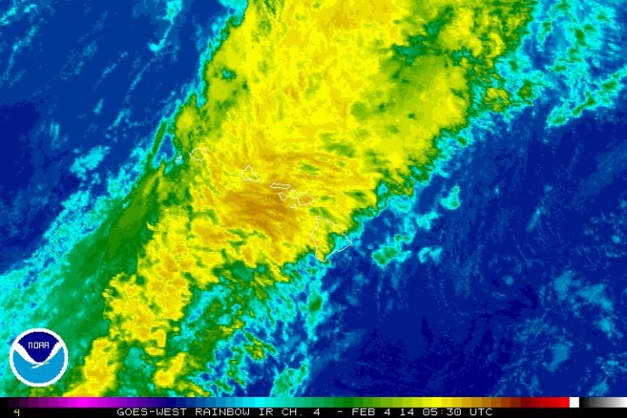
Satellite imagery, Feb. 3, 2014, 7:30 p.m. courtesy NOAA/NWS.
By Maui Now Staff
The National Weather Service issued a flood advisory for the island of Maui in Maui County until 11 p.m.
“At 8:01 p.m. radar showed moderate to heavy rain and isolated thunderstorms moving over Maui from the west and southwest. Rainfall rates between one and two inches per hour will lead to ponding of water along roadways,” the NWS forecast stated.
“Although most of the moderate to heavy rain will initially impact leeward portions of the island, heavy showers will impact windward areas as well,” authorities said.
The National Weather Service also issued a special weather statement for Maui saying radar at 7:50 p.m. showed a line of strong thunderstorms over near shore waters southwest and south of Maui.
The system was moving toward the east-northeast at 20 mph.
“Latest data indicates that the strongest winds associated with this line of thunderstorms will pass just south of Maui, remaining in the ʻAlenuihāhā Channel,” between Hawaiʻi Island and Maui, the statement said.
According to the NWS, locally gusty winds near 40 mph and small hail is possible along southwest and south Maui from ʻUlupalakua to Kaupō through 9 p.m.
A special marine warning was also issued for Maui County Windward waters and the ʻAlenuihāhā Channel between Hawaiʻi Island and Maui until 11:30 p.m.
At 9:31 p.m., radar showed a line of strong thunderstorms capable of producing strong winds to 40 knots, stretching southwestward from Maui windward waters through the ʻAlenuihāhā Channel to waters west of ʻUpolu Point.
The line of thunderstorms was moving east at 15 to 20 knots. Boaters are advised to seek safe harbor until the storm passes. If caught on open water during frequent lighting, the NWS advises that boaters should stay below deck and keep away from ungrounded metal objects.
Earlier this evening, a special marine warning was issued for for Māʻalaea Bay, Maui County Leeward Waters, and the ʻAlenuihāhā Channel between Hawaiʻi Island and Maui. The warning was in effect until 8:45 p.m. At 7:08 p.m., the NWS said radar showed a line of thunderstorms capable of producing strong winds to 40 knots and “pea-size” hail. The line was about 36 miles southwest of Kahului, and was moving east at 20 knots.
The public is advised to stay away from streams, drainage ditches, and low-lying areas that are prone to flooding.
Motorists and pedestrians are reminded not to cross fast flowing or rising water in their vehicle or on foot.
Sponsored Content


