

Maui Flood, Wind, Traffic Updates
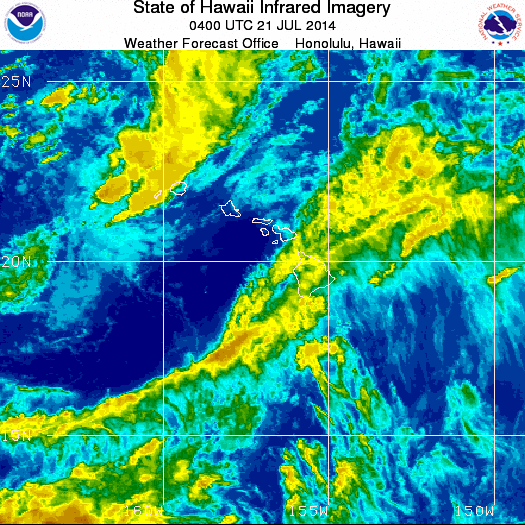
Satellite imagery courtesy NOAA/NWS, Sunday, July 20, 2014, 6:00 p.m.
By Maui Now Staff
FLASH FLOOD WATCH HAS BEEN CANCELLED 4:22 p.m. (Update 7/21/2014). The threat for heavy rainfall has diminished, says Civil Defense.
—
FLOOD ADVISORY EXTENDED FOR MAUI UNTIL 12:15 a.m.: (Update: 9:11 p.m. 7/20/2014) The National Weather Service extended a flood advisory for the Island of Maui until 12:15 a.m. on Monday, July 21, 2014. The advisory may need to be extended if heavy rain persists.
At 9 p.m. on Sunday, July 20, 2014, radar showed locally heavy rain continued
to affect windward West Maui and windward Haleakalā. The area of heavy rain was nearly stationary.
Other locations in the advisory include Kahului, Waiheʻe, Makawao, Hoʻokipa Beach Park and Haʻikū.
A flash flood watch continues to be in effect for all of Maui County until 6 p.m. on Monday, July 21, 2014.
FLOOD ADVISORY FOR MAUI EXTENDED TO 9:15 P.M. 7/20/14: (Update: 6:26 p.m. 7/20/14) The National Weather Service has extended the flood advisory for the Island of Maui until 9:15 p.m.
At 6:18 p.m., forecasters with the NWS said radar showed heavy rain continuing to affect windward West Maui and windward Haleakalā. The area of heavy rain was nearly stationary.
Other locations in the advisory include: Kahului, Wailuku, Waiheʻe, Pukalani, Pāʻia, Nāpili, Keʻanae, Kapalua, Kahakuloa, Honolua, Honokōhau, and Haʻikū. Satellite image courtesy NOAA/NWS, 6 p.m. 7/20/14.
FLOOD ADVISORY EXTENDED FOR MAUI: UPDATE 3:39 p.m. HST 7/20/14: The National Weather Service has extended the flood advisory for the island of Maui until 6:30 p.m.
At 3:24 p.m., radar showed heavy rain over windward west Maui and windward Haleakalā. The area of rain was nearly stationary.
Other locations in the advisory include, but are not limited to Kanahā Beach Park, Wailuku, Waikapū, Waiheʻe, Waiehu, Spreckelsville, Puʻunēnē, Paʻuwela, Pāʻia, Nāhiku, Makawao, Kapalua, Kahakuloa, Huelo, Hoʻokipa Beach Park, Honolua, Honokōhau, Haliʻiamile, Hāna, Kahului, Makawao and Haʻikū.
OAHU RAINFALL TOTALS TOP 13 INCHES IN SOME LOCATIONS: rainfall inches over the 24 hour period ending at 2 p.m. HST 7/20/14: Punaluʻu Stream, Oʻahu 13.18; Hakipuʻu Mauka Oʻahu 13.39; Poamoho Oʻahu 12.04; Waiahole Oʻahu 9.46; Ahuimanu Loop Oʻahu 8.67; Maunawili Oʻahu 7.86; Olomana Fire Station Oʻahu 6.59.
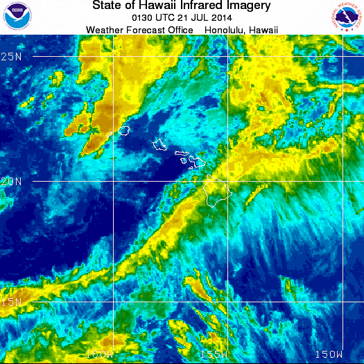
Satellite imagery courtesy NOAA/NWS, Sunday, July 20, 2014, 3:30 p.m.
MAUI RAINFALL TOTALS UPDATE over the same period (24 hr period ending at 2 p.m. 7/20/14): Hāna Airport 3.97; Haʻikū 1.75; Kahului Airport 0.57; Kahakuloa 3.40; Puʻu Kukui 3.44; Kaupō Gap 1.85; Pukalani 1.64; Kula Branch Station 1.81; ʻUlupalakua 0.67; Kīhei 0.01; Waikapū Country Club 0.23; Lahainaluna 0.66; Mahinahina 0.09; Kahoʻolawe 0.93; Lānaʻi 0.53; Kamalo Molokaʻi 0.99; Makapulapai Molokaʻi 1.55; Kaunakakai Mauka Molokaʻi 0.49; Molokaʻi Airport 0.87.
WIND ADVISORY 12:23 p.m. 7/20/14: The National Weather Service has issued a wind advisory for the islands of Lānaʻi, Molokaʻi and Kahoʻolawe until 4 p.m. on Sunday, July 20, 2014.
The agency is forecasting winds to be coming from the northeast at 25 to 35 mph with localized gusts to 55 mph.
Winds are expected to trend down through 4 p.m. Winds this strong can bring down tree branches and make driving difficult, especially for high profile vehicles.
FLOOD WATCH: A flood watch is also in effect until Monday at 6:45 p.m. on Monday, July 21, 2014.
The National Weather Service says deep tropical moisture continues to spread across the island chain from the southeast. This will bring locally heavy rain, showers, and a risk of flooding and thunderstorms through Monday.
The agency says that although rainfall totals will likely be highest over windward and mauka areas, the threat for flooding persists over all parts of the state.
RAINFALL TOTALS: rainfall inches over the 24 hour period ending at 11 a.m. HST 7/20/14: Hāna Airport: 4.07 inches; Haʻikū: 1.54; Kahului Airport: 0.54; Kahakuloa: 3.30; Puʻu Kukui: 3.40; Kaupō Gap:1.85; Kepuni: 0.42; Pukalani: 1.64; Kula Branch Station: 1.81; ʻUlupalakua: 0.07; Kīhei: 0.57; Waikapū Country Club: 0.08; Lahainaluna: 0.66; Mahinahina: 0.06; Lānaʻi: 0.53; Kahoʻolawe: 0.93; Kamalo Molokaʻi: 0.99; Makapulapai Molokaʻi: 1.53; Kaunakakai Mauka Molokaʻi: 0.49; Molokaʻi Airport: 0.87.
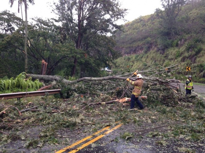
County crews work to clear a downed tree near Maliko Gulch on Maui, 7/20/14. Photo courtesy County of Maui.
TRAFFIC UPDATES:
- 12:17 p.m. 7/20/14: Honoapiʻilani Highway at Nakalele Point is open.
- 11:45 a.m. 7/20/14. Hāna Hwy. at Maliko Gulch is now open.
- 9:20 a.m. 7/20/14: Honoapiʻilani Hwy. (30) at Nakalele Point is closed and vehicles are being turned around. The Kahakuloa Bridge is over flowing.
- 9:13 a.m. 7/20/14: ʻĪao Valley State Park is closed due to current inclement weather and hazardous conditions.
- 8:43 a.m. 7/20/14 TRAFFIC ADVISORY: The makai lane of Piʻilani Highway (31) 3 miles south of Sun Yet Sen Park is blocked due to a downed tree.
- 7:35 a.m. 7/20/14: The road is closed on Hāna Highway at Maliko Gulch due to a large tree that is blocking both lanes of the roadway.

Kahakuloa Valley flooding, July 20, 2014. Photo courtesy Alisha Coston-chung.
SPECIAL WEATHER STATEMENT for MAUI COUNTY: 10:02 a.m. 7/20/14: Strong outflow associated with a thunderstorm just east of Maui county will bring strong northeasterly winds to 40 mph and gusts to 50 mph across Maui County. Expect winds to continue through noon today. A flood watch is also in effect until Monday at 6 a.m.
FLOOD ADVISORY FOR ISLAND OF MAUI EXTENDED UNTIL 10:30 AM: At 7:15 a.m., radar showed heavy rain over West Maui and over Upcountry Maui from Pāʻia to ʻUlupalakua. Heavy rain is also ready to move onshore along windward Haleakalā from Pāʻia to Hāna. Other locations in the advisory include Kahului, Wailuku, Pukalani, Makawao, Kahakuloa, Kula, Keʻanae, Nāhiku, Wailea, Kīhei, Nāpili, and Kapalua.
Run off from this storm may also cause rock and mudslides in steep terrain Locations in the warning include but are not limited to Hālawa Valley and highway 450 east of Kamalo.
Sponsored Content


