

Iselle Downgraded to Tropical Storm, Maui Topography Detailed
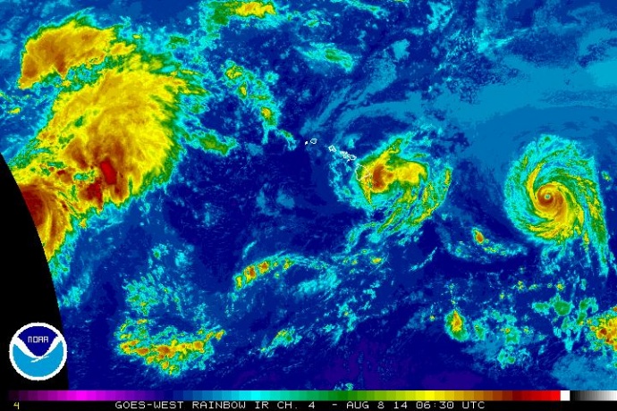
Satellite imagery of Iselle at 6:30 p.m. HST, Thursday, Aug. 7, 2014. Image courtesy CPHC/NOAA/NWS.
By Wendy Osher
(Update: 12:15 a.m. 8/8/2014)
Iselle has since been downgraded to a tropical storm, and is now on a weakening trend, according to the National Weather Service.
An eye wall was no longer discernible on the last radar check, and maximum sustained winds were near 60 miles per hour, with gusts near 75 mph.
The system has since slowed its movement toward the west as well and was moving at 9 mph, according to the CPHC. It was last tracked about 50 miles S of Hilo; 75 miles SE of Kailua-Kona; 40 miles E of South Point; 155 miles SSE of Kahului, Maui; 200 miles SE of Kaunakakai, Molokaʻi; 170 miles SE of Lānaʻi City; 240 miles SE of Honolulu; 335 miles SE of Līhue, Kauaʻi; and 380 miles ESE of Niʻihau.
The National Weather Service has continued a tropical storm warning for Maui County, Oʻahu and Kauaʻi County. This means conditions are expected somewhere within the warning area within 36 hours.
On Oʻahu the onset of the storm was projected to occur between 6 a.m. and 2 p.m. on Friday, Aug. 8.
The Civil Defense agency says the onset of tropical storm conditions are expected over Maui County overnight. Very large damaging surf is expected along mainly east and south shores as well. Rainfall totals of 5 to 8 inches, with isolated maximum amounts of 12 inches, are also expected along the track of Iselle.
Authorities say these rains could cause life-threatening flash floods and rock and mud slides. The combination of a dangerous storm surge and the tide will cause normally dry areas near the coast to be flooded by rising waters.
In an earlier report, Mike Cantin with the National Weather Service said that dangers on land with strong winds and flooding potential, and on the sea with high waves and storm surge along the coast make the system a threat. “On all facets the storm is a triple threat of tropical cyclone impacts over the next 24 hours.”
Power Outage Updates:
A power outage affecting an estimated 2,700 customers in the Pukalani area was reported at around 10:30 p.m. on Thursday. As of 12:15 a.m., the majority of Pukalani customers who lost power have been brought back online. Approximately 20 customers remained without power with restoration expected early Friday when crews can safely access electrical lines that came down in a gulch.
Power was restored to an estimated 120 customers on Piʻiholo Road at around 10:30 p.m. after wind debris came into contact with power lines. Small pockets of customers, including the County of Maui Olinda Water Treatment Plant, remain without power at last report. Repairs will be conducted as soon as crews can safely access the area. In the interim, customers in the Upper Kula area are asked to continue water conservation.
(Update: 9 p.m. 8/7/2014)
Current Situation:
Iselle continues to make its way across the Big Island of Hawaiʻi at this hour. Maximum sustained winds observed by the Hurricane Hunter planes are around 75 mph. Right now, Iselle is located about 70 m ESE of Hilo, and is moving to the WNW at 17 mph.
“Despite the fact that it seems as through the storm is weakening, that doesn’t mean that the impact Iselle is going to be any less that what we have been advertising all day long,” said Tony Reynes with the National Weather Service in an evening press conference.
Reynes said the prognosis that was given earlier still stands. “We are still looking at a fairly large wind field in terms of tropical storm sustained winds — for the Big Island, anywhere from 60 to 70 mph sustained winds with gusts to 85. We’re looking at surf possibly reaching 15 to 25 feet. The other hazard that comes with Iselle is the rain. Some surface observations that we have been following across the east portions of the Big Island are showing that the rains are starting now to move inland from the outer rain bands of Iselle.”
As the night goes on, Reynes said we can expect the impacts of rain to ramp up. “We’re talking about possible 5-8 inches of rain, with isolated amounts of up to 12 inches. Those numbers were the prior numbers that we gave you, and those still stand,” he said.
Maui Impacts:
As the storm keeps moving throughout the night, and it moves to the west of the Big Island later tonight, the impacts on Maui are going to be on the increase, according to Reynes.
We can expect 45-55 mph sustained winds with gusts up to 65 mph; 18-foot surf; and also 5-8 inches of rain, with isolated amounts of up to 12 inches.
In terms of Maui and the Big Island, Reynes said we have to really keep in mind the effect of the topography, and the local effects that the mountains are going to make.
“For example, if you are a resident of the northwest corner of Maui — if you are to the Pailolo Channel for example, or even close to Māʻalaea Bay, those are areas where you are going to experience accelerated flow because of the interaction of the mountains with the circulation of the storm. You can actually see much stronger wind gusts in any of these areas,” said Reynes.
“Also people that live on the southeast corner or southeast coast of Maui, very close to the Alenuihaha Channel, that is an area that is historically know for having very strong winds. Communities along those areas where we experience acceleration of the winds because of the mountains, must take extra precautions,” he said.
Oʻahu Impacts:
The timing for Oʻahu will be on Friday some time in the late morning towards the early afternoon hours, according to officials with the National Weather Service.
We’re looking at 30-45 mph sustained winds with wind gusts up to 55 mph; 10-15 foot surf. Normally windward coast will be affected by high surf, however, some of the south facing shores of all smaller islands could see 10 feet in terms on the surge of the surf, forecasters said.
Rain also stands at between 4-7 inches, with isolated amounts of up to 10 inches on both Oʻahu and Maui.
Accelerated flow is also anticipated along the Koʻolau range because of downslope acceleration.
“You have the strong winds hitting the windward side of Oʻahu. Those winds then reach the top of the mountains, and just like anything, wind with gravity has to come down. Because it is coming down from the top of the mountain, it’s like when you’re driving your car down hill, if you don’t apply the brakes, your car is going to just keep accelerating. Unfortunately, wind does not have a natural brake, so a 50 mph wind on the windward side of the mountain can easily reach 60 to 70 mph by the time it makes it to the central valley,” said Reynes.
Kauaʻi Impacts:
We are looking at effects later on Friday, but similar numbers. We’re looking at 10-15 feet surf in terms of impact of surf; wind speeds about 45 mph sustained with gusts up to 55 mph.
Overview:
Despite the fact that maybe the storm could weaken as it moves through the rest of the island chain tomorrow, it really doesn’t matter how much the winds are going to decrease around the center of the storm, said Reynes.
“The winds in the periphery of the storm are going to be interacting with our mountains — with the Koʻolau Mountains, with the West Maui Mountains, with Haleakalā. It’s going to be an event where no part of the state is going to be spared. We can expect the same or similar impacts throughout the state at least through Friday evening,” he said.
“It’s very important to put our plan in action, and don’t venture outside, and just keep listening to the official information that is out there,” said Reynes.
Sponsored Content


