

All Clear Issued for Maui: Storm Warning Cancelled

3:45 p.m 8/8/14 image courtesy NOAA/NWS.
By Wendy Osher
(Update: 3:45 p.m. 8/8/2014)
Maui County Civil Defense and Mayor Alan Arakawa have announced the all clear for residents as the tropical storm warning for the county was canceled this afternoon.
Tropical Storm Iselle dispersed after hitting the Big Island last night and stopping the storms progression to Maui; however the Mayor still urged caution in the coming days.
“There may be remnants of the storm still hitting us, please me aware of your surroundings and use common sense. The residents of Maui County prepared for the worst and I am proud to say we were ready should Iselle had made it to our shores,” he said.
The Central Pacific Hurricane Center cancelled warnings for both Maui County and Oʻahu.
Officials with the Maui County Civil Defense Agency say reconnaissance aircraft indicated the field of tropical storm force winds around the center is Iselle has become smaller therefore; the tropical storm warning is cancelled.
Officials cautioned that gusty winds and showers will continue this afternoon and overnight.
The flash flood watch for the state remains in effect until 6 a.m. on Saturday.
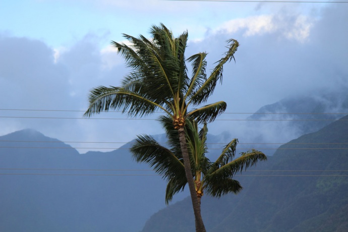
Iselle wind, 8/8/14. Photo by Wendy Osher.
(Update: 3:04 p.m. 8/8/2014)
The National Weather Service canceled the tropical storm warning for the island of Hawaiʻi.
A tropical storm warning continues for the counties of Maui, Oʻahu and Kauaʻi.
County Communications Director Rod Antone said the warning for Maui County is due to impacts still being felt on Lānaʻi and Molokaʻi. He said the Island of Maui is no longer under those conditions.
A tropical storm warning means that tropical storm conditions are expected somewhere within the warning area.
Iselle is currently 120 miles southwest of Honolulu and is still producing locally damaging wind gusts over the smaller islands, according to the Hawai’i Emergency Management Agency.
County officials say all Maui Bus fixed routes and paratransit service will resume from 3 p.m. today (8/8), or the next available route start time after 3 pm. Commuter service will resume regular service tomorrow morning.
(11:22 a.m. 8/8/2014)
Iselle is now going through a weakening phase, according to a midday update issued by the National Weather Service.
“We anticipate its interaction with the Big Island to take a number on it — kind of a gut punch for it. As it moves to the west, the center of the storm is now southwest of the Big Island, and is still moving to the WNW out over the ocean,” said Mike Cantin with the National Weather Service.
According to Cantin, “If you look at the satellite imagery and radar, you can’t really identify a good center to the system right now. It’s really ragged. The terrain of the Big Island did a number on its circulation. In fact, the middle and upper portion of the storm have moved onto the west as we anticipated. The lower portion has kind-of hung back over the Big Island and slowed down ever so slightly–hence the rainfall hanging over the eastern and southern portions of the Big Island thus far.”
As the system moves to the west, Cantin said, “all that deep tropical moisture along the eastern fringes of the system is now being chucked around to the north and northwest, streaming across Maui County and into Oʻahu, and is starting to work its way to Kauaʻi. So over the next several hours, we expect an increased and deeper moisture to work its way in.”
“We’ve already seen some heavy showers on Maui and Oʻahu with rain rates well over two inches per hour, moving quickly,” said Cantin, who noted that we will continue to see bursts of heavy rain.
“Those storms become locked in — and what we call train over the same area — they move through and another system moves in right after it, and that can lead to some serious flash-flooding,” said Cantin.
As for winds, Cantin said wind gusts continue to be strong enough to bring down trees across the state, with the exception being Kauaʻi. “It looks like the wind threat will linger as those storms continue driving in from the southeast as the system swings through. So, the threat is definitely not over,” said Cantin.
“As we go through the middle of the day into the afternoon, any of these heavy showers — in addition to producing that heavy rainfall, they are going to mix down the wind. The winds aloft are pretty strong still. As that rain falls down, it draws down those winds, so you get bursts of rain and wind — potentially taking out branches and power lines,” said Cantin.
“Later on this afternoon and evening as the storm continues westward, we’re going to start to see things dwindling for the Big Island, and then progressing more towards Oʻahu and into Kauaʻi,” said Cantin.
Right now, Cantin said, the current track may remain south enough with enough wind shear to continue to weaken the system that Kauaʻi may miss the worst of the conditions.
Maui remains under a tropical storm warning with an additional 3-5 inches of rain expected for Maui, and 1-2 additional inches of rain projected for the Big Island, according to the National Weather Service.
Sponsored Content


