

Daily Weather Forecast (10/16/14) By Meteorologist Malika Dudley
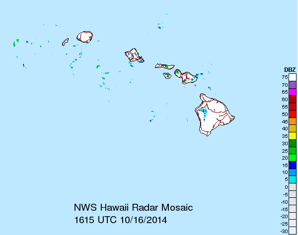
Radar imagery 10/16/14 6:30am – Image courtesy: National Weather Service in Honolulu
By Meteorologist Malika Dudley
MAUI NOW WEATHER FORECAST for Thursday 10/16/14
Today:
We expect partly cloudy skies today with scattered windward showers and isolated leeward showers. Highs in the mid to upper 80’s but feeling warmer than that due to the higher humidity with east winds around 15 mph. Winds may increase to 15 to 20 mph by Thursday night, gusting to 30 mph.
Ana:
Starting Friday there is quite a bit of uncertainty in the forecast. It’s highly dependent on where ANA ends up tracking and at what intensity. If the current forecast track holds true we expect gradual deterioration of our weather Friday with the possibility of frequent showers, thunderstorms, heavy rain and winds from 15 to 25 mph, gusting to 35 mph sometime Friday night. Same type of conditions Saturday through Monday with increasing winds – kicking up to 35 to 50 mph. I’ll keep an eye on it and bring you the latest as the situation remains very fluid over the next few days as ANA continues to approach.
Detailed ANA forecast for 10/16/14 at 2 p.m.
Surf:
Our current SSW will slowly fade through Friday. Today the best southern exposures might see wave heights of waist to chest high. As ANA continues to approach most of the swell will be blocked by the island of Hawaii for Maui County shores however, based on the track ANA ends up taking, we may see knee to chest high surf ahead of the storm for best exposed shores and sloppy but bigger conditions as the storm approaches. Again, totally dependent on where the storm ends up going. Our mix of north shore swells should bring waist to head high surf for best exposures Thursday and Friday.
Other Areas of Interest:
Sunset tonight at 6:01 p.m.
Sunrise tomorrow at 6:22 a.m.
UV index at 9 (“very high” exposure level)
Sponsored Content


