

Malika Dudley’s Maui County Forecast (10/30/14)
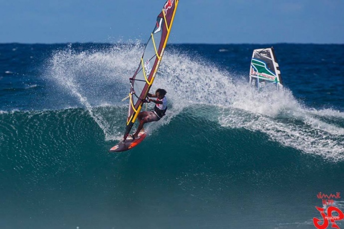
Aloha Classic at Ho’okipa yesterday / Image: Jimmie Hepp
**A breakdown of expected conditions specific to Maui County is presented below in graphical form. All graphics are provided by the National Weather Service in Honolulu.**
Alerts
The National Weather Service has issued a HIGH SURF ADVISORY for east shores of Molokaʻi and Maui until 6 a.m. Saturday, Nov. 1, 2014. Hazardous ocean conditions are expected due to a combo of north swell and increasing winds. Watch out for rip currents, dangerous shore break conditions and strong breaking waves.
A SMALL CRAFT ADVISORY is posted for the Pailolo Channel, Māʻalaea Bay and Maui County windward waters until 6 a.m. Saturday, Nov. 1, 2014. Rough seas are expected from 8 to 11 feet. Winds are forecasted out of the northeast at 20 to 25 knots. Inexperienced mariners are cautioned to avoid navigating in these conditions.
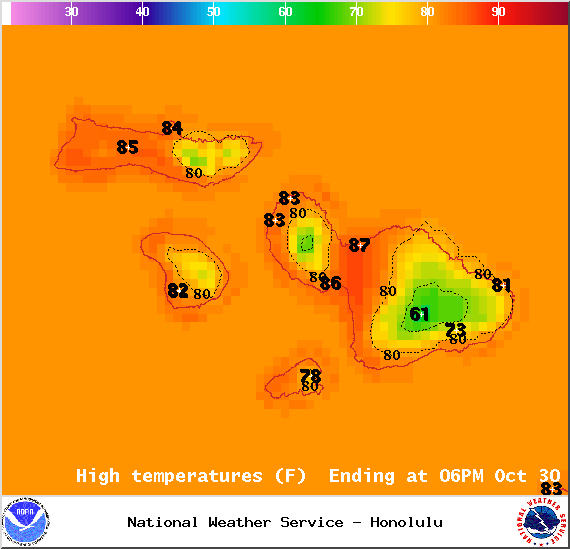
High Temperatures. Image courtesy National Weather Service.
Today
We expect mostly sunny skies for the leeward sides across Maui County with the possibility of isolated showers pushing into lee areas on our strong winds. Windward and mauka areas can expect mostly cloudy skies with scattered showers. Locally heavy rainfall is possible late in the day as a front approaches. High temperatures should fall in the range of 82° to 87° with higher elevations experiencing lower temperatures overall. Generally we expect trade winds from 15 – 25 mph.
Sunrise: 6:27 a.m.
Sunset: 5:51 p.m.
UV index at 7 (“high” exposure level)
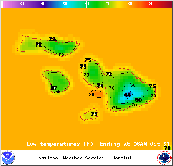
Low temperatures. Image courtesy National Weather Service.
Tonight
Tonight we expect breezy winds and cloudy conditions. We should get easterly winds from 15 to 25 mph. Leeward areas are forecasted to get scattered showers while windward and mauka spots could see frequent showers. Locally heavy rainfall is possible. Low temperatures should fall in the range of 74° to 79° with a high of about 71° at 5000 feet.
Moonrise: 12:37 p.m.
Moonset: 12:20 a.m.
Next Full Moon: Nov 6, 2014 at 12:23 p.m.
Next New Moon: Nov 22, 2014 at 2:33 a.m.
Halloween Night Forecast (will update tomorrow with the latest)
Kīhei/Mākena: Partly cloudy, 20% chance of isolated showers, winds 15 – 20 mph
Windward including Hāna/Makawao: Mostly cloudy, 50% chance of scattered showers, 15 – 25 mph
Central Maui – Partly cloudy, 20% chance of isolated showers, winds 10 – 25 mph
Leeward West side including Lahaina – Partly cloudy, 40% chance of scattered showers, winds 15 – 20 mph
Windward West side including Wailuku – Mostly cloudy, 50% chance of scattered showers, winds 15 – 20 mph
Lānaʻi City – Partly cloudy, 30% chance of scattered showers, winds 15 – 20 mph
Molokaʻi windward – Mostly cloudy, 70% chance of numerous showers, winds 15 – 25 mph
Molokaʻi leeward – Mostly cloudy, 50% chance of scattered showers, winds 15 – 20 mph, 35 mph gusts
Looking Ahead
The front that is expected to affect us today should gradually dissipate Friday through Saturday. Trade winds are forecasted to be breezy pushing showers into windward and mauka spots. The strongest winds could carry some showers into leeward areas as well. Heavier downpours are not out of the question at this point but because of the breezy winds, rainfall will not accumulate in one area for too long. Sunday trade winds are expected to gradually soften through early next week. Another cold front is expected midweek. Will keep an eye on it.
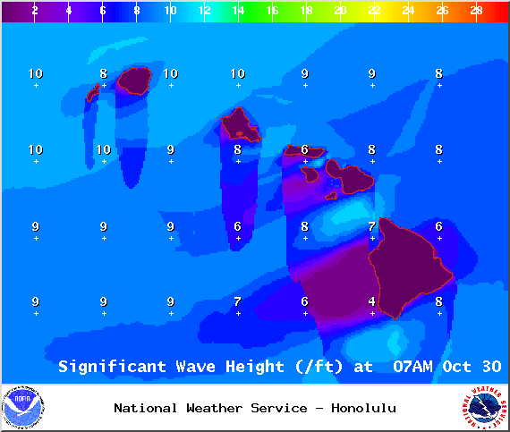
Significant Wave Heights. Image courtesy National Weather Service.
Surf & Seas
North: Surf is expected in the chest to shoulder high range with occasional plusses at the best breaks exposed to the swell.
West: Breaks exposed to the north swells should see waist to chest high waves with occasional plusses. Spots that catch a south-southwest could see wave heights up to waist high at the best exposures. Breaks that don’t catch either are forecasted to get ankle to knee high surf.
South: Ankle-slappers to possibly waist high surf is expected. The best southern exposures could see waves in the waist to chest high range.
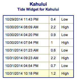
Kahului Tides. Image courtesy National Weather Service.
As expected, former hurricane ANA merged with a storm south of the Aleutians. This north-northwest swell (340-360°) should peak today. Another shot of surf energy is expected to fill in tonight into Friday, peaking in the afternoon at a couple feet overhead. The swell is expected to remain below advisory levels. A new northwest swell (305-325°) is expected by midweek.
A trade wind swell will build in as our trades strengthen. In tandem with the north swells mentioned above, this has prompted the high surf advisory for east facing shores.
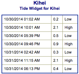
Kīhei tides. Image courtesy National Weather Service.
Our current south-southwest swell (200-180°) is expected to hold today before fading out Friday and into the weekend. A reinforcing swell (200-185°) is expected over the weekend, peaking in the knee to waist high range Saturday into Sunday morning before fading out. After that swell subsides, surf goes quiet with not much on the horizon out of the South Pacific.
Keep in mind, surf heights are measured on the face of the wave from trough to crest. Heights vary from beach to beach, and at the same beach, from break to break.
Almanac for Kahului Airport
Maximum Temperature for today:
Normal 86°
Record 95° / Set in 1984
Minimum Temperature for today:
Normal 69°
Record 59° / Set in 1949
Hydrology – wet and dry areas. Image courtesy National Weather Service.
Hydrology – wet and dry areas. Image courtesy National Weather Service.
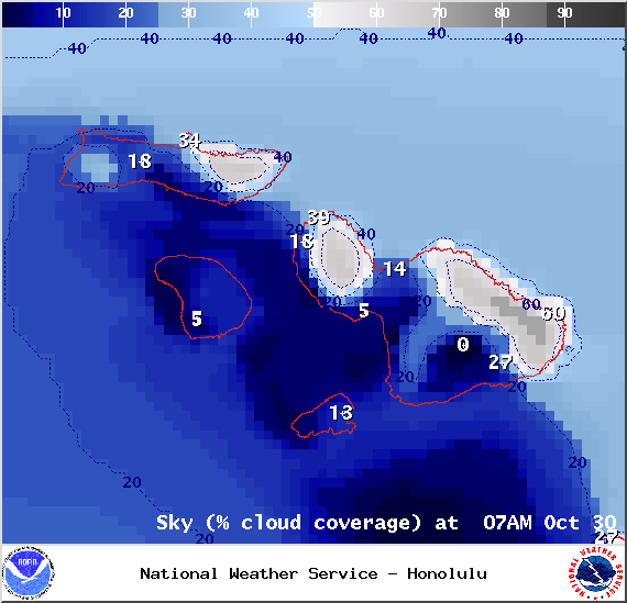
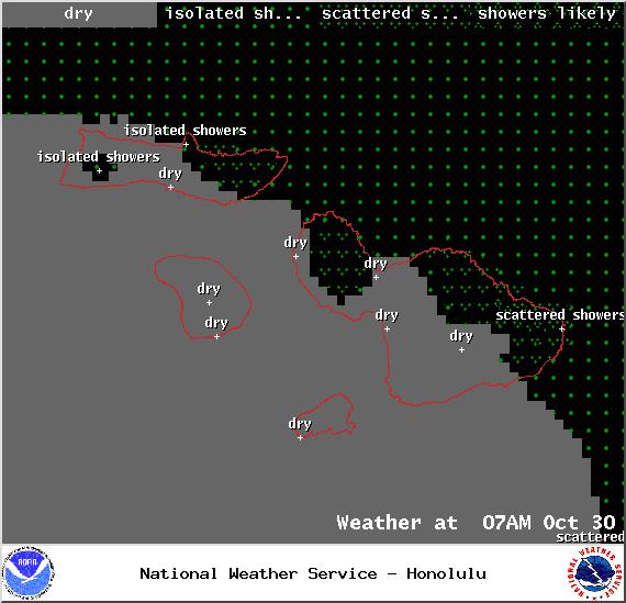
Cloud coverage 7 a.m. 10/30/14. Image courtesy National Weather Service.
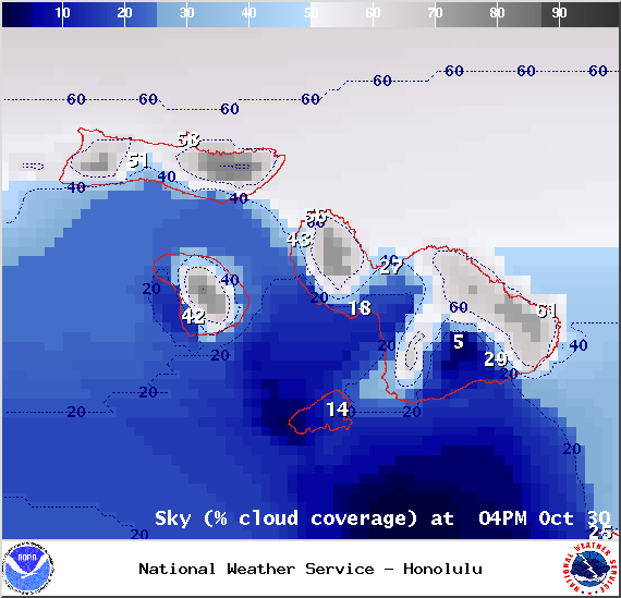
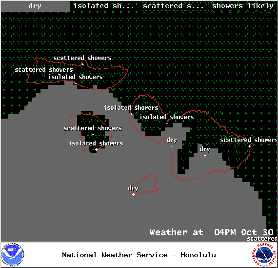
Cloud coverage 4 p.m. 10/30/14. Image courtesy National Weather Service.
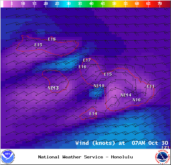
Wind imagery 7 a.m. 10/30/14. Image courtesy National Weather Service.
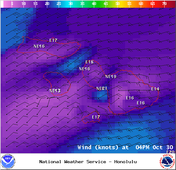
Wind imagery, 4 p.m. 10/30/14. Image courtesy National Weather Service.
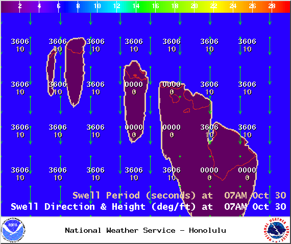
Swell imagery 7 a.m. 10/30/14. Image courtesy National Weather Service.
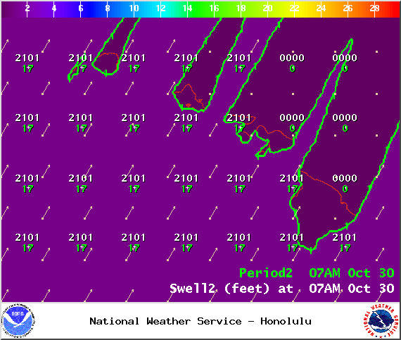
Swell imagery, 7 a.m. 10/30/14. Image courtesy National Weather Service.
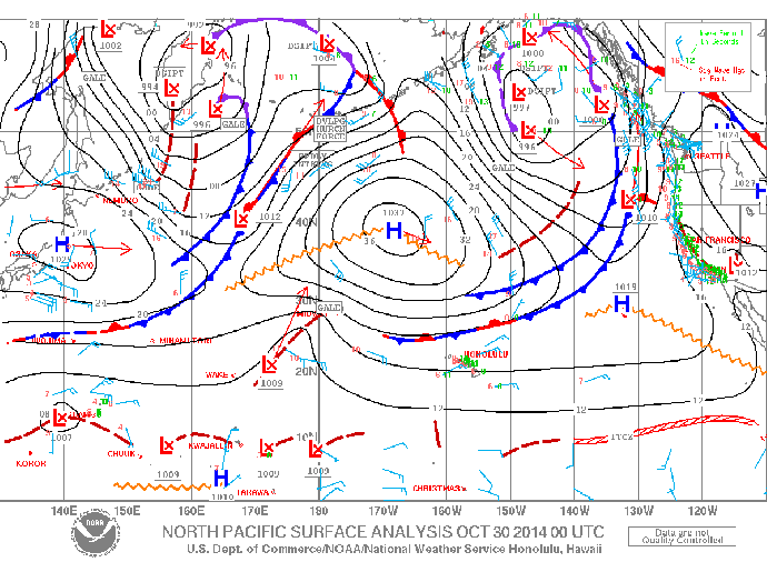
Ocean surface analysis 10/30/14. Image courtesy National Weather Service.
Sponsored Content


