

North Fills in Today, Series of Swells Expected
By Meteorologist Malika Dudley / Email: [email protected]
North: Surf is expected in the waist to head high range. Best breaks could see head high to slightly overhead set waves.
West: Breaks that don’t catch the swells are forecasted to get smaller surf in the ankle high range. Spots that are open to the north swell should see knee to waist high waves.
South: Ankle-slappers to possibly thigh high surf is expected as the south-southwest swell continues to ease.
A new northwest swell (315-335°) is expected to fill in this morning peaking in the knee to waist high range overnight.
A reinforcement is on tap out of the north-northwest (330-360°) building Wednesday and peaking late in the day and holding through early Thursday in the chest to head high range, slightly overhead on the sets.
Maybe an even bigger swell on the horizon for next weekend. Super Typhoon Nuri could possibly bring us a solid swell around 11/11.
Our current south-southwest swell continues to slowly fade out through the first half of this week. After that swell subsides, surf goes quiet with not much on the horizon out of the South Pacific.
Keep in mind, surf heights are measured on the face of the wave from trough to crest. Heights vary from beach to beach, and at the same beach, from break to break.
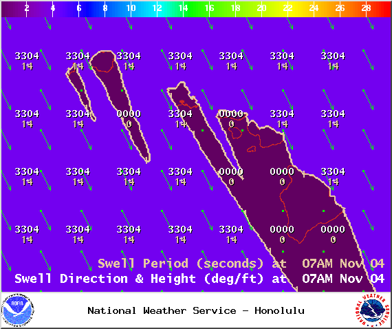
Swell 1 – Tuesday Nov. 4, 2014 / Image: NOAA / NWS
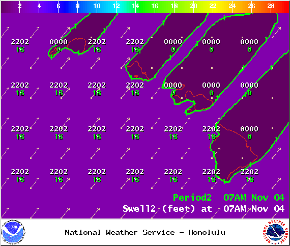
Swell 2 – Tuesday Nov. 4, 2014 / Image: NOAA / NWS
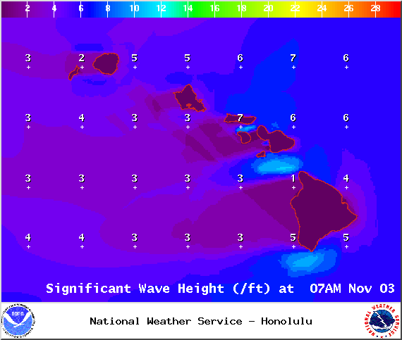
Wave heights – Tuesday Nov. 4, 2014 / Image: NOAA / NWS
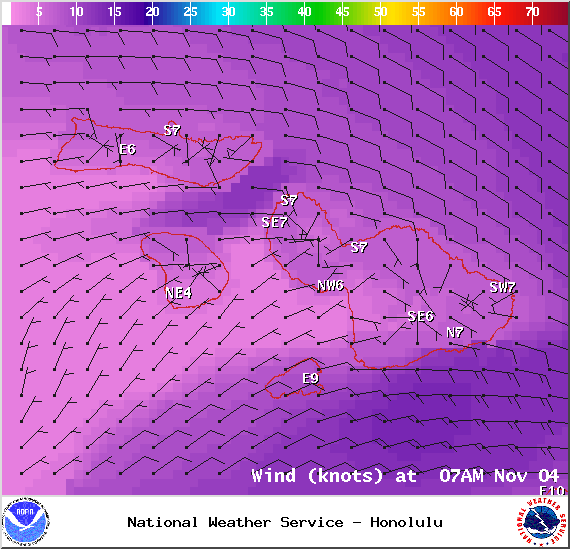
Expected winds at 7am in Maui County on Tuesday Nov. 4, 2014 / Image: NOAA / NWS
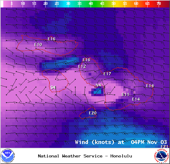
Expected winds at 4pm in Maui County on Tuesday Nov. 4, 2014 / Image: NOAA / NWS
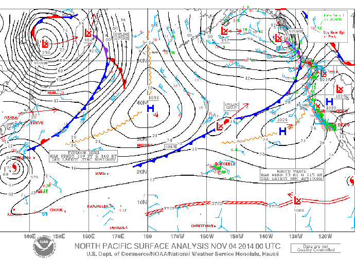
Surface map – Tuesday Nov. 4, 2014 / Image: NOAA / NWS
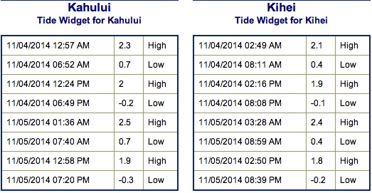
Tides – Tuesday Nov. 4, 2014 / Image: NOAA / NWS
Sponsored Content


