

Large NNW Swells Expected
By Meteorologist Malika Dudley / Email: [email protected]
**Click on the images below to make them larger.**
North: Surf is expected in the chest to head high range. Best breaks could see overhead to a couple feet overhead set waves, especially early in the day.
West: Breaks that don’t catch the swells are forecasted to get smaller surf in the ankle high range. Spots that are open to the north-northwest swell should see waist to head high waves. Maybe even overhead from time to time, especially early in the day.
South: Ankle-slappers to possibly thigh high surf is expected.
 Our current north-northwest swell (325-355°) is bringing waves in the chest to head high range with some plusses for our best exposures. This swell will begin to fade tomorrow. Maybe an even bigger swell (320-345°) on the horizon for next weekend, possibly peaking with waves well overhead. Typhoon Nuri could possibly bring us a solid swell starting around Nov. 10 and peaking Nov. 11 with waves well overhead for best breaks.
Small swells generated in the South Pacific are expected to bring us waves in the thigh high or less range. You might see possible plusses at the best tides and exposures but they will be inconsistent at best and Maui County spots shadowed by other islands will remain flat. There isn’t much on the horizon out of the South Pacific.
Keep in mind, surf heights are measured on the face of the wave from trough to crest. Heights vary from beach to beach, and at the same beach, from break to break.
**Click here for Malika’s full weather report.**

Ho’okipa / Image: Jimmie Hepp
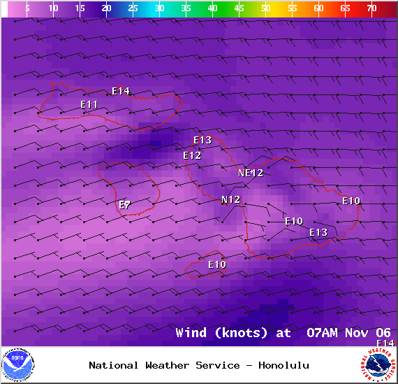
Image: NOAA / NWS
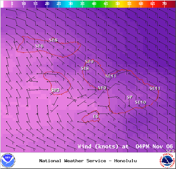
Image: NOAA / NWS

Image: NOAA / NWS
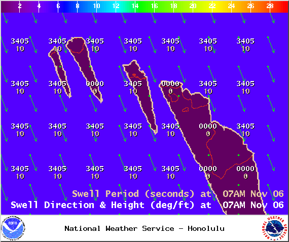
Image: NOAA / NWS
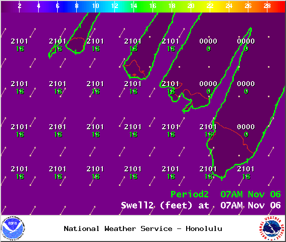
Image: NOAA / NWS
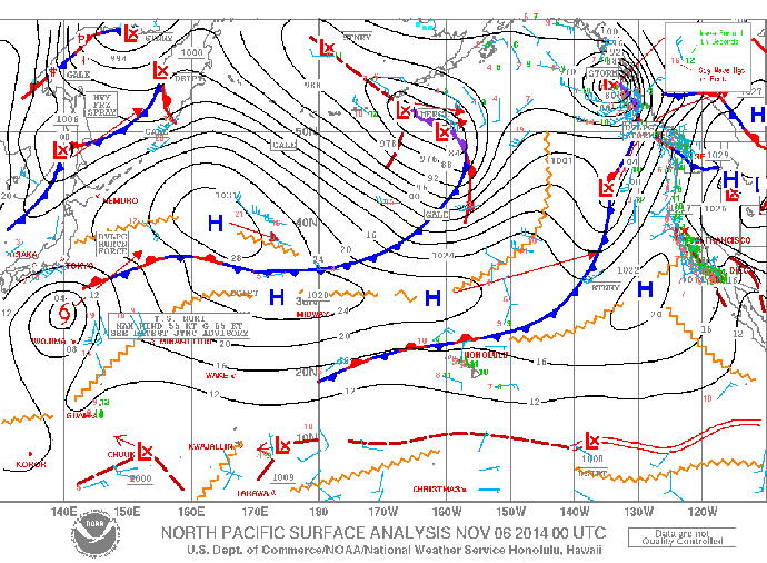
Image: NOAA / NWS
Sponsored Content


