

Hazy Skies and Showers Possible Across Maui County Today

Image: Elenita Mamuad
By Meteorologist Malika Dudley / Email: [email protected]
Alerts
The National Weather Service allowed has extended the High Surf Advisory for the west side of Molokaʻi and the north shores of both Maui and Molokaʻi until Friday at 6 a.m.
A reinforcing north northwest swell is expected to arrive later today, once again pushing surf heights to the high surf advisory criteria along most north and west facing shores of the smaller Hawaiian islands. This elevated surf will likely continue through Friday.
**Click directly on the images below to make them larger. Charts include: Maui County high/low forecasted temperatures, projected winds, chance of cloud cover, projected localized weather conditions and expected wave heights.**
Today, Thursday November 13, 2014
Partly sunny skies with scattered showers are expected today. An area of enhanced moisture is expected to bring increasing showers along the south facing slopes of Haleakala. Prefrontal moisture is also forecasted to impact Maui County this afternoon and into the evening. The UHSOEST vog model is showing areas of haze throughout Maui County today. High temperatures should fall in the range of 82° to 87° with highs from 68 – 71° at 5000 feet. Winds are expected to be variable up to 15 mph. In the afternoon they are forecasted to veer out of the south at about 15 mph.
Sunrise: 6:35 a.m.
Sunset: 5:45 p.m.
UV index at 7 (“high” exposure level)
Tonight
Tonight we expect mostly cloudy skies with passing showers. Southwest winds up to 15 mph are forecasted. Low temperatures should fall in the range of 73° to 78° with a low of about 49° at 5000 feet. The moon is 62.8% full tonight.
Moonrise: 11:58 p.m.
Moonset: 12:50 p.m.
Next New Moon: Nov 22, 2014 at 2:33 a.m.
Next Full Moon: Dec 6 at 2:27 a.m.
Looking Ahead
A front that stalled over Oahʻu on Tuesday is expected to linger and help draw moisture up from the south and over Maui County today. These showers will be quite disorganized and scattered in nature. A second front is expected to bring prefrontal moisture to Maui County and the Big Island this afternoon and into the evening. As the front pushes down the island chain Saturday and Sunday, moisture from the deep tropics that is lingering in our area coupled with unstable conditions aloft may be enough to fuel substantial rainfall and even thunderstorms over the weekend. Will keep an eye on it. Cooler, drier conditions are expected early next week.
The Leonid meteor shower is active beginning today. For more details on the show in the sky click here.
Almanac for Kahului Airport
Maximum Temperature for today:
Normal 84°
Record 92° / Set in 1968
Minimum Temperature for today:
Normal 68°
Record 59° / Set in 1967
**Click here for your detailed Maui County surf report.**
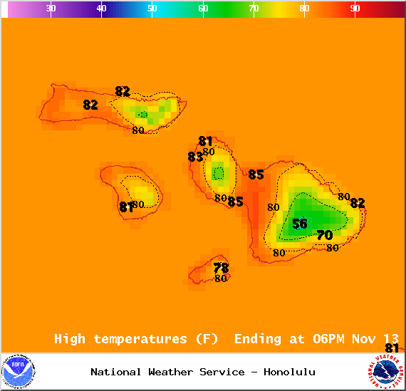
Image: NOAA / NWS

Image: NOAA / NWS
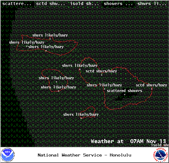
Image: NOAA / NWS
Image: NOAA / NWS

Image: NOAA / NWS
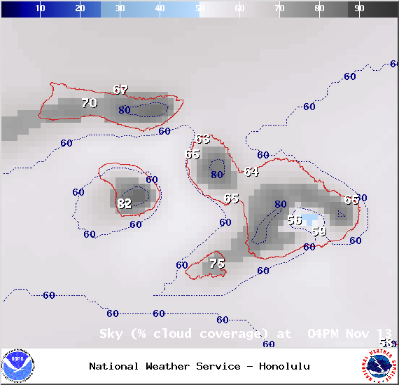
Image: NOAA / NWS

Image: NOAA / NWS
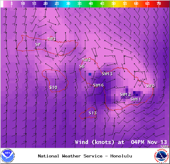
Image: NOAA / NWS
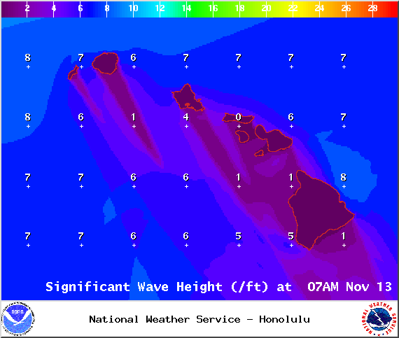
Image: NOAA / NWS
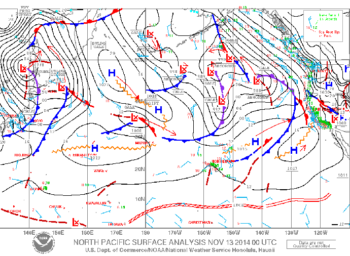
Image: NOAA / NWS
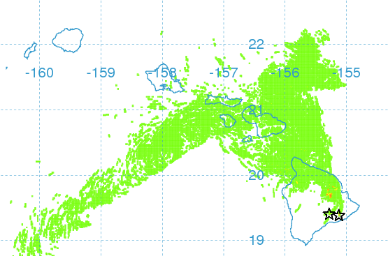
Image: UHSOEST
Sponsored Content


