Strong Trade Winds Today, Showers Likely Tomorrow
By Meteorologist Malika Dudley / Email: [email protected]
Alerts
The Small Craft Advisory has been extended to Thursday at 6 a.m. for Maui County waters, the Pailolo Channel, Māʻalaea Bay and the ʻAlenuihāhā Channel. Winds of 25 to 30 knots are expected out of the northeast and seas up to 14 feet. Inexperienced mariners should avoid navigating in these conditions.
**Click directly on the images below to make them larger. Charts include: Maui County high/low forecasted temperatures, projected winds, chance of cloud cover, projected localized weather conditions and expected wave heights.**
Today, Wednesday November 19, 2014
Today we expect trade wind weather. That means windward and mauka areas can expect scattered morning showers with partly cloudy skies during the day. Leeward spots can expect mostly clear skies and lots of sunshine. High temperatures should fall in the range of 81° to 86° with highs from 67 – 70° at 5000 feet. East winds are expected from 15 – 25 mph with gusts to 40 mph.
Sunrise: 6:38 a.m.
Sunset: 5:44 p.m.
UV index at 6 (“high” exposure level)
Tonight
Tonight we expect mostly clear skies for leeward spots. Windward and mauka areas will have partly cloudy skies and scattered showers. East winds from 15 to 20 mph are forecasted. Low temperatures should fall in the range of 67° to 72° with a low of about 52° at 5000 feet.
Moonset: 4:00 p.m.
Moonrise: 5:00 a.m. on Nov. 20
Next New Moon: Nov. 22, 2014 at 2:33 a.m.
Next Full Moon: Dec. 6 at 2:27 a.m.
The peak nights of the Leonid meteor shower have passed but the shower is active until November 20. For details on the show in the sky click here.
Looking Ahead
Our current cool, dry trade wind weather conditions are expected to hold through tomorrow. Trade winds are expected to remain breezy through the week with lighter winds currently forecasted for the weekend. Thursday night unstable conditions could spawn enhanced showers for Maui County. Showers will be more active through about Saturday morning. Friday into the weekend there’s the possibility for isolated thunderstorms. A front is expected to reach the islands late this weekend, pushing down the island chain to Maui County sometime on Monday. Ahead of the front showery weather is likely to be drawn up out of the south.
Almanac for Kahului Airport
Maximum Temperature for today:
Normal 84°
Record 91° / Set in 1992
Minimum Temperature for today:
Normal 68°
Record 58° / Set in 2004
**Click here for your detailed Maui County surf report.**

Image: NOAA / NWS

Image: NOAA / NWS

Conditions at 7am – Image: NOAA / NWS
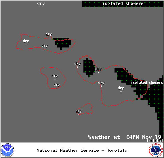
Conditions at 4pm – Image: NOAA / NWS

Cloud Cover Conditions at 7am – Image: NOAA / NWS
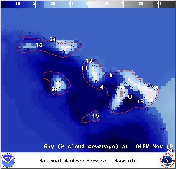
Cloud Cover Conditions at 4pm – Image: NOAA / NWS
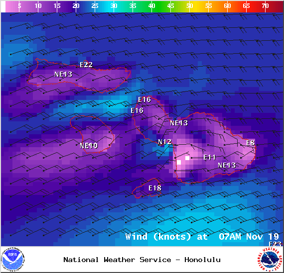
Wind Conditions at 7am – Image: NOAA / NWS
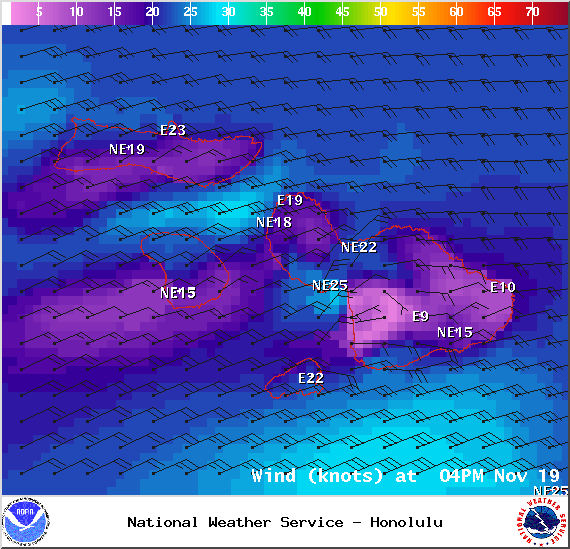
Wind Conditions at 4pm – Image: NOAA / NWS
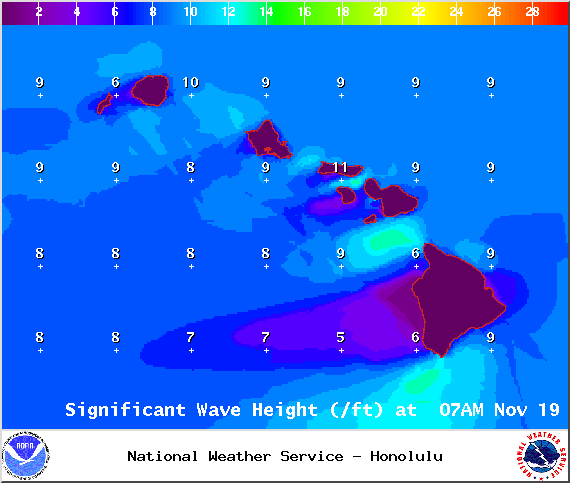
Swell Heights at 7am – Image: NOAA / NWS
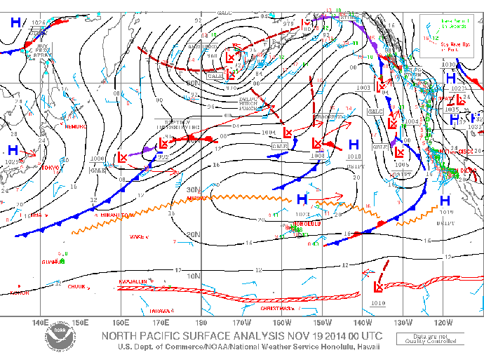
Surface Map – Image: NOAA / NWS
Sponsored Content