

Several Ocean Alerts Posted for Large Thanksgiving Swell
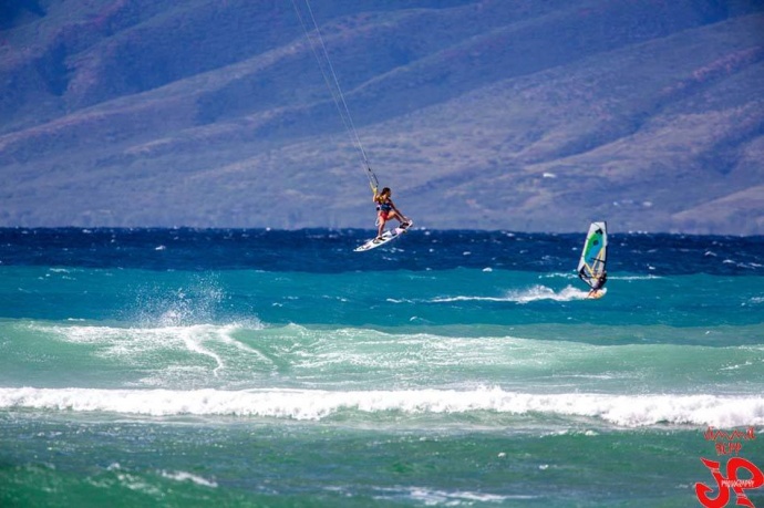
Ho’okipa yesterday / Image: Jimmie Hepp
By Meteorologist Malika Dudley / Email: [email protected]
Alerts
A Wind Advisory is in effect until 6 p.m. this evening for winds out of the northeast from 20 to 35 mph, gusting to 45 mph across the Maui Central Valley, Lāna’i and Kaho’olawe. The advisory may need to be extended if strong winds persist. Winds this strong can bring down tree branches and make driving difficult, especially for high profile vehicles.
A High Surf Advisory is in effect for the north and east facing shores of Maui and Molokaʻi for a larger than expected north-northeast swell. Surf along north facing shores could reach heights of 12 to 15 feet. Surf along east facing shores could reach heights of 8 to 12 feet. The advisory is set to expire at 6 p.m. on Thursday.
Expect strong breaking waves, shore break and dangerous currents that make getting into the water hazardous and swimming difficult.
A Marine Weather Statement has been issued by the National Weather Service for north facing harbors, including Kahului harbor. A large north-northeast swell will continue to affect these areas producing moderate surges and large breaking waves. Mariners should exercise caution when operating vessels inside harbors or near harbor entrances.
A Small Craft Advisory is posted for all Maui County waters until 6 p.m. today. Winds of 20 to 25 knots are expected and rough seas from 10 to 15 feet. Inexperienced mariners should avoid navigating in these conditions.
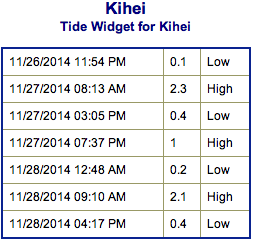
**Click directly on the images below to make them larger. Charts include: Maui County projected winds, forecasted swell direction, height & period, tides, a surface map and expected wave heights.**
 Maui County Surf Forecast, Thursday November 27, 2014
North: Surf is expected overhead to double maybe even triple overhead for the best spots on Molokaʻi and Maui’s northern exposures.
West: Spots that are open to the northwest-north swell will get some wrap with waves expected overhead or more. Breaks that don’t catch the swell are forecasted to get smaller surf at ankle high or flat.
South: Many areas will remain flat today.
A mix of north-northwest and north-northeast swells today. This swell is expected to begin to ease as the day goes on. A new north-northwest is expected to fill in Friday bringing overhead to possibly double overhead waves at the best exposures.
 Another swell out of the northeast is expected to bring another round of overhead waves over the weekend. New west-northwest swell could start building Monday with a reinforcement over the weekend. Will keep an eye on it.
Super small trace amounts of swell expected out of the SPAC. Tiny to small surf is expected off and on for top spots through Saturday this week (180-220°). There isn’t much on the horizon to get excited about.
**Click here for your detailed Maui County weather report.**
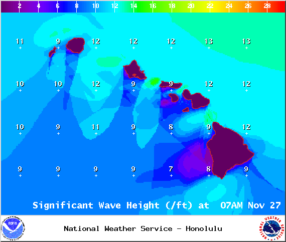
Image: NOAA / NWS
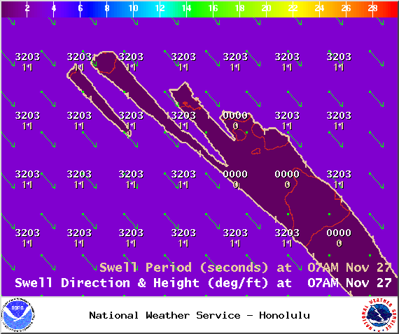
Image: NOAA / NWS

Image: NOAA / NWS
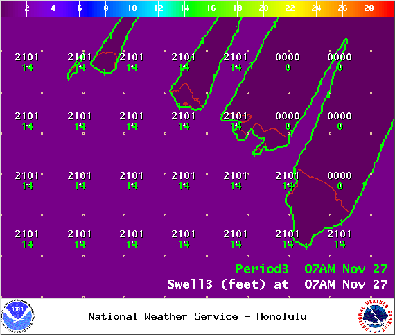
Image: NOAA / NWS
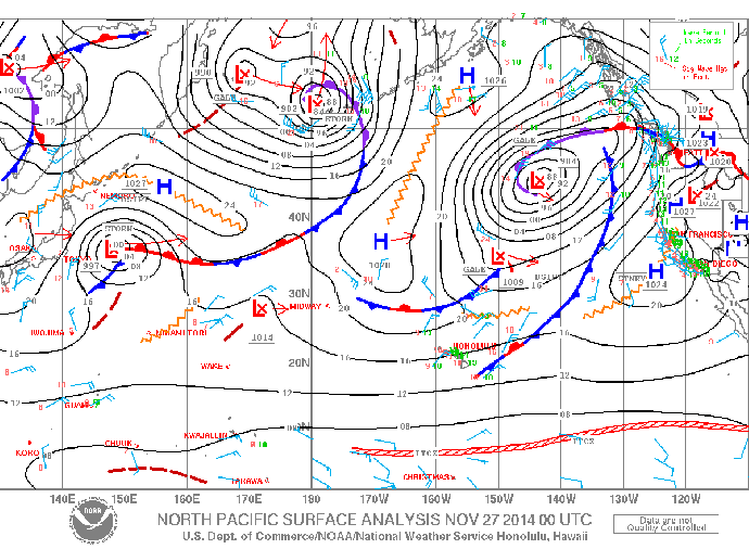
Image: NOAA / NWS

Image: NOAA / NWS
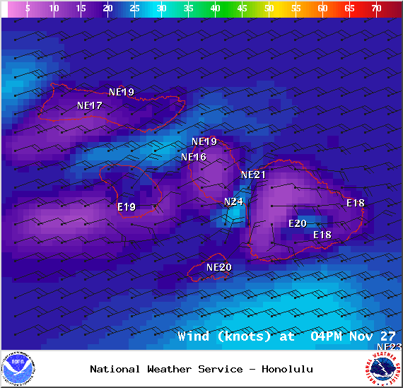
Image: NOAA / NWS
Sponsored Content


