Photo by Wendy Osher, ʻĪao Stream 7/29/13.
By Maui Now Staff
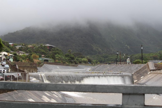
Today (Thursday, July 23, 2015) is the deadline to comment on a draft environmental assessment filed by the US Army Corps of Engineers and the Maui Public Works Department for the proposed modification of the ʻĪao Stream (Wailuku River) Flood Control Project located in Wailuku.
The purpose of the project is to address ongoing flood hazards caused by long-term damage to the existing flood control structures since their original construction in 1981.
ARTICLE CONTINUES BELOW AD ARTICLE CONTINUES BELOW AD According to the document, the waterway is in danger of reverting to a flood hazard zone due to deterioration of the right bank, and undermining of the levee toe, resulting from changes in the streambed dynamic, and upstream watershed use and development that have occurred during the past 30 years.
ʻĪao. Photo by Wendy Osher.
The Draft EA has been prepared pursuant to both the National Environmental Policy Act of 1969 and the Hawaiʻi law on Environmental Impact Statements.
Members of the public and agencies that have special expertise, legal jurisdiction, or interest in the proposed action are invited to participate in the review process.
ARTICLE CONTINUES BELOW AD The Draft Environmental Assessment is available for review online, with comments due by July 23, 2015.
Below is a brief project description and background as outlined in the DEA:
“The ‘Īao Stream (Wailuku River) drainage basin is a 10 square mile area that begins at the boundary between the Lahaina and Wailuku Judicial districts and extends from the crests of the Kahoʻolewa and Kapilau Ridges to the Pacific Ocean.
The basin is 8 miles long and averages 1.25 miles in width. It is characterized by two major topographic features: a coastal plain that extends about 3 miles inland, and ‘Īao Valley, the largest valley in West Maui, which extends from the coastal plain to the summit of Pu‘u Kukui at an elevation of 5,800
feet above sea level.
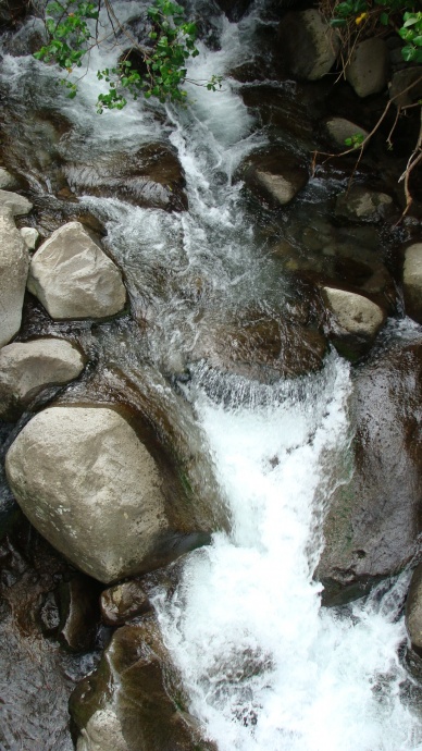
‘Īao Stream (Wailuku River) is about 12,000 ft in length from an upstream sediment basin to its outlet into Kahului Bay, and about 30% is lined with existing concrete channels. The remaining portions of the stream are an alluvial channel where the stabilization problem s occur. Levees are situated on the right bank to protect the town of Wailuku. For more than a century, stream flow had been intermittent below the ‘Īao intake due to three diversion structures which redirected the water to agricultural areas.
Downstream of these agricultural diversion structures, stream flow had been absent 80 to 90% of the time, punctuated by infrequent high flows following intense rainfall events when stream discharge volume was sufficient to over top the agricultural diversion structures. High water flows into the channelized portion of ‘Īao Stream occurred only during periods of prolonged intense rainfall. In April 2014, an interim in-stream flow standard was established following an Order and Agreement issued by the Commission on Water Resource Management.
Pursuant to that April 2014 Settlement Agreement, the Wailuku Water Company began the release of 10 million gallons of water per day into ‘Īao Stream (Wailuku on October 13, 2014.”