VIDEO: Tracking Tropical Disturbance 96-C, Current Forecast “Optimistic”
By Wendy Osher / Video by Meteorologist Malika Dudley
Warning Coordination Meteorologists with the Central Pacific Hurricane Center are currently monitoring a tropical disturbance in the Central north Pacific.
As of 1:46 p.m. on Wednesday, Sept. 23, Tropical Disturbance 96-C was located less than 800 miles southeast of Hilo, Hawaiʻi.
Forecasters say showers and thunderstorms associated the area of low pressure have continued to pulse over the past several hours.
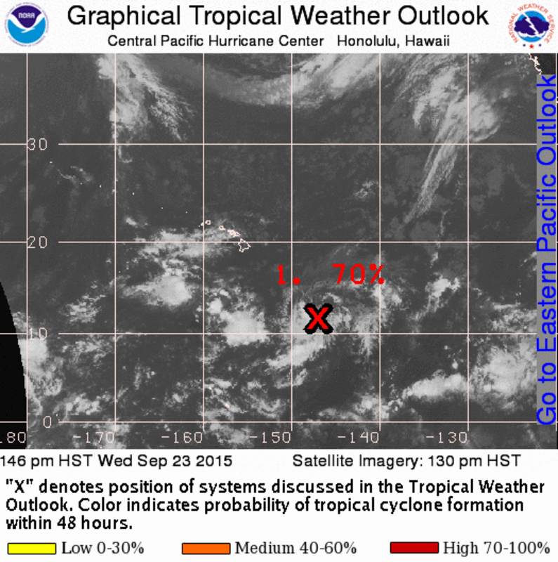
Tropical Disturbance 96-C. Image credit: NWS/CPHC/NOAA
A tropical weather outlook issued by the agency states that “environmental conditions will remain conducive for development over the next couple of days as the low moves slowly toward the northwest.”
The agency states that the chance of the system forming into a cyclone over the next 48 hours is 70%.
“It’s not completely formed as a tropical cyclone yet, but it looks likely that we will see a tropical cyclone in this area,” said CPHC Warning Coordination Meteorologist Chris Brenchley during an interview with Maui Now Meteorologist Malika Dudley on Wednesday afternoon.
“You can see the cloud bands are already circulating in,” said Brenchley. “The general consensus of the models is that it will slowly drift north, but we don’t see it as a real imminent threat to the islands at this time.”
“As it goes north, what happens is, if it does develop as a tropical cyclone, it gets a lot of wind shear… which would start to weaken it,” said Branchley.
Sponsored Content