

High Surf Warning, New XL WNW Expected

Image: Jimmie Hepp
Alerts
A High Surf Warning is posted for the north & west facing shores of Molokai and the north shore of Maui from 9 a.m. Tuesday through 6 p.m. Wednesday. Surf along north facing shores is expected to be 20 to 30 feet. West shores are expected to get up to 12 to 20 feet.
A Small Craft Advisory is posted for all windward waters and the Pailolo channel through 6 p.m. Wednesday for seas up to 14 feet.
Check our breaking news section for any urgent weather alerts.
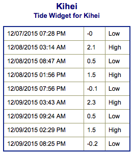
**Click directly on the images below to make them larger. Charts include: Maui County projected winds, tides, swell direction & period and expected wave heights.**
 Maui Surf Forecast
North: Wave heights are expected to be head high to a couple feet overhead today. In the late afternoon and evening sets will reach overhead to maybe even double overhead by sunset.
West: Wave heights about waist high today. Spots farther to the south are much smaller.
South: Wave heights under knee high today. Spots shadowed by other islands will be flat.
 Our current northwest swell is expected to continue fading today. A new west-northwest will build late in the day to warning levels. The swell is expected to peak early Wednesday and get up to 2 to 3 times overhead. The best deep water breaks open to the swell could get up to 4 or even 5 times overhead. Swell should begin easing late in the day Wednesday. This swell will shift to a more northwesterly swell later in the week.
Our current south-southwest is mainly leftovers today.
Trade swell will rebuild for the second half of the week as winds pick up in strength.
Keep in mind, surf heights are measured on the face of the wave from trough to crest. Heights vary from beach to beach, and at the same beach, from break to break.
**Click here for your detailed Maui County weather report.**
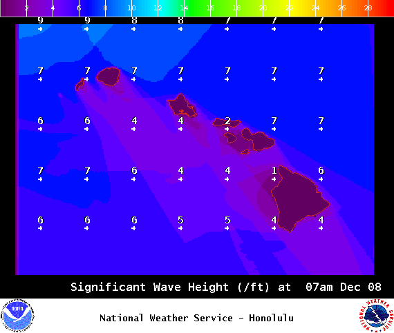
Image: NOAA / NWS
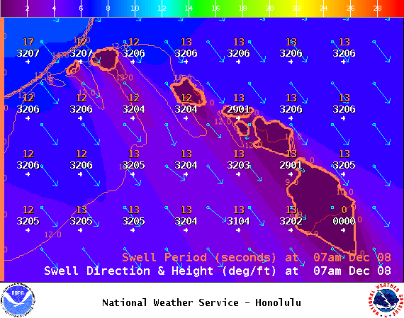
Image: NOAA / NWS
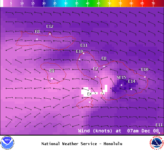
Image: NOAA / NWS
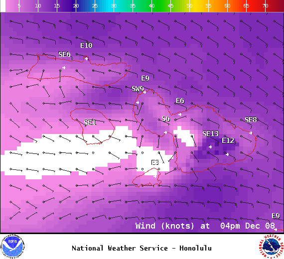
Image: NOAA / NWS
Image: NOAA / NWS
Sponsored Content


