

Storm in NW Pacific Sending First Big Swell of Season
Image: Tad Craig
Alerts (as of 1:00 a.m.)
A Small Craft Advisory is in effect for our usual windy coastal waters.
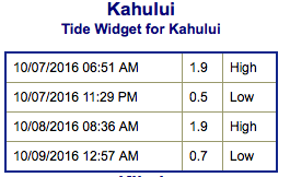
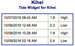
**Click directly on the images below to make them larger. Charts include: Maui County projected winds, tides, swell direction & period and expected wave heights.**
 Maui Surf Forecast
North: Wave heights are expected to be knee/waist high today.
West: Surf is knee/waist high today with some tummy high waves on the sets at the best breaks.
South: Surf is knee/waist high today with some tummy high waves on the sets at the best breaks.
 Minimal south-southwest energy this week. A small south swell is peaking Friday with knee to waist high waves at the best exposures.
Minor north-northwest swell up to about waist high for exposed breaks.
Back to back pulses out of the North Pacific are lining up this weekend and early next week. The first storm has developed in the northwest Pacific and is sending our first good size northerly swell for the winter season. Northwest swell builds through Saturday and peaks Sunday morning before fading later that day into Monday. Another swell is expected to build late Tuesday as well.
Keep in mind, surf heights are measured on the face of the wave from trough to crest. Heights vary from beach to beach, and at the same beach, from break to break.
**Click here for your detailed Maui County weather report.**
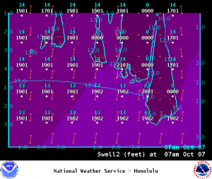
Image: NOAA
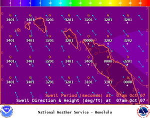
Image: NOAA
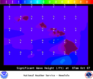
Image: NOAA
Image: NOAA
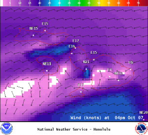
Image: NOAA
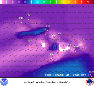
Image: NOAA
Sponsored Content


