

Flood Watch Extended, Unsettled Weather Through Weekend

Image: Chris Archer
Alerts (as of 1:00 a.m.)
A Flash Flood Watch is posted through Sunday afternoon.
A High Surf Advisory is posted for east facing shores until 6 p.m. Friday.
A Gale Warning is posted through 6 a.m. Friday for our windiest channels and waters.
A Small Craft Advisory is posted for all remaining Maui County waters through 6 a.m. Saturday.
**Click directly on the images below to make them larger. Charts include: Maui County high/low forecasted temperatures, projected winds, projected localized weather conditions and expected wave heights.**
Looking Ahead
A disturbance high in the atmosphere has created instability that led to snowfall on our Big Island summits yesterday. This feature will remain just south of the islands through Friday. Breezy trade winds will give way to increasingly moist southerly flow over the state. The combination of these two features will cause pockets of heavy rain and even a few thunderstorms over and near the state for the next few days. The disturbance is forecast to move away from the islands on Monday with the airmass drying out somewhat at that time.
Today
Windy conditions are expected today with mostly cloudy skies and likely showers for windward spots. Scattered showers are forecast for leeward spots. Locally heavy rainfall is possible with a slight chance of thunderstorms. High temperatures from 79° to 84°. Northeast winds 15 to 20 mph, with higher gusts.
UV index at 6 (“high” exposure level)
Tonight
East to southeast winds 10 to 20 mph. Mostly cloudy with scattered showers. Low temperatures from 67° to 72°.
Our Maui Now Weather homepage always includes daily: Sunrise | Sunset | Moonrise | Moonset | Moon Phase | Live Weather Cams | 5-day Forecast | Current Temperature & Conditions
***Click here for your marine outlook and surf report.***
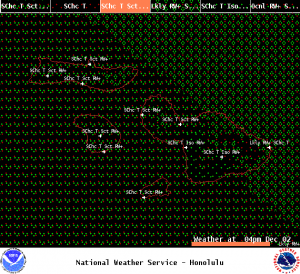
Image: NOAA

Image: NOAA
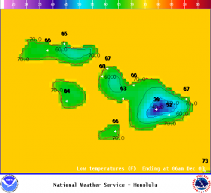
Image: NOAA
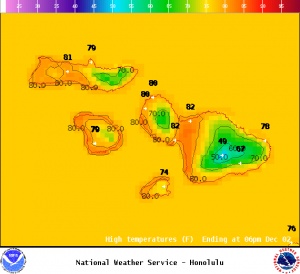
Image: NOAA
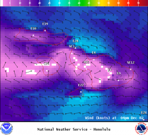
Image: NOAA
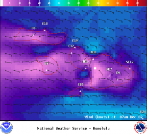
Image: NOAA
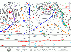
Image: NOAA
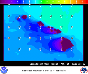
Image: NOAA
Sponsored Content


