

Fernanda Takes NW Turn, Steady Weakening Forecast
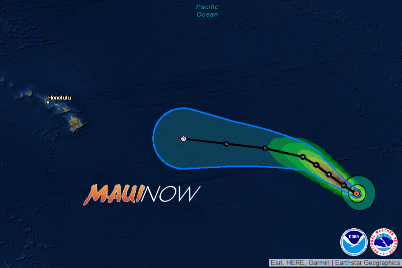
Hurricane Fernanda remains in the Eastern Pacific and is now located an estimated 1645 miles ESE of Hilo, Hawaiʻi.
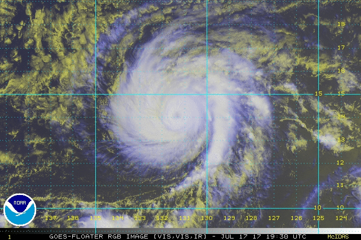
As of 5 a.m. HST (8 a.m. PDT) on Monday, July 17, 2017, Fernanda had 125 mph sustained winds and was categorized as a Category 3 (winds 111-130 mph) hurricane.
It’s current track has taken a turn for the NW and its present movement is at 10 mph.
Forecasters with the National Hurricane Center say steady weakening is forecast during the next 48 hours.
The official intensity forecast shows steady weakening with the system becoming a remnant low around day 5.
It is too soon to determine what the direct impacts to the state will be at this time. However, an increase in surf is expected Tuesday and a general increase in moisture is possible next weekend.
(In relation to other areas within the Hawaiian Islands, the system at 5 a.m. HST, was located: 1715 miles ESE of Kailua-Kona; 1680 miles ESE of South Point; 1725 miles ESE of Hāna; 1750 miles ESE of Kahului; 1795 miles ESE of Kaunakakai; 1785 miles ESE of Lānaʻi City; 1855 miles ESE of Honolulu; 1855 miles ESE of Joint Base PHH; 1980 miles ESE of Barking Sands; 1955 miles ESE of Līhue; 2000 miles ESE of Niʻihau; 2580 miles E of Johnston Atoll; 1830 miles SSW of Las Vegas NV; and 3140 miles ESE of Midway.)

Fernanda Advisory #023. 8 a.m. PDT (5 a.m. HST) Mon Jul 17, 2017. PC: NOAA/NWS/National Hurricane Center.

Fernanda Advisory #023. 8 a.m. PDT (5 a.m. HST) Mon Jul 17, 2017. PC: NOAA/NWS/National Hurricane Center.
Fernanda Advisory #023. 8 a.m. PDT (5 a.m. HST) Mon Jul 17, 2017. PC: NOAA/NWS/National Hurricane Center.
Fernanda Advisory #023. 8 a.m. PDT (5 a.m. HST) Mon Jul 17, 2017. PC: NOAA/NWS/National Hurricane Center.
Sponsored Content


