

NW & SW Swells Bring Waves to Maui County

Image: Asa Ellison
Alerts (as of 1:00 a.m.)
Flash Flood Watch: Posted from Monday morning through Tuesday afternoon. Heavy showers associated with an upper trough and cold front moving down the island chain could result in flash flooding Monday through Tuesday. The latest guidance indicates the greatest potential for flooding will occur over Oahu, Maui County and Big Island.
**Click directly on the images below to make them larger. Charts include: Maui County projected winds, tides, swell direction & period and expected wave heights.**
Maui Surf Forecast
North: Surf heights are expected to be chest/head high today for spots open to the trade swell. Northwest swell is up to about chest/head high as well. New north-northwest starts building Sunday afternoon.
West: Surf heights are expected to be chest/head high today for spots open to the trade swell. Spots not catching the trade swell but catching the northwest could get up to chest/head high. Spots catching the southwest could get up to knee/waist high in the morning and dropping.
South: Spots catching the southwest could get up to knee/waist high in the morning and dropping.
Northeast trade swell for eastern exposures is forecast to continue fading. Our current northwest pulse is dropping today, another northwest reinforcement is expected to fill in Wednesday with a larger northwest forecast for Friday.
A fun south-southwest has filled in and is forecast to peak Monday and keep waves waist/chest/shoulder high through the middle of the week before slowly fading Thursday and into the weekend.
Keep in mind, surf heights are measured on the face of the wave from trough to crest. Heights vary from beach to beach, and at the same beach, from break to break.
**Click here for your detailed Maui County weather report.**
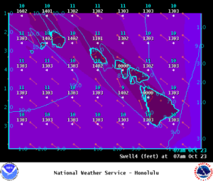
Image: NOAA
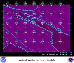
Image: NOAA
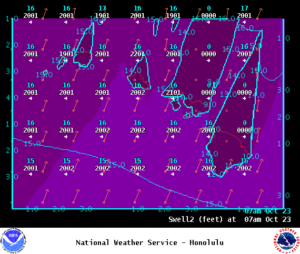
Image: NOAA
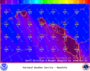
Image: NOAA
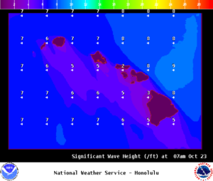
Image: NOAA
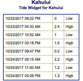
Image: NOAA
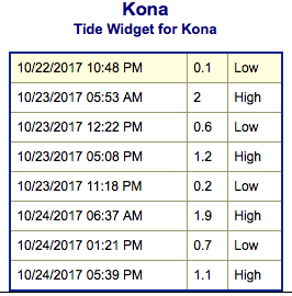
Image: NOAA
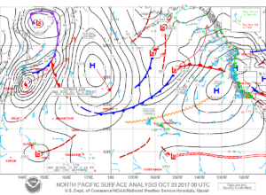
Image: NOAA
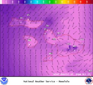
Image: NOAA
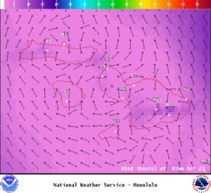
Image: NOAA
Sponsored Content


