

20th Fissure Opens, Elevated Levels of Sulfur Dioxide
Hawaiian Volcano Observatory reports a new fissure has opened in the Lanipuna Gardens Subdivision northeast from fissure 19. That brings the total count to 20 since the eruption onset in the East Rift Zone on May 3, 2018. The narrow lava flow from fissure 17 is still moving slowly toward the ocean at approximately 20 yards per hour. There are no homes or roads threatened at this time.
Due to the volcanic activity, the following are issued:
- The Hawaii Department of Transportation (HDOT) is working to reopen the Keaʻau-Pāhoa Road (Highway 130) from Mālama Street to Kamaili Road this morning for local traffic only. Motorists are advised to drive with caution as metal plates will be placed over the cracks on the roadway. HDOT and County personnel will be stationed along the route to ensure the roadway is safe for local traffic.
- Dept. of Health reports hazardous emissions of sulfur dioxide (SO2) gas from fissures are especially dangerous for elderly, children/babies and people with respiratory problems. SO2 can be carried with wind, or, cover an area with no wind.
- Residents of Lower Puna are advised to be on the alert to gas emissions.
- Highway 132 is closed at Pohoiki Road intersection and a checkpoint is located on Highway 130 by Pāhoa High School. Only local traffic allowed beyond all roadblocks.

7 a.m., HST on Monday, May 14, 2017. An early morning view of fissure 17, still erupting and supplying lava to a flow that was still advancing (out of view). View is looking toward the east. PC: US Geological Survey
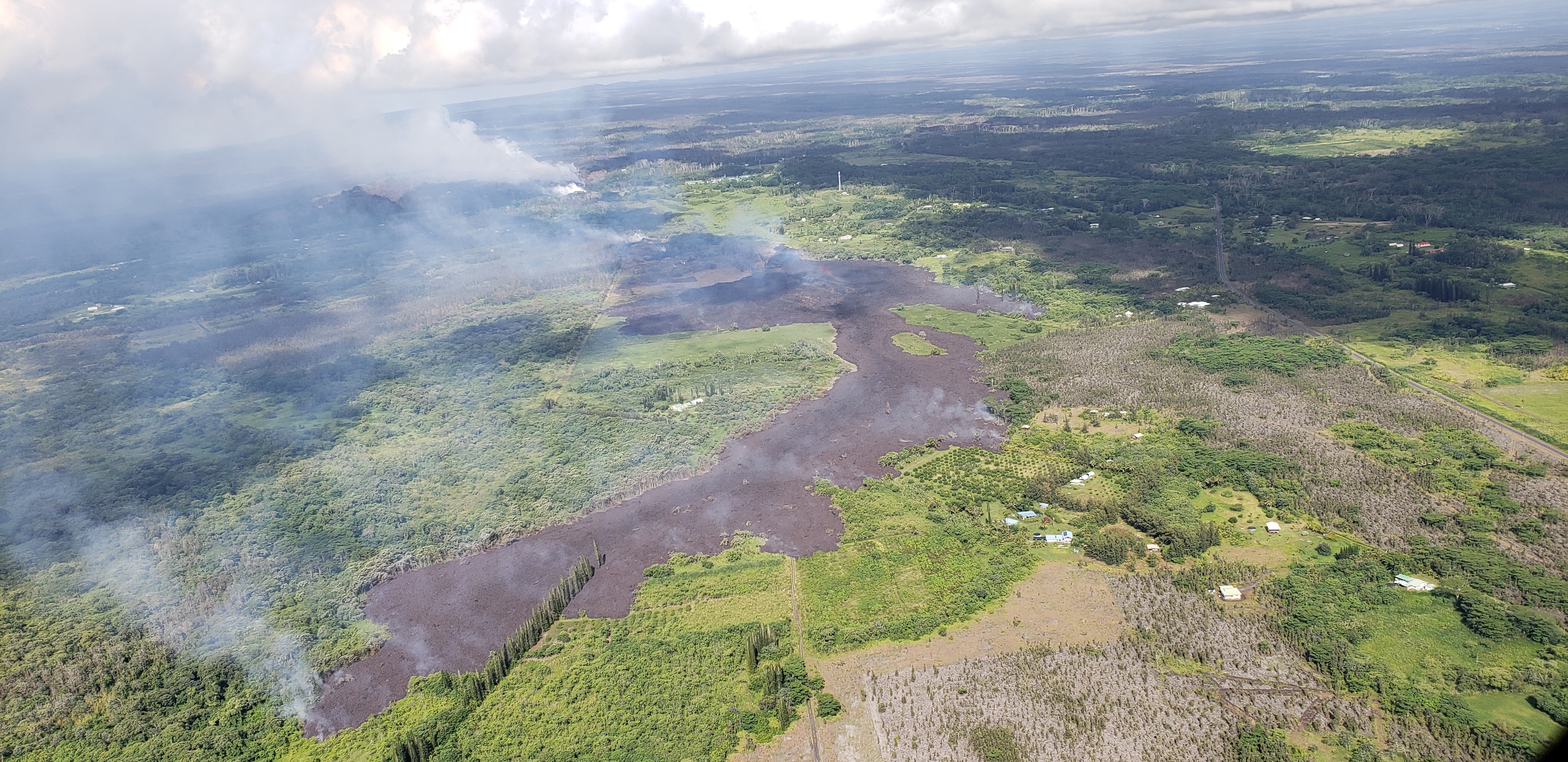
At 8:44 a.m., HST on Monday, May 14, 2018. Aerial view of the active ‘a‘ā flow spreading from fissure 17 (the fissure’s low lava fountains can be seen in middle of photo). Highway 132 can be seen on right side of photograph. View is toward the west. Photograph courtesy of the Hawai`i County Fire Department. PC: US Geological Survey
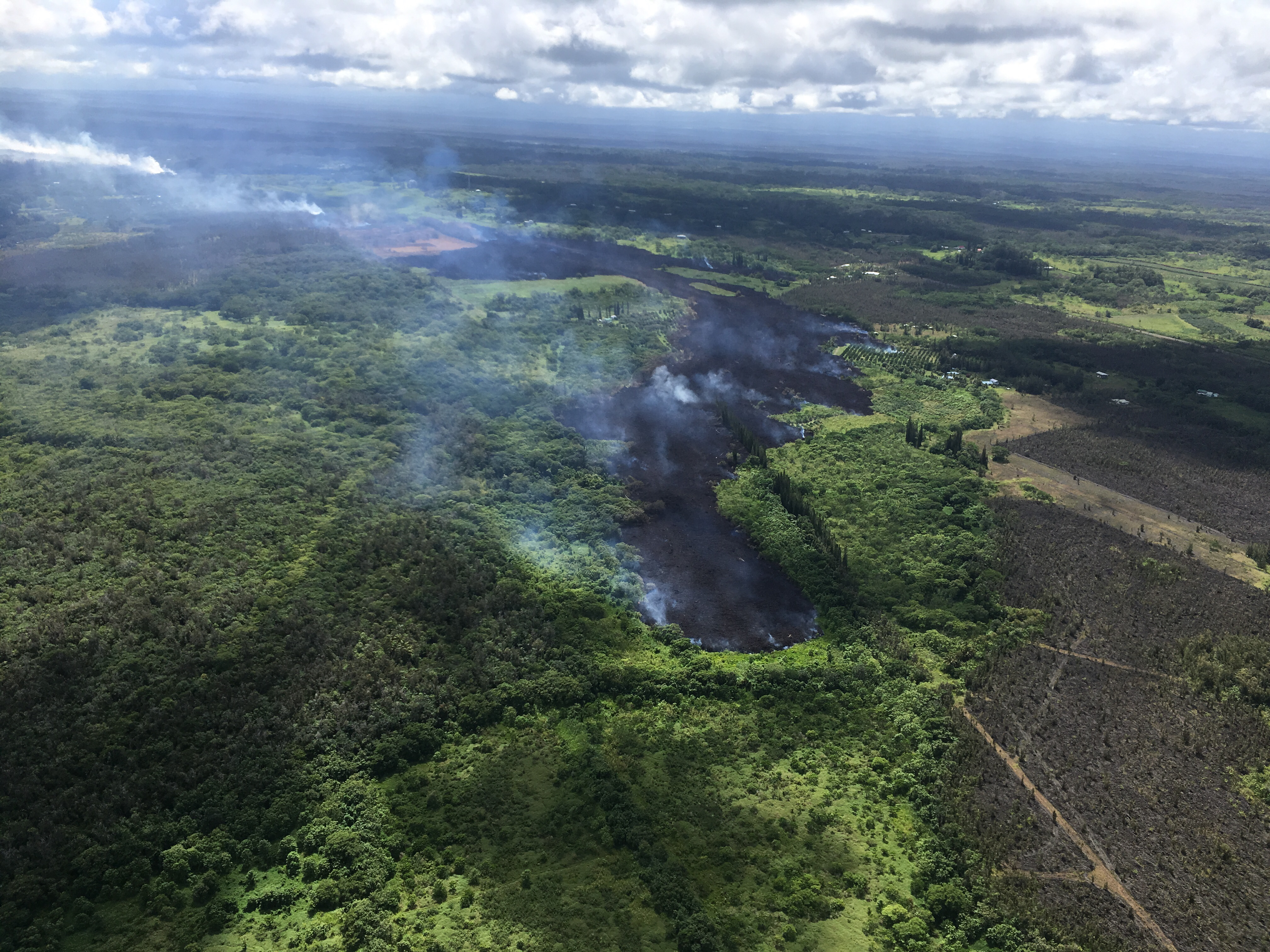
Around 2:30 p.m. HST on Monday, May 14, 2018, a steam jet appears on fissure 17, above the area with active fountaining. Steam jets at this location were repeating about once a minute. PC: US Geological Survey
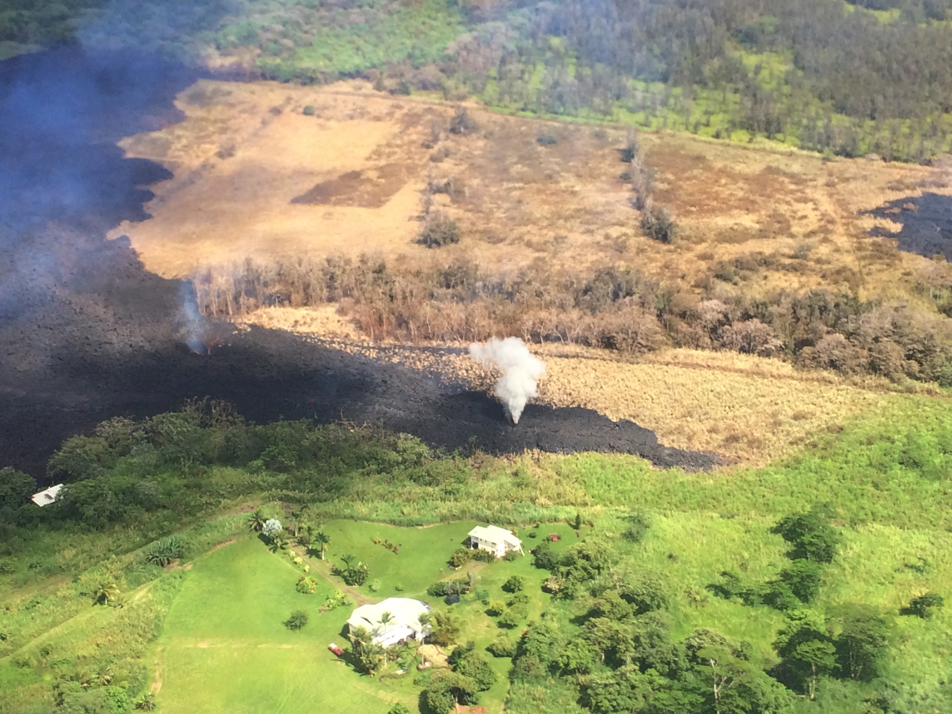
At 2:30 p.m. HST on Monday, May 14, 2018, the flow front of Fissure 17 continues down slope. The barren, brown area to the right in the photograph is a lobe of the Kii Flow from the eruption of 1955. The Fissure 17 flow front is located approximately .7 miles makai of Highway 132 and is 1.4 miles mauka of Hwy 137. PC: US Geological Survey
Sponsored Content


