

Lane Approaches Hawaii, Potential Mid-Week Impacts
Forecasters with the Central Pacific Hurricane Center say, “Lane is forecast to pass south of the main Hawaiian Islands Wednesday and Thursday, potentially causing local impacts as it tracks west-northwestward.” The agency says interests in these islands should watch the progress of Lane closely, “since long-range track and intensity forecast errors can be large.”
At 5 p.m. HST on Sunday, Aug. 19, 2018, the center of Hurricane Lane was located 735 miles ESE of Hilo; 790 miles ESE of Kailua-Kona; 745 miles ESE of South Point; 825 miles SE of Hāna; 855 miles SE of Kahului; 895 miles SE of Kaunakakai; 880 miles ESE of Lānaʻi City; and 955 miles ESE of Honolulu (near latitude 13.8 North, longitude 145.8 West).
According to the CPHC, Lane is moving toward the west near 14 mph, a motion that is expected to continue from tonight through Monday night, but with a slightly slower forward speed.
At 5 p.m., Lane remained a Category 3 Hurricane with maximum sustained winds are near 120 mph. Forecasters say some weakening forecast through tomorrow night, but Lane will likely remain a powerful hurricane through Monday night, according to the CPHC.
The latest long-range forecast has Lane passing roughly 230 miles to the SW of South Point on Hawaiʻi Island Wednesday into Thursday as a weakening Category 1 Hurricane with 90 mph winds.
Hurricane-force winds currently extend outward up to 25 miles from the center and tropical-storm-force winds extend outward up to 105 miles.
“Lane’s satellite presentation has not changed much since late this morning. The main features include a murky cloud-filled eye surrounded by a symmetric convective ring,” according to the latest CPHC forecast.
SURF IMPACTS: A large swell generated by Lane is expected to reach the southeast and east facing shores of the Big Island, and possibly east facing shores of Maui, overnight, according to the CPHC. Forecasters say this swell may produce large and dangerous surf along these shorelines starting early Monday.
Saffir-Simpson Scale
Tropical Storm – winds 39-73 mph (34-63 kt)
Category 1 – winds 74-95 mph (64-82 kt)
Category 2 – winds 96-110 mph (83-95 kt)
Category 3 – winds 111-129 mph (96-112 kt)
Category 4 – winds 130-156 mph (113-136 kt)
Category 5 – winds 157 mph and up (137+ kt)
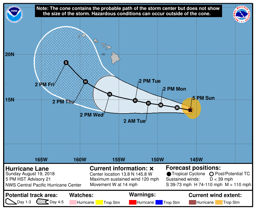
Hurricane Lane, 5-day forecast track., 5 p.m. 8.19.18. PC: NOAA/CPH
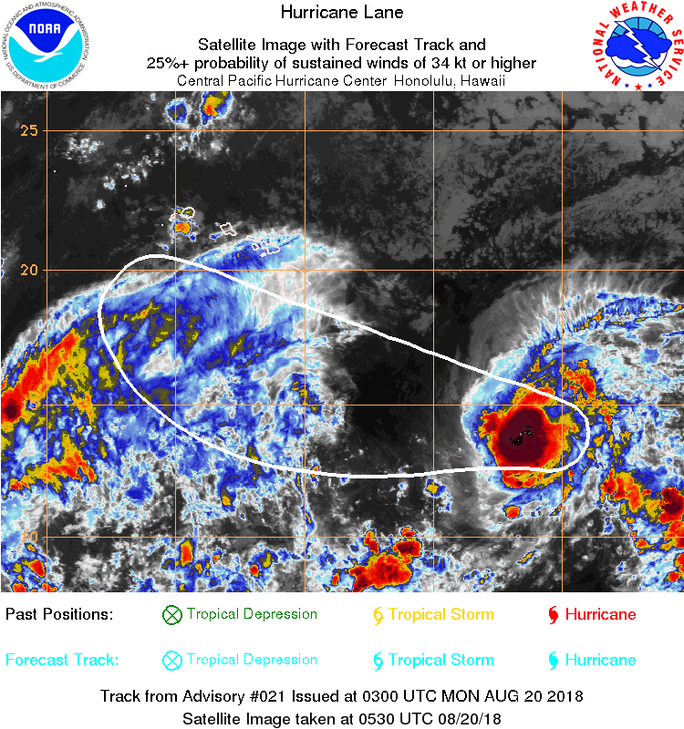
Hurricane Lane satellite imagery., 5 p.m. 8.19.18. PC: NOAA/CPH

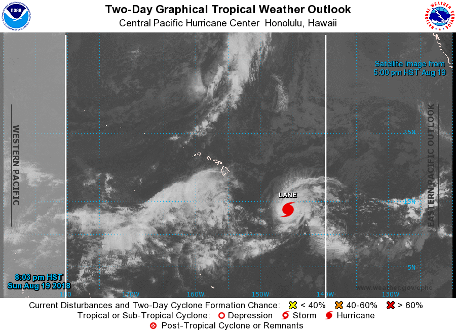
Hurricane Lane, satellite imagery, 5 p.m. 8.19.18. PC: NOAA/CPH
Hurricane Lane, satellite imagery 5 p.m. 8.19.18. PC: NOAA/CPH
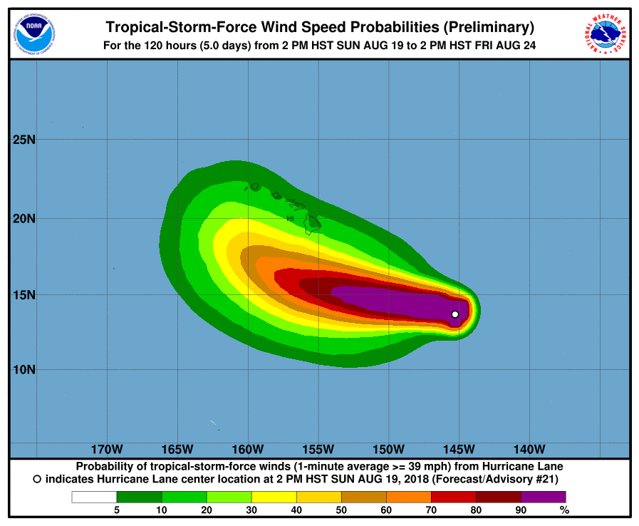
Hurricane Lane, tropical storm force wind probabilities. 5 p.m. 8.19.18. PC: NOAA/CPHC
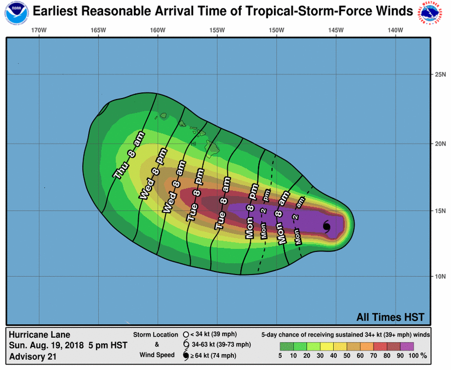
Hurricane Lane, earliest reasonable arrival times of tropical storm force winds. PC: 5 p.m. 8.19.18 NOAA/CPHC
Sponsored Content


