Flossie Could Bring Wet Weather to Hawaiʻi by Monday
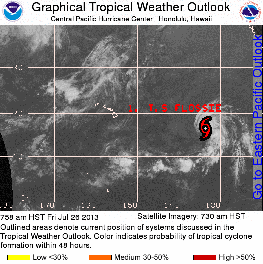
NOAA imagery and graphics of Flossie track, 7/26/13. Courtesy image.
By Wendy Osher
Forecasters with the National Weather Service say the current path of Tropical Storm Flossie indicates that it will reach the state early Monday.
As of 8 a.m. on Friday, July 26, 2013, Flossie was located about 1,520 miles east of Hilo, Hawaiʻi, and was moving toward the west-northwest at 18 mph.
The system had maximum sustained winds of 50 mph, with tropical storm force winds extending outward up to 70 miles from the center.
According to the NWS discussion, Flossie should begin to gradually weaken by Sunday.
By early next week, forecasters say the system may approach from the east, bringing an increase in clouds and showers across the island chain.
Until then, tradewind weather is expected to continue over the state through the weekend.
“Our overall message now is that folks should keep an eye on Flossie and review their hurricane plans and supply list,” said Mike Cantin, warning coordination meteorologist with the National Weather Service Forecast Office in Honolulu.
“There remains uncertainty in the timing, track, and intensity of the system, however, we’d like to get folks thinking about preparations ahead of the weekend,” said Cantin.
Sponsored Content