New Kuhua Corridor Proposed Mauka of Cane Haul Road
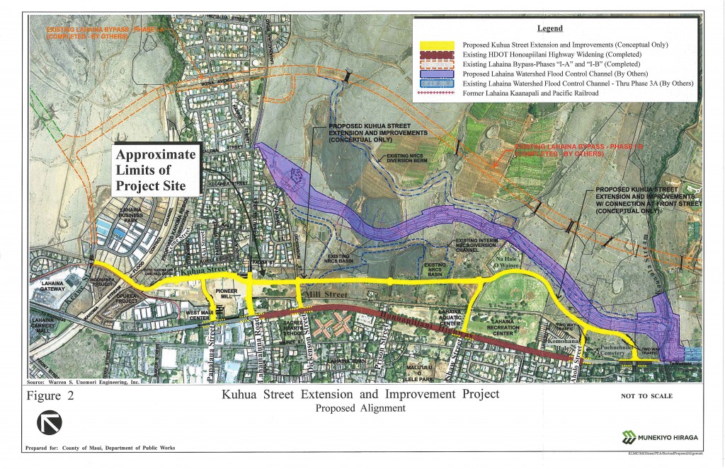
Kuhua Street Extension project location map courtesy Munekiyo Hiraga via Final Environmental Assessment. Click image to view in greater detail.
A Final Environmental Assessment has been filed for the proposed Kuhua Street Extension project that is designed to provide an alternate local transportation corridor parallel to the Honoapiʻilani Highway between Front Street and Keawe Street in West Maui.
The project calls for a two mile route to be aligned east and mauka of the existing Mill Street cane haul road and the Honoapiʻilani Highway, and is proposed for development by the County of Maui, Department of Public Works.
The Kuhua Street Extension was first proposed as the “Mill Street Collector Road” and was envisioned to follow the cane haul road alignment. According to the FEA, the alignment was revised to a more mauka and east location, utilizing Kuhua Street, “based on technical considerations and input from the community and state and county transportation stakeholders.”
The proposed alignment has a south terminus with Honoapiʻilani Highway, across from the Front Street intersection. The north terminus is at Keawe Street at the former cane haul road that crosses the Kahoma Stream Flood Control Channel.
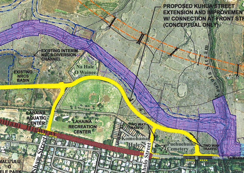
The road runs parallel to the existing Mill Street cane haul road until it nears the Lahaina Recreation Center where it veers around the center between the park and Nā Hale O Waine‘e housing project and mauka of the Puehuehuilei Cemetery
According to the FEA, the project was first identified in 2005 as a possible remedy to disperse traffic from the highway and provide an alternate route for motorists traveling to three public schools along the road. The project is also envisioned as an alternate route that can be used for when accidents occur on the Honoapiʻilani Highway in the vicinity.
According to the FEA document, “The preparation and approval of construction plans is estimated to take approximately two years to complete and is dependent on available funding allocations.” The estimated construction period is projected at one year for each of the proposed two phases which include: (1) Phase 1: north of Lahainaluna Road; and (2) Phase 2: south of Lahainaluna Road.
According to the document, the project cost estimates as of 2013 were approximately $36 million to construct. The FEA further states that the County of Maui will need to obtain funding for land acquisition, a portion of the design and construction of the project.
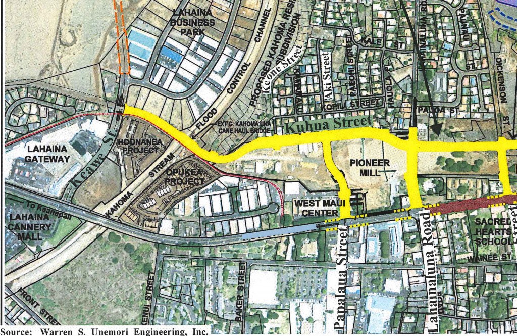
Proposed Kuhua Street Extension map showing south terminus at the Honoapiilani Highway/Front Street Intersection. Image credit: Warren S Unemori Engineering, Inc. via Munekiyo Hiraga and Final Environmental Assessment prepared for the Maui Department of Public Works.
Proposed Kuhua Street Extension map showing north terminus at Keawe Street. Image credit: Warren S Unemori Engineering, Inc. via Munekiyo Hiraga and Final Environmental Assessment prepared for the Maui Department of Public Works.
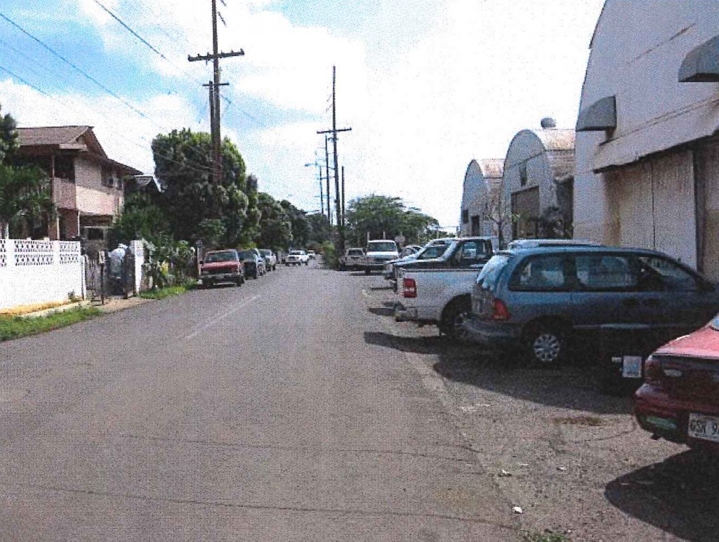
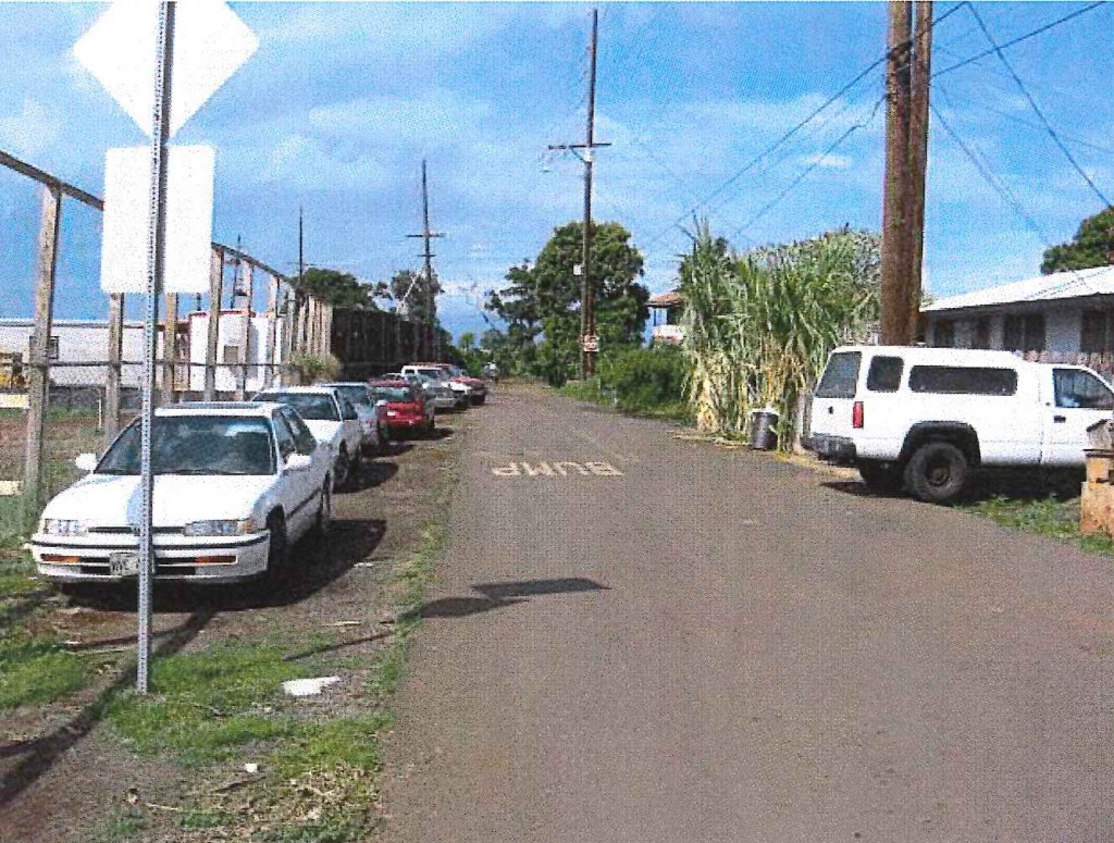
View south near Keone Street on Kuhua Street toward Lahainaluna Road Intersection. Old Kuhua Tract subdivision on left and Pioneer Mill site quonset huts on right. Photo credit: Munekiyo Hiraga via Final Environmental Assessment prepared for the Maui Department of Public Works.
View North on Kuhua Street toward Kahoma Stream Flood Control Channel. Pioneer Mill Site on Left and Old Kuhua Tract Subdivision on right. Photo credit: Munekiyo Hiraga via Final Environmental Assessment prepared for the Maui Department of Public Works.
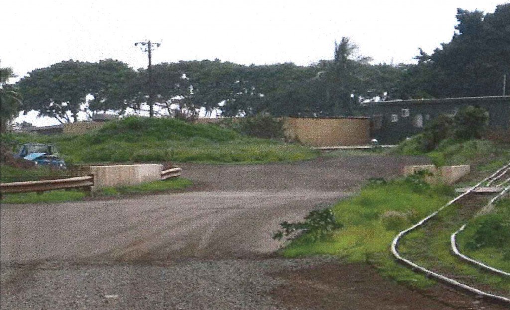
View South at Kahoma Stream Flood Control Channel Crossing (Cane Haul Road and LKPR Sugar Cane Train Track). Photo credit: Munekiyo Hiraga via Final Environmental Assessment prepared for the Maui Department of Public Works.
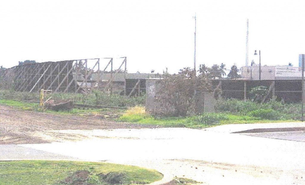
View at Keawe Street/Kuhua Street intersection (North Terminus). Photo credit: Munekiyo Hiraga via Final Environmental Assessment prepared for the Maui Department of Public Works.
Sponsored Content