Cold Front Expected to Affect our Weather Soon

Image: Chris Archer
Alerts (as of 1:00 a.m.)
A Small Craft Advisory is posted for the ʻAlenuihāhā, Kaiwi & Pailolo channels, as well as Māʻalaea Bay through 6 a.m. Wednesday.
**Click directly on the images below to make them larger. Charts include: Maui County high/low forecasted temperatures, projected winds, projected localized weather conditions and expected wave heights.**
Looking Ahead
Breezy trade winds will continue into Wednesday. Low clouds and showers will favor windward and mauka areas. A cold front will approach Kauai from the northwest and cause our winds to weaken and veer from the southeast on Thursday and Friday. Sea breeze convergence could trigger cloud build ups and locally heavy afternoon showers across island interiors during that time. Locally breezy northeasterly trade winds will fill in after the front moves across the island chain this weekend.
Today
We expect mostly cloudy skies with numerous windward showers in the morning and scattered showers in the afternoon. Partly sunny for the leeward sides with scattered morning showers and isolated showers in the afternoon. East winds are expected from 15 to 20 mph. High temperatures from 81° to 86°.
UV index at 12 (“extreme” exposure level)
Tonight
East winds are expected around 10 to 15 mph. Mostly cloudy skies are expected with scattered windward showers and isolated leeward showers. Low temperatures from 69° to 74°.
Our Maui Now Weather homepage always includes daily: Sunrise | Sunset | Moonrise | Moonset | Moon Phase | Live Weather Cams | 5-day Forecast | Current Temperature & Conditions
***Click here for your marine outlook and surf report.***
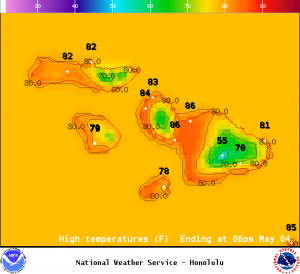
Image: NOAA / NWS
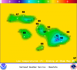
Image: NOAA / NWS
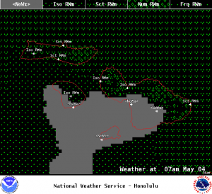
Image: NOAA / NWS
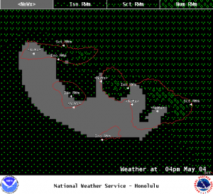
Image: NOAA / NWS
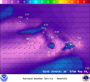
Image: NOAA / NWS
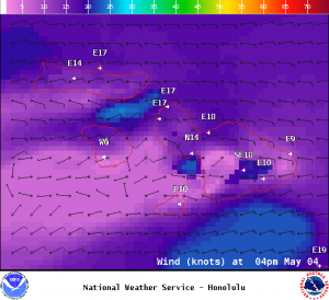
Image: NOAA / NWS
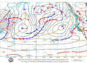
Image: NOAA / NWS
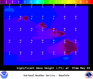
Image: NOAA / NWS
Sponsored Content