

Wet Trades Today, Drier Air Mass Expected Soon

Image: Chris Archer
Alerts (as of 1:00 a.m.)
A Gale Watch is posted starting Thursday night for the typical windy waters around the Big Island and Maui County.
A Small Craft Advisory is posted until 6 p.m. Saturday for gusty northeast winds.
**Click directly on the images below to make them larger. Charts include: Maui County high/low forecasted temperatures, projected winds, projected localized weather conditions and expected wave heights.**
Looking Ahead
Solid trade winds are forecast through the middle of next week. The trades will pick up Thursday night through the holiday weekend. A much drier airmass is expected to move in from the east on Thursday and should keep trade showers to a minimum Thursday night through Saturday. The airmass will moisten up quickly Saturday night as some deep tropical moisture gets drawn northward into the islands, bringing a wet trade wind pattern to the state through the remainder of the holiday weekend and into the middle of next week.
Today
Mostly cloudy today with showers likely in windward spots. Partly cloudy with a few passing showers in lee areas. East winds are expected from 10 to 20 mph. High temperatures from 85° to 90°.
UV index at 12 (“extreme” exposure level)
Tonight
East winds are expected from 10 to 25 mph. Mostly clear and windy with a slight chance of windward showers. Low temperatures from 73° to 78°.
Our Maui Now Weather homepage always includes daily: Sunrise | Sunset | Moonrise | Moonset | Moon Phase | Live Weather Cams | 5-day Forecast | Current Temperature & Conditions
***Click here for your marine outlook and surf report.***
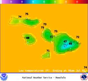
Image: NOAA / NWS
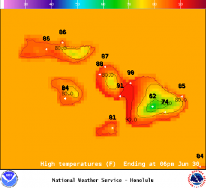
Image: NOAA / NWS
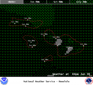
Image: NOAA / NWS
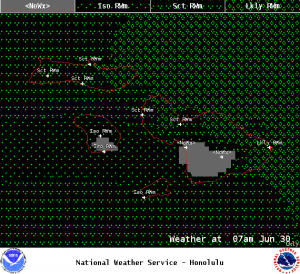
Image: NOAA / NWS
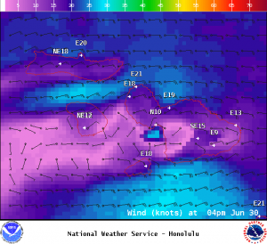
Image: NOAA / NWS
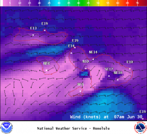
Image: NOAA / NWS
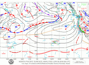
Image: NOAA / NWS
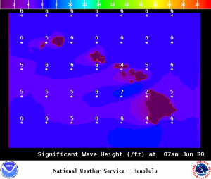
Image: NOAA / NWS
Sponsored Content


