

Mix of Swells Expected This Weekend

Image: Aaron Lynton
Alerts (as of 1:00 a.m.)
A High Surf Warning is posted for north and west facing shores of Maui and Molokai through noon Saturday. See more details in our surf forecast at the link at the bottom of this page.
Gale Warning posted for all offshore waters today.
Small Craft Advisory posted through 6 p.m. Saturday for all coastal waters.
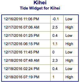
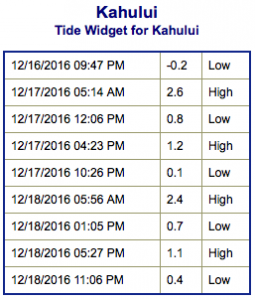
**Click directly on the images below to make them larger. Charts include: Maui County projected winds, tides, swell direction & period and expected wave heights.**
 Maui Surf Forecast
North: Double overhead to triple overhead surf is expected today. Showing strongest for Ho’okipa eastward. Larger sets are possible at the best exposures in the morning.
West: Surf is knee/waist high today for most westerly exposures in the morning with tummy/chest high surf at the best breaks. Spots exposed to the west-northwest wrap will be bigger.
South: Surf is expected to be ankle/waist high today for southern exposures. Spots catching the wrap may get a bit bigger.
 West-northwest swell is showing Saturday along with a northwest swell. The swell energy will begin to ease today. West-southwest wind swell will also mix in Saturday because of the Kona winds so surf may seem a bit jumbled.
A smaller northwest swell is expected to build Sunday, peak in the evening and hold through Monday.
Nothing significant is expected out of the SPAC in the near future.
Keep in mind, surf heights are measured on the face of the wave from trough to crest. Heights vary from beach to beach, and at the same beach, from break to break.
**Click here for your detailed Maui County weather report.**
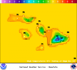
Image: NOAA
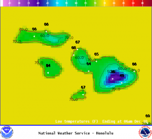
Image: NOAA

Image: NOAA
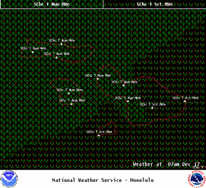
Image: NOAA
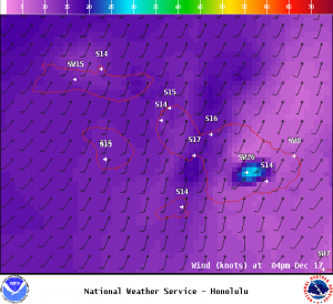
Image: NOAA
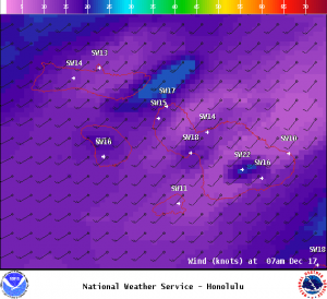
Image: NOAA
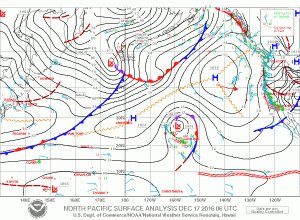
Image: NOAA
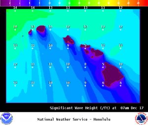
Image: NOAA
Sponsored Content


