

Forecast: Winds Gusting to 60 mph This Weekend

Image: Asa Ellison
Alerts (as of 1:00 a.m.)
High Wind Watch: In effect from noon Saturday through Saturday night for strong northeasterly winds accompanying a weak front and behind it. Winds will accelerate through mountain passes, at higher elevations and on downsloping leeward sides. The strongest winds will be in the lee of mountains, across much of Lāna’i and Kaho’olawe and through the central valley of Maui.
High Surf Advisory: East shores of Molokai and Maui from noon Saturday.
Small Craft Advisory: All coastal waters and channels through noon Saturday.
Gale Warning: In effect from Saturday at noon through Sunday at 6 a.m. for all offshore waters and coastal waters and channels.
**Click directly on the images below to make them larger. Charts include: Maui County high/low forecasted temperatures, projected winds, projected localized weather conditions and expected wave heights.**
Looking Ahead
Trade winds are forecast to increase as a front approaches the state from the northwest. The front will move across the smaller islands Saturday and stall near the Big Island from late Saturday night into early next week. Very strong and potentially damaging northeast trade winds are expected along and behind the front this weekend, with winds easing early next week.
Today
Conditions are transitioning to windy and wet. Mostly cloudy skies with occasional windward and mauka showers and partly cloudy with scattered showers for the leeward sides. High temperatures from 74° to 79°. Northeast winds increasing to 20 to 35 mph with gusts up to 60 mph in the afternoon.
UV index at 7 (“very high” exposure level)
Tonight
Mostly cloudy with occasional windward showers and scattered leeward showers. Low temperatures from 66° to 71°. Northeast winds increasing to 15 to 25 mph with gusts up to 60 mph tonight.
Our Maui Now Weather homepage always includes daily: Sunrise | Sunset | Moonrise | Moonset | Moon Phase | Live Weather Cams | 5-day Forecast | Current Temperature & Conditions
***Click here for your marine outlook and surf report.***
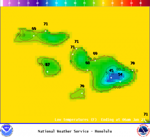
Image: NOAA
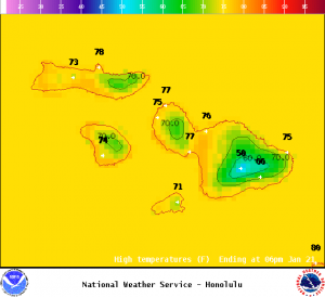
Image: NOAA
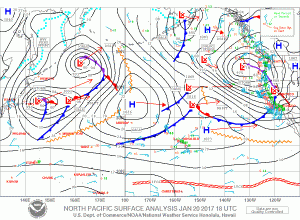
Image: NOAA
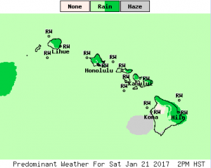
Image: NOAA
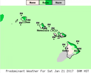
Image: NOAA
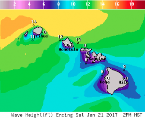
Image: NOAA
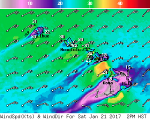
Image: NOAA
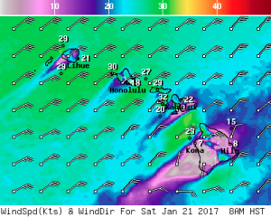
Image: NOAA
Sponsored Content


