

Trade Winds are Back! Showers in Forecast

Image: Chris Archer
Alerts (as of 1:00 a.m.)
Small Craft Advisory: For northeast winds up to 25 knots with 30 knot gusts through 6 p.m. Saturday.
**Click directly on the images below to make them larger. Charts include: Maui County high/low forecasted temperatures, projected winds, projected localized weather conditions and expected wave heights.**
Looking Ahead
Trade winds are forecast to continue filling in and become breezy by the weekend. Windward areas could be more showery Friday night and Saturday before drier and cooler weather moves in Sunday. Trade winds are expected to then weaken to moderate levels Tuesday with a transition to more typical windward and mauka shower coverage.
Today
We expect trade winds around 10 to 20 mph. Partly sunny skies are forecast today with scattered windward showers and mostly sunny skies in leeward spots. Temperatures up to 83° to 88°.
UV index at 8 (“high” exposure level)
Tonight
Mostly cloudy skies with numerous windward showers and scattered leeward showers. Low temperatures from 73° to 78°. Winds are expected to be trades around 15 to 20 mph.
Our Maui Now Weather homepage always includes daily: Sunrise | Sunset | Moonrise | Moonset | Moon Phase | Live Weather Cams | 5-day Forecast | Current Temperature & Conditions
***Click here for your marine outlook and surf report.***
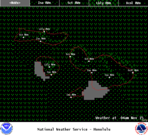
Image: NOAA
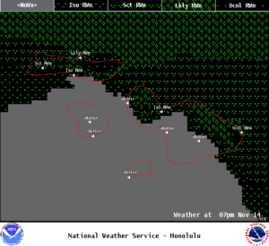
Image: NOAA
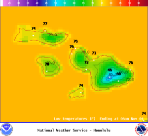
Image: NOAA
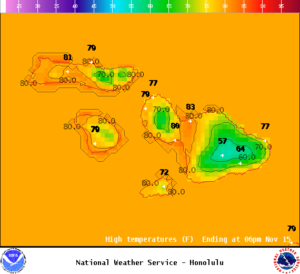
Image: NOAA
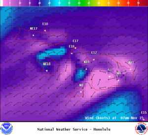
Image: NOAA
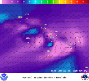
Image: NOAA
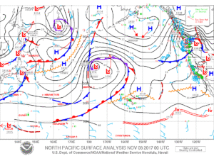
Image: NOAA
Sponsored Content


