

Mokuhinia Draft Archaeological Survey Completed
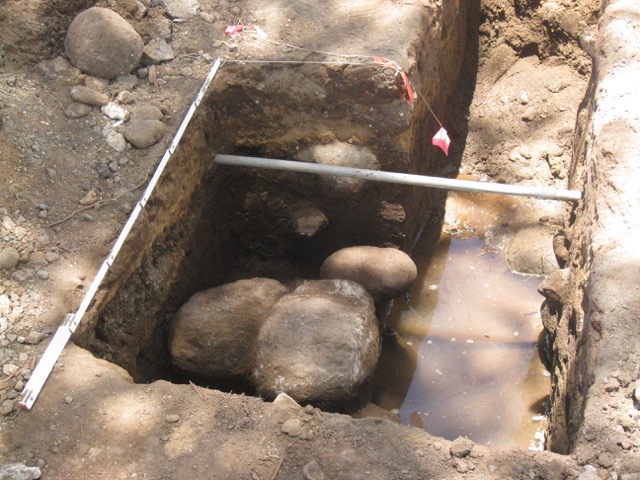
Closeup shots of the Cultural Surveys Hawai‘i work trench that uncovered the location and corner stones of the causeway (last year). The causeway connected the King’s Road (Front Street) to the island and would have been guarded by sentries. It’s located in the Moku‘ula parking lot at the Front Street driveway entrance. File photo courtesy: Friends of Mokuʻula.
Update: (10:29 a.m. 12.21.17)
Weather conditions on Tuesday forced the cancellation of a community meeting to review a Draft Archaeological Inventory Survey (AIS) Report for the Mokuhinia Ecosystem Restoration Project in Lahaina.
However, while the meeting is being rescheduled, the public can still review an electronic copy of the Draft AIS report online. A press release will be sent out when the public meeting is rescheduled.
Previous Post:
The public is invited to review the Draft Archaeological Inventory Survey for the Mokuhinia Ecosystem Restoration Project, which was recently completed by Cultural Surveys Hawaiʻi.
The draft survey was submitted to the State Historic Preservation Division on Dec. 11, 2017.
A public meeting has been set for tonight, Wednesday, Dec. 20, at 6 p.m at Nā Aikane Cultural Center located at 562A Mokuhinia Way in Lahaina.
Loko o Mokuhinia is the former wetland that surrounded the ancient island of Mokuʻula in West Maui, located at the site known today as Maluʻulu o Lele Park.
Loko o Mokuhinia was a 17-acre pond that is cited in Hawaiian traditions as the home of Kihawahine, a deity in royal lineage, and guardian for the sacred Mokuhinia ponds and Mokuʻula Island.
State documents describe the island as the preferred residence of high ranking aliʻi through the mid-1800s.
According to an Environmental Assessment filed for the project in 2013, the pond was filled in 1914 due to hygienic and development purposes when the pond became stagnant.
Several years later, in 1918, an executive order established the site as the current Maluʻulu o Lele Park, with the pond and island now located approximately 2 to 3 feet below the ground surface of the park, according to state documentation.
The full Integrated Feasibility Report and Environmental Assessment document from 2013 is available online.
Sponsored Content


