

Ask the Mayor: The History Behind the “Baby Beaches”
The mayor answers questions from the public in this series.
By Mayor Alan Arakawa
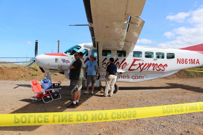
The empty lot near the Wailea Fire Station where the LEGO-style barriers now reside. This is a file photo from the emergency landing on the Piʻilani Highway; the plane was moved to this area. File photo by Wendy Osher.
Q: I am curious about the Lego-style barriers on the corner of Piilani Hiway (sic) and Kilohana Rd., by the Wailea Fire Station. These cement barriers have been there for quite some time, but have now been painted a forest green color and have little yellow reflectors on them! What are they?
A. Those LEGO type blocks as you describe it are concrete barriers placed there by the Department of Parks and Recreation, to keep people from dumping illegally on parks property. For a while now people were using that corner of Piilani and Kilohana as a dumping ground. The area is a parcel of land was obtained by the county many years ago and originally was to be the site of a park, police and fire station.
Although a fire station was built, the rest is undeveloped park property. Over the years the county has received numerous complaints about the area being used as a dumping grounds for construction materials, dirt and etc. Also people would park heavy equipment in the area creating dust and diesel fumes drifting into the condos across the street.
The barriers were put up sometime ago to keep vehicles out of the area and to prevent illegal dumping and other activities. As far as the color goes, I haven’t been able to confirm this but from what I understand either parks or a community group had the barriers painted green to cover up the graffiti to make it more visually pleasing.
Q: I frequent Baby Beach in Spreckelsville but have gotten confused when people also refer to another baby beach next to the Paia Youth and Cultural Center. Are there two beach parks with the same name in Paia and Spreckelsville?
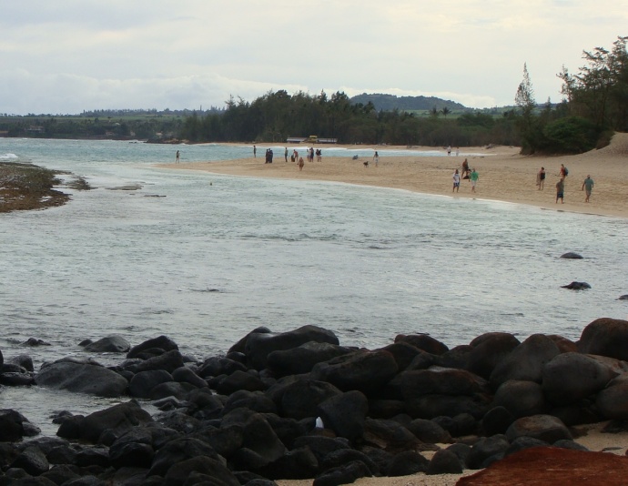
Spreckelsville, “Baby Beach.” File photo by Wendy Osher.
A: Actually, the beach park you are referring to next to the Paia Youth and Cultural Center, the one with the basketball courts, is officially listed as the “Lower Paia Park” on our county property tax maps. But for many decades and to this day, long-time residents refer to that park as “Baby Park.” This was because it was viewed as the “baby brother” to the much larger H.P. Baldwin Park right up the street along Hana Highway.
The confusion began later, after newer residents began frequenting a particular beach in Spreckelsvile located at the end of Baldwin Beach and nicknamed it “Baby Beach,” because it was protected by a reef and perfect for infants and young children to go swimming. So to answer your question, yes, there is a “Baby Beach” in Spreckelsville and a “Baby Park” in Paia, even though neither are official names for either areas.
Q: I read one of your answers to “Ask the Mayor” in today’s paper regarding the plans for the North/South connector road. I got deeper involved than I should have but found some rather interesting and puzzling street misnomers involving the very street that might the future N/S connector road.
The problem the way I see it is the confusing naming of a number of streets but all named “E. Welakahao Rd.” It might be purely a Google mistake but the mistake rubbed off to some county maps as well. The “main” E. Welakahao Rd. runs from Piilani Hwy. to S. Kihei Road and becomes S. Welakahao Rd to the end at the beach. No problem there but if you look at the Google map, the road leading off E.Welakahao at the HOPE Chapel and heading south is also named E. Welakahao Rd. Further down that road is another short road leading east of that road and is also labeled E. Welakahao Rd. and ends at the Piillani Hwy. Furthermore, the road from Piilani Hwy. to the Maui Water treatment plant is also labeled E. Welakahao Rd. This mistake might have been around for a long time and had never bothered anyone but I thought I bring it to your attention.
A. You are correct, our Department of Public Works says Google Maps has misnamed some streets in that area of Kihei. Not only that, but Google Maps also seems to have gotten the boundaries of South Maui Regional Park wrong as well. We will look into this and make any necessary corrections. Mahalo for taking the time to research this and point this out. Members of the public who might notice other discrepancies with Google Maps can click on the “Report a problem” link near the bottom, right-hand corner of any Google Map.
Sponsored Content


