

Emergency Proclamation Issued as Kīlauea Lava Flow Advances
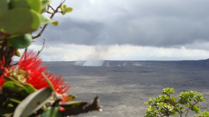
Kilauea Volcano, file photo by Wendy Osher.
By Wendy Osher
Governor Neil Abercrombie today signed an emergency proclamation as a lava flow from the Kīlauea Volcano advances toward Highway 130 near Pāhoa on Hawaiʻi Island.
According to the governor’s office, the proclamation was issued in preparation as the lava flow approaches the highway, “potentially isolating communities in lower Puna from the rest of Hawaiʻi County.”
The proclamation gives the state the ability to reestablish abandoned roads for access to isolated communities, and activates the Major Disaster Fund for disaster relief.
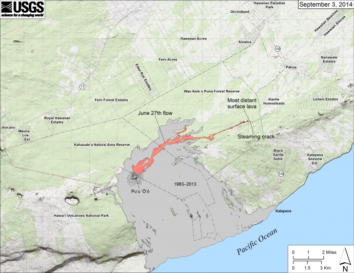
Map showing the June 27th flow in Kīlauea’s East Rift Zone as of September 3, 2014. The area of the flow as mapped on September 1 is shown in pink, while widening and advancement of the flow as of September 3 is shown in red. Map courtesy USGS/ Hawaiian Volcano Observatory.
Under the proclamation, the disaster emergency relief period begins today and continues through Oct. 15, 2014.
The state Department of Health also issued an advisory this afternoon, for residents living near the lava flow to take precautions and plan ahead for potential smoke exposure.
The advisory was issued in the wake of a lava flow from the Kīlauea Volcano that began on June 27, 2014.
State health officials say smoke from burning vegetation may contain fine particles that may trigger adverse respiratory conditions. The agency also noted that low levels of sulfur dioxide are being emitted from the flow, and described the gas as an irritant.
Affected residents are advised to avoid outdoor activities and physical exertion.
Health officials advise that the effect on nearby areas will largely depend on wind and weather conditions.
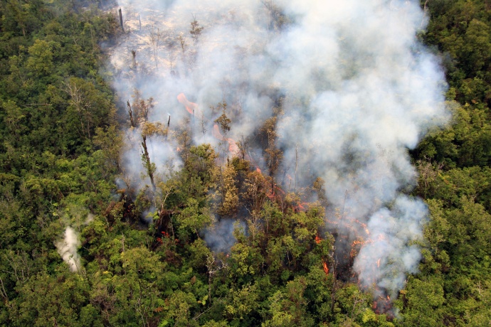
One small portion of the flow front was quite vigorous, with an open stream of lava moving through the forest. Photo courtesy USGS/ Hawaiian Volcano Observatory.
The Hawaiian Volcano Observatory issued a status update on the flow today saying it remains active.
“An HVO overflight yesterday afternoon observed lava continuing to issue onto the surface from a ground crack, and moving slowly through thick forest. The most distant active lava was approximately 8.3 miles from the vent and 0.7 miles from the eastern boundary of the Wao Kele o Puna Forest Reserve,” HVO officials said in the observation update.
The agency says some breakout flows were observed creeping into the forest and producing smoke plumes as well.
The observatory planned to conduct another overflight today as they continue to monitor the situation.
***Additional updates on the June 27 flow can be found at our sister site Big Island Now.
Sponsored Content


