

Trade Winds Expected Back in a Few Days

Haleakalā / Image: Chris Archer
By Meteorologist Malika Dudley / Email: [email protected]
Alerts (Updated at 8:30 a.m.)
A High Surf Advisory is posted through 6:00 p.m. Saturday for the north and west facing shores of Moloka’i and the north shore of Maui. Surf from 12 to 16 feet is expected for the north exposures, while wave heights of 8 to 12 feet are expected for the west side of Moloka’i. Expect strong breaking waves, shore break and strong longshore and rip currents making swimming difficult and dangerous.
A Small Craft Advisory is posted for all Maui County waters (excluding Ma’alaea Bay and the Pailolo Channel) through 6:00 p.m. Saturday for rough seas of 6 to 11 feet. Inexperienced mariners should avoid navigating in these conditions.
**Click directly on the images below to make them larger. Charts include: Maui County high/low forecasted temperatures, projected winds, chance of cloud cover, projected localized weather conditions and expected wave heights.**
Today, Thursday, January 15, 2015
Today we should get partly to mostly cloudy skies in Maui County. We also expect hazy skies due to the light and variable winds forecasted up to 15 mph (see UHSOEST vog model above). Weaker winds mean a land and sea breeze pattern is likely to set up. Mostly sunny skies are in the forecast for Maui County. As the land heats up, sea breezes are expected to develop which may lead to afternoon cloud cover and possible isolated light showers. High temperatures are expected to fall in the range of 80° to 85°.
Sunrise: 7:05 a.m.
Sunset: 6:05 p.m.
UV index at 7 (“high” exposure level)
Tonight
Partly cloudy skies and areas of haze. Leeward spots may be cloudy to start but are expected to clear as the land breeze takes hold. A bit cooler tonight as we expect less cloud cover. Without the clouds to trap the heat, radiational cooling will take place and low temperatures from 58° to 65° degrees are expected at lower elevations. At higher elevations the low temperature will be colder. Light and variable winds up to 15 mph are forecasted.
Moonrise: 2:21 a.m.
Moonset: 1:56 p.m.
Next New Moon: Jan. 20 at 3:14 a.m.
Next Full Moon: 1:09 p.m. on Feb. 3
Looking Ahead
Dry and hazy weather can be expected over the next several days as a ridge of high pressure lies across the area. A weak front is expected north of the state and will help to continue to block our trade winds through the end of the work week. Light to moderate trade winds are expected later this weekend and into early next week as an area of high pressure passes by to our north. A slight increase in showers can be expected over windward and mauka areas at that time. Light southeast winds are expected to make their way back into the forecast middle of next week.
Almanac for Kahului Airport
Maximum Temperature for today:
Normal 81°
Record 88° / Set in 2006
Minimum Temperature for today:
Normal 63°
Record 53° / Set in 2010
**Click here for your detailed Maui County surf report.**
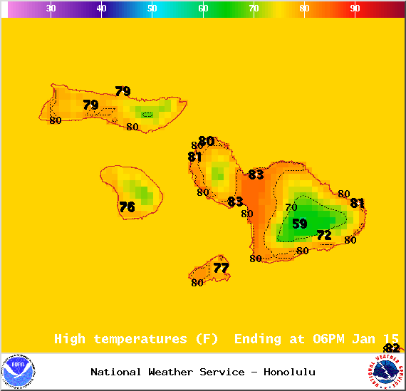
Image: NOAA / NWS
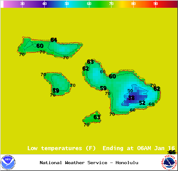
Image: NOAA / NWS
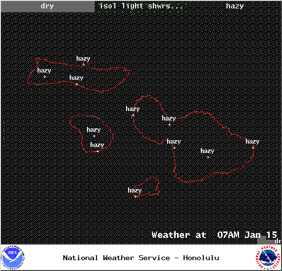
Image: NOAA / NWS
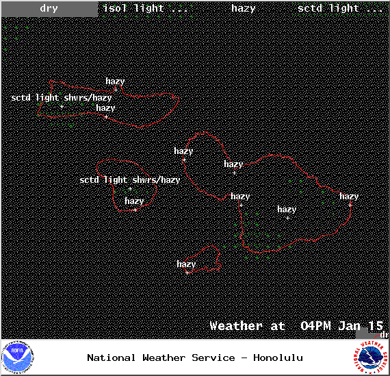
Image: NOAA / NWS
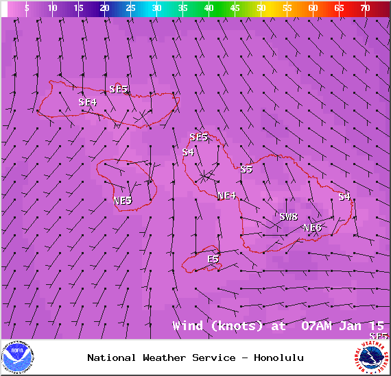
Image: NOAA / NWS
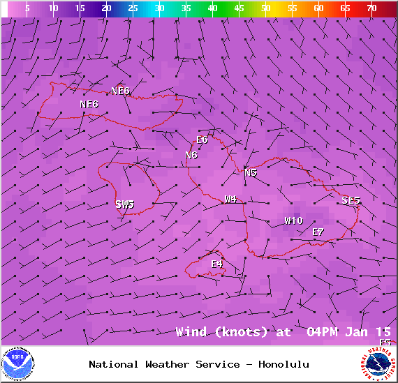
Image: NOAA / NWS
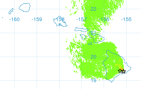
Image: UHSOEST vog model
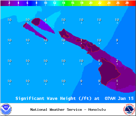
Image: NOAA / NWS
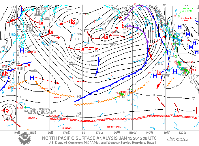
Image: NOAA / NWS
Sponsored Content


