

WEEKEND WEATHER: Increased Showers and Surf
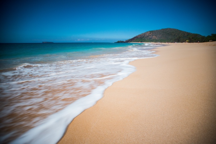
Mākena Beach 1.23.15 / Image: Chris Archer
By Meteorologist Malika Dudley / Email: [email protected]
Alerts
A Marine Weather Statement has been issued by the National Weather Service for a very large west-northwest swell. The Weather Service in Honolulu says the very large swell will remain elevated through Saturday. They are warning of strong harbor surges and large breaking waves at harbor entrances exposed to the swell. Some locations that can expect such conditions are Kaumalapau harbor on Lāna’i.
The High Surf Warning has been extended for the north and west shores of Moloka’i and the north shore of Maui. The warning is posted through Sunday at 6:00 a.m. Wave heights of 20 to 30 foot faces are expected along the north shores while 12 to 18 foot faces are expected on the west side of Moloka’i. Expect ocean water occasionally sweeping across portions of beaches, very strong breaking waves and strong longshore and rip currents. Breaking waves may occasionally impact harbors making navigating the harbor channel difficult. Large breaking surf, significant shore break and dangerous currents will make entering the water very hazardous. Boaters should be aware of an increased number of surfers in the water.
The High Surf Advisory has also been extended for the west shores of Maui, Lāna’i and Kaho’olawe through Sunday at 6:00 a.m. Wave heights from 8 to 12 feet are expected on Maui. Surf heights of 6 to 9 feet are expected for Lāna’i and Kaho’olawe. Expect strong breaking waves, shore break and strong longshore and rip currents making swimming difficult and dangerous.
A Small Craft Advisory has been issued for all island waters through Sunday at 6:00 a.m. for winds from 15 to 25 knots and rough seas of 7 to 17 feet.
**Click directly on the images below to make them larger. Charts include: Maui County high/low forecasted temperatures, projected winds, chance of cloud cover, projected localized weather conditions and expected wave heights.**
Today
Today we should get partly sunny skies in Maui County with scattered windward and mauka showers and isolated leeward showers. Winds are expected out of the north from 15 to 20 mph with higher gusts after the passage of the front. High temperatures forecasted to fall in the range of 78° to 83°.
UV index at 6 (“high” exposure level)
Tonight
Partly cloudy skies are forecasted with limited showers. Low temperatures from 69° to 74° degrees are expected. Northeast winds from 15 to 20 mph are expected.
Next Full Moon: 1:09 p.m. on Feb. 3
Next New Moon: 1:47 p.m. on Feb. 18
Sunday
Partly cloudy skies are expected with light windward and mauka showers. Trade winds are back in the forecast out of the northeast from 15 to 20 mph with higher gusts. High temperatures are running from 76° to 81° and low temperatures from 69° to 74°.
Looking Ahead
A front is expected to reach Maui county Saturday, spreading clouds and scattered moderate showers as it goes. The front will stall and weaken Sunday. Some lingering moisture from the front may push into the Hana coast of Maui maintaining lingering clouds and showers into Monday. Winds will shift out of the north after the front passes, bringing cool and dry conditions. Dry northeast trade winds are expected Sunday and will continue through midweek. Another front is expected to reach the islands late next week.
**Click here for your detailed Maui County surf report.**
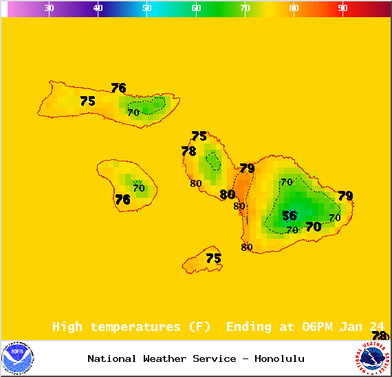
Image: NOAA / NWS
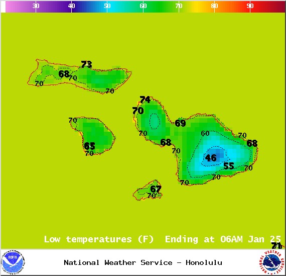
Image: NOAA / NWS
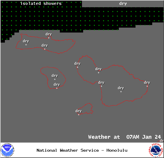
Image: NOAA / NWS
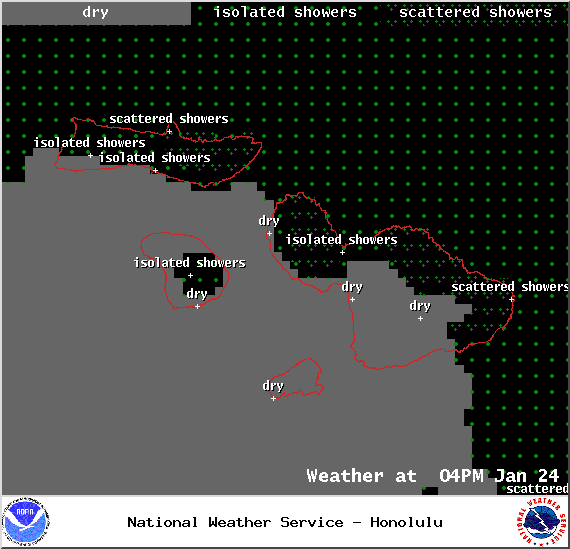
Image: NOAA / NWS
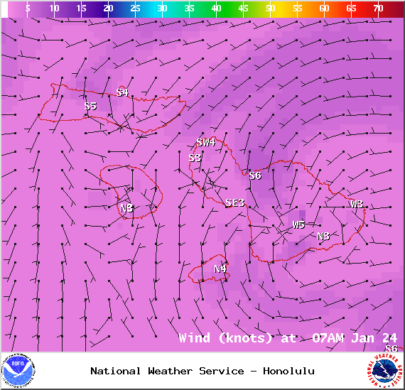
Image: NOAA / NWS

Image: NOAA / NWS
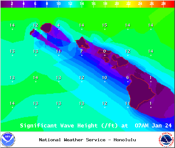
Image: NOAA / NWS
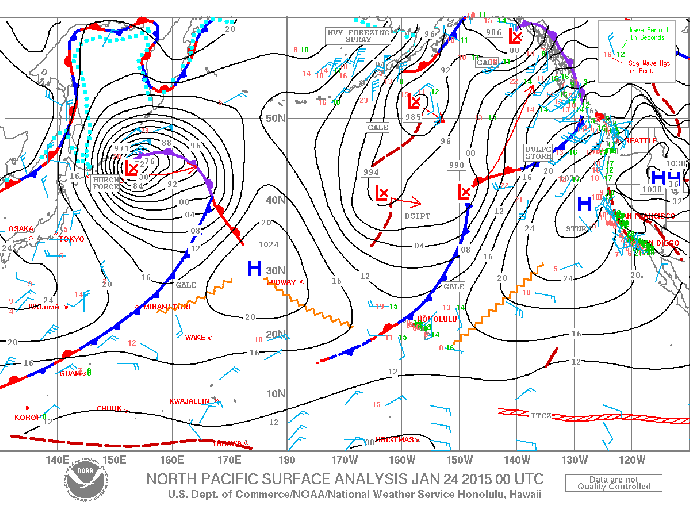
Image: NOAA / NWS
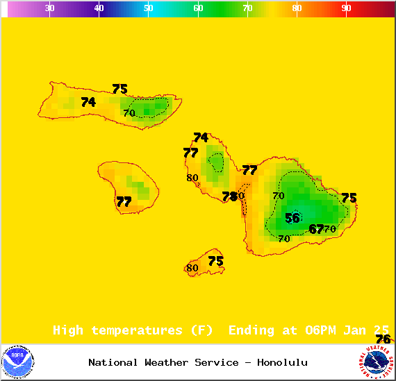
Image: NOAA / NWS
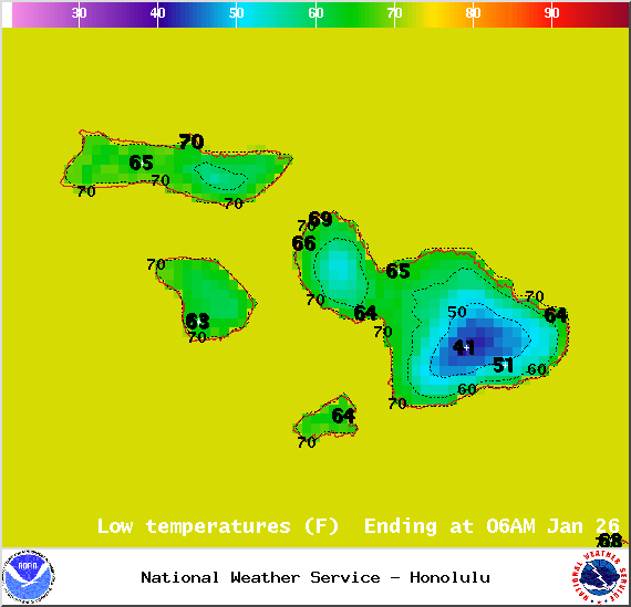
Image: NOAA / NWS
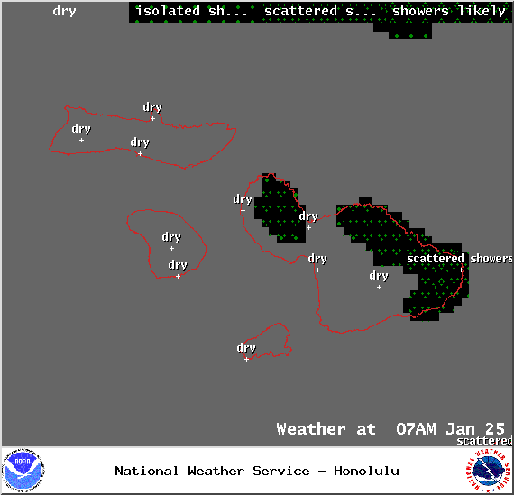
Image: NOAA / NWS
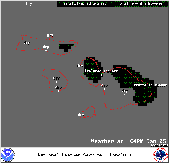
Image: NOAA / NWS
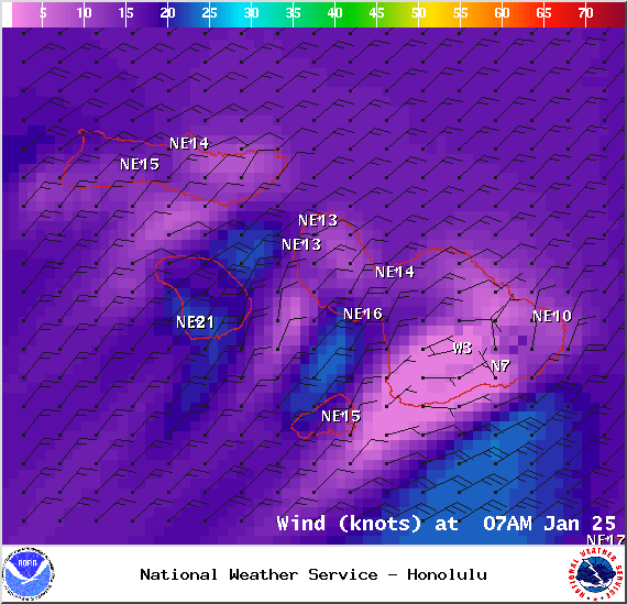
Image: NOAA / NWS
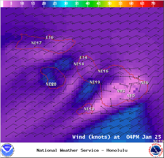
Image: NOAA / NWS
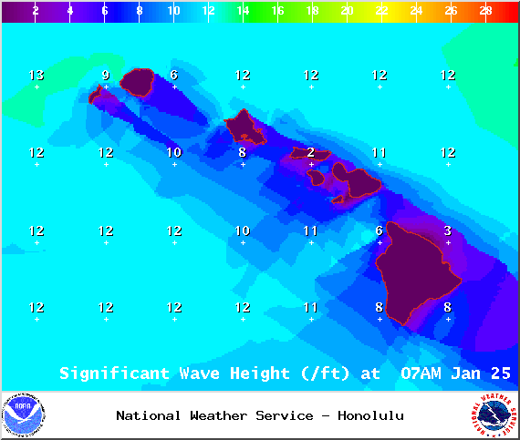
Image: NOAA / NWS
Sponsored Content


