

Maui News 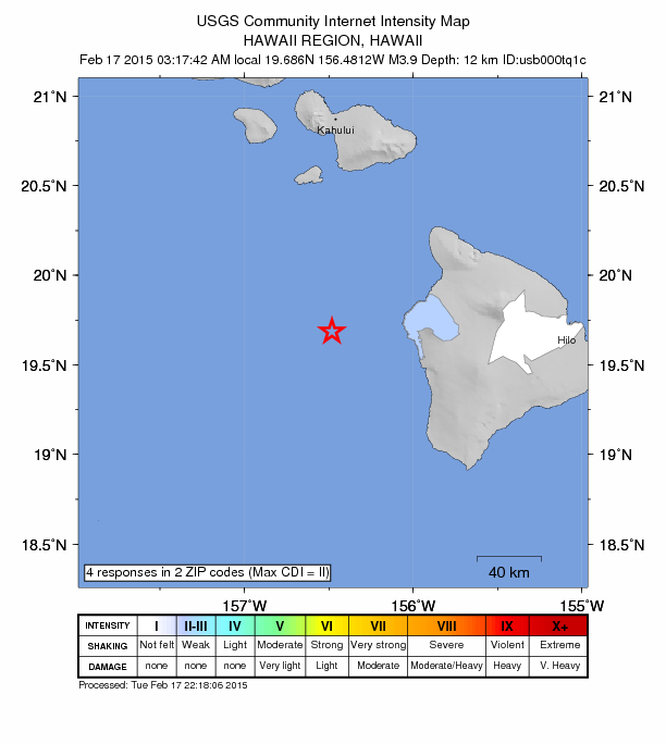
Few Report Feeling 3.9 Quake Off Hawaiʻi Island
A
A
A
Hawaiʻi Island 3.9 earthquake (2/17/15) intensity map, courtesy USGS.
By Wendy Osher
There were no immediate advisories issued following a preliminary magnitude 3.9 earthquake reported at 3:17 a.m. HST on Tuesday, Feb. 17, in the ocean off of Kailua-Kona on Hawaiʻi Island.
The USGS reports that the earthquake occurred at a depth of 12 km and was located 32 miles west of Kailua-Kona, Hawaiʻi; 75 miles south of Kīhei, Maui; 82 miles south of Kahului, Maui; 82 miles south of Wailuku Maui; and 142 miles southeast of Honolulu, Oʻahu.
ARTICLE CONTINUES BELOW AD
ARTICLE CONTINUES BELOW AD
According to the agency’s “Did You Feel It?” website, only four responses were received including three reports from Kailua-Kona and one from Hilo on the Big Island of Hawaiʻi.
ADVERTISEMENT
ADVERTISEMENT
Sponsored Content


Subscribe to our Newsletter
Stay in-the-know with daily or weeklyheadlines delivered straight to your inbox.
Comments
This comments section is a public community forum for the purpose of free expression. Although Maui Now encourages respectful communication only, some content may be considered offensive. Please view at your own discretion. View Comments
