

Advisory Level NW Swell Peaks Later Today
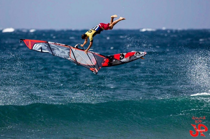
Ho’okipa / Image: Jimmie Hepp
By Meteorologist Malika Dudley / Email: [email protected]
Alerts
A High Surf Advisory is posted for north and east facing shores of Maui and Moloka’i from 6:00 a.m. Monday through 6:00 p.m. Tuesday. Surf is expected to rise to 10 to 15 foot faces along north shores and 6 to 9 feet along east facing shores. Expect strong breaking waves, shore break and strong longshore and rip currents making swimming difficult and dangerous.
A Small Craft Advisory is posted for all Maui County channels, Maui County windward waters and Māʻalaea Bay through 6:00 a.m. Tuesday. Northeast winds up to 25 knots are forecasted along with rough seas of 8 to 15 feet. Inexperienced mariners should avoid navigating in these conditions.
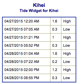
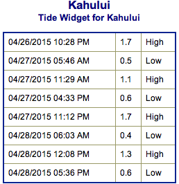
**Click directly on the images below to make them larger. Charts include: Maui County projected winds, forecasted swell direction, height & period, tides, a surface map and expected wave heights.**
 Maui County Surf Forecast
North: Wave heights are expected to start out around chest/head high today building to well overhead and near double overhead at the best breaks open to the swell late in the day.
West: Wave heights waist/shoulder high at the breaks open to the swell late in the day. Otherwise, ankle/knee high conditions are expected today for spots shadowed from the swells.
South: Knee to waist high waves are expected today. Best breaks could get tummy high sets.
 A boost out of the northwest is expected to build Monday and peak Monday afternoon in the overhead to well overhead range. Swell is expected to slowly ease Tuesday.
Our current south-southwest swell is expected to fade through the early part of this week. This week is looking pretty quite out of the southern hemisphere. Next week we could see some activity around May 5th or 6th pending development of storms.
Keep in mind, surf heights are measured on the face of the wave from trough to crest. Heights vary from beach to beach, and at the same beach, from break to break.
**Click here for your detailed Maui County weather report.**
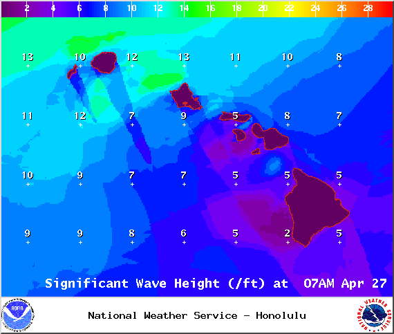
Image: NOAA / NWS
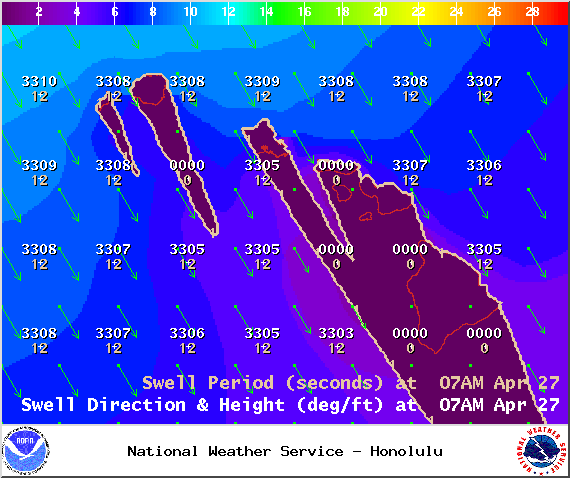
Image: NOAA / NWS
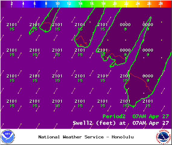
Image: NOAA / NWS
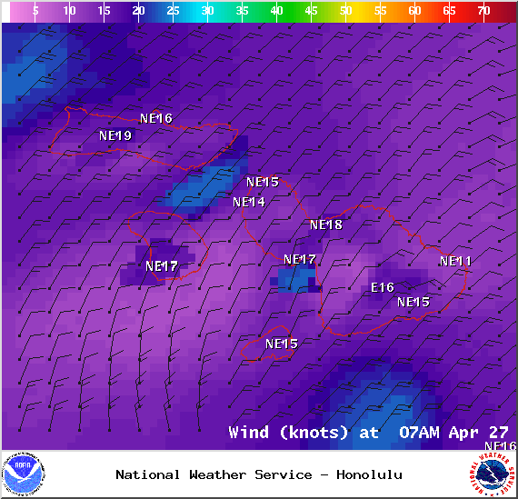
Image: NOAA / NWS

Image: NOAA / NWS
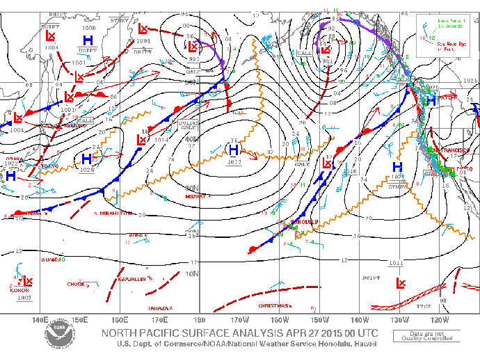
Image: NOAA / NWS
Sponsored Content


