

Kahului Harbor Surges, Warning Level Surf Today
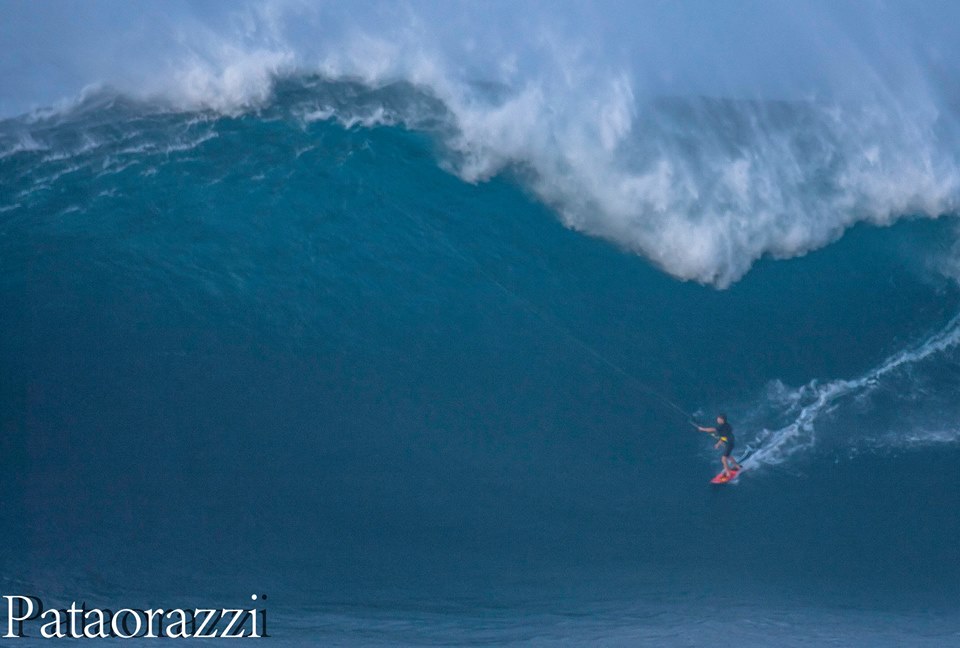
Image: John Patao / Jaws Peahi 10-27-15
Alerts
A High Surf Warning is posted for north and west facing shores of Maui and Molokai through 6 p.m. Wednesday. Wave heights are expected to rise to 20 to 30 foot faces along north shores and 15 to 20 feet for west shores.
A Marine Weather Statement is posted for the large north-northwest swell the is currently affecting the islands. Moderate harbor surges and large breaking waves are expected at harbor entrances open to this swell. That includes Kahului and Hilo harbors. Mariners should use extreme caution when entering or leaving port and when mooring or launching vessels.
A Small Craft Advisory is posted for all Maui County channels and windward waters through 6 p.m. Wednesday. Northeast winds up to 25 knots and hazardous seas up to about 12 feet are expected.
Check our breaking news section for any urgent weather alerts.
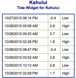
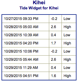
**Click directly on the images below to make them larger. Charts include: Maui County projected winds, tides, swell direction & period and expected wave heights.**
 Maui Surf Forecast
North: Wave heights are expected to be double to triple overhead today. The best breaks could get even larger early on. Surf will be on a downward trend through the day.
West: Wave heights waist/chest high are expected today. The best exposures could get up to shoulder high on the sets from time to time. Spots shadowed by other islands will be smaller. Some north-northwest will fill in for breaks open to the swell bringing knee/waist high waves.
South: The south-southwest is expected to bring waist/chest/shoudler high waves today. The best breaks could be a bit bigger from time to time.
 A solid north-northwest swell from 335° to 355° is presently affecting northwest exposures. Tomorrow the swell will be biggest early in the day with a fading trend expected through the day.
Another more ‘westerly’ swell (295° to 315°) is expected on the heels of the current swell energy. This swell is forecast to quickly build Thursday and mix in with our current swell for head high to well overhead waves. This swell should peak Friday before slowly fading.
Our current south-southwest peaked Tuesday and has begun to gradually ease Wednesday. A new south-southwest fills in Thursday/Friday to keep wave heights around waist/chest high.
Next week another pulse of south-southwest is expected. Will keep an eye on it.
Keep in mind, surf heights are measured on the face of the wave from trough to crest. Heights vary from beach to beach, and at the same beach, from break to break.
**Click here for your detailed Maui County weather report.**
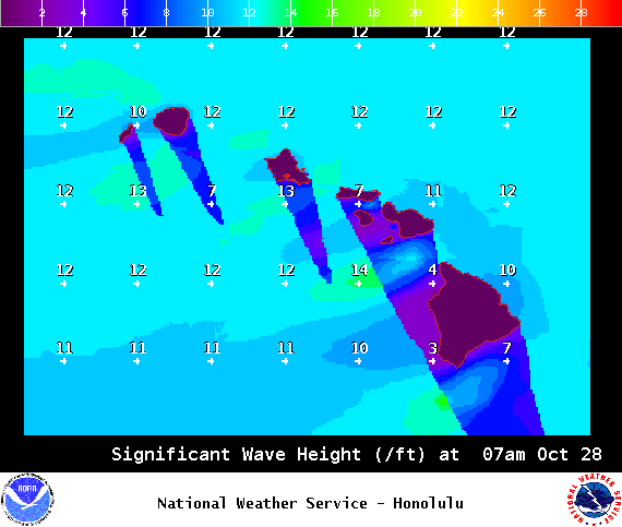
Image: NOAA / NWS
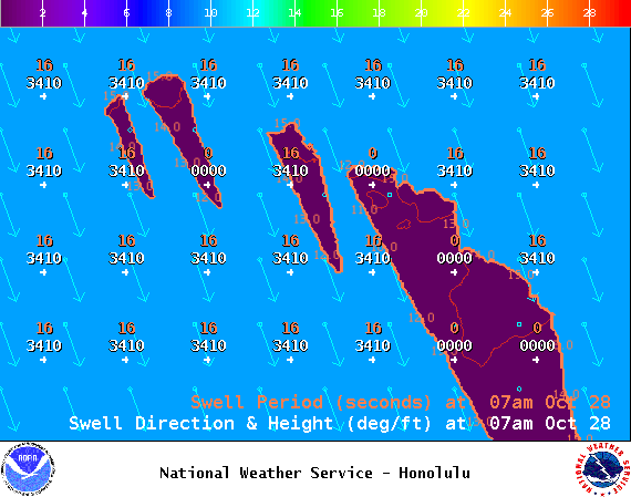
Image: NOAA / NWS
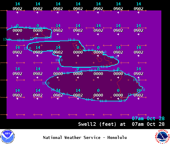
Image: NOAA / NWS
Image: NOAA / NWS
Image: NOAA / NWS
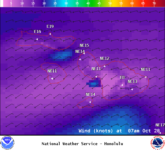
Image: NOAA / NWS
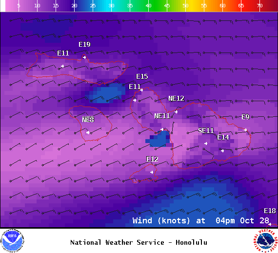
Image: NOAA / NWS
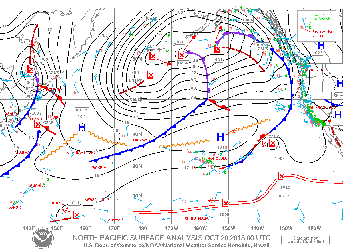
Image: NOAA / NWS
Sponsored Content


