

Very Large NW Swell Fills in Today
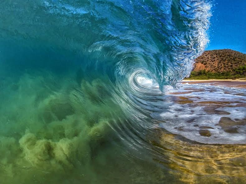
Image: James Dawson
Alerts
A High Surf Warning is posted for north and west shores of Molokai and the north shore of Maui through 6 p.m. Saturday.
A Small Craft Advisory is posted for all Maui County waters (except Ma’alaea) through 6 p.m. Saturday evening.
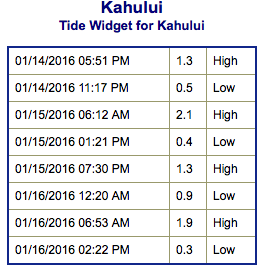
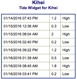
**Click directly on the images below to make them larger. Charts include: Maui County projected winds, tides, swell direction & period and expected wave heights.**
 Maui Surf Forecast
North: Morning starts out mellow but rapidly builds to 20 to 25 foot faces at the spots with good exposure. The best breaks could get up to thirty feet with deep water breaks possibly double that size. Waist high trade swell around Hana as well.
West: Wrap from a northwest swell will bring shoulder high to overhead surf for West Maui spots that have northern exposure. The best breaks could get up to a few feet overhead on the sets.
South: Wave heights are under waist high today out of the southwest. Knee/waist high trade swell will filter in and some spots will catch some of the northwest swell wrap as well.
 A very large northwest swell will build overnight, peak on Friday, then decline this weekend. A slightly smaller northwest swell is expected Tuesday night and Wednesday of next week.
Trade swell is expected to remain pretty small at waist/chest high or less.
Swell from tropical system Pali is expected to slowly continue fading through the week.
A new south-southwest swell is expected for the weekend with waist/head high waves, peaking Sunday.
Keep in mind, surf heights are measured on the face of the wave from trough to crest. Heights vary from beach to beach, and at the same beach, from break to break.
**Click here for your detailed Maui County weather report.**
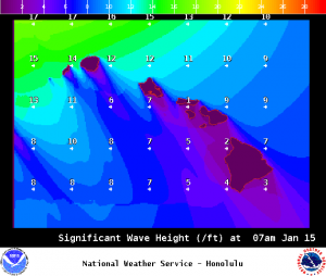
Image: NOAA / NWS
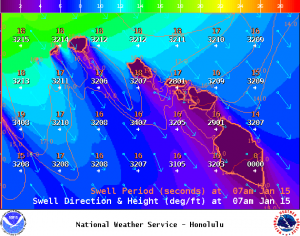
Image: NOAA / NWS
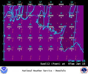
Image: NOAA / NWS
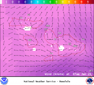
Image: NOAA / NWS
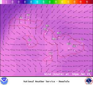
Image: NOAA / NWS
Image: NOAA / NWS
Sponsored Content


