Cool, Breezy Trade Wind Weather Today

Image: Jimmie Hepp
Alerts (as of 1:00 a.m.)
A Small Craft Advisory is posted for all Hawaiian waters through 6 p.m. Saturday. The ʻAlenuihāhā channel is under a more urgent Gale Warning.
A High Surf Advisory is posted for the east facing shores of Maui and Molokai through 6 a.m. Saturday.
**Click directly on the images below to make them larger. Charts include: Maui County high/low forecasted temperatures, projected winds, projected localized weather conditions and expected wave heights.**
Looking Ahead
Cool and breezy trade wind weather will continue through Saturday with trade winds gradually diminishing Sunday into Monday. The trades will bring periods of clouds and a few showers to windward areas. Increased moisture approaching the islands from the southeast could fuel additional windward showers on the Big Island and Maui this weekend. Trade winds will slow down to moderate speeds on Sunday and become light and variable Monday night into Tuesday. A cold front is expected to move down the island chain on Tuesday, bringing a brief period of showers, followed by another round of cool and breezy weather.
Today & Sunday
Today we expect mostly cloudy skies and scattered windward and mauka morning showers. The leeward sides can expect partly cloudy skies. High temperatures from 78° to 83°. Winds out of the northeast from 15 to 25 mph with gusts up to 40 mph. Sunday winds will drop just a notch to 10 to 25 mph.
UV index at 11 (“extreme” exposure level)
Tonight
Northast winds are expected from 15 to 30 mph tonight. Mostly cloudy skies with scattered showers for windward and mauka spots just isolated showers in leeward areas. Low temperatures from 66° to 71°. Winds will drop slightly on Sunday from 10 to 25 mph.
Our Maui Now Weather homepage always includes daily: Sunrise | Sunset | Moonrise | Moonset | Moon Phase | Live Weather Cams | 5-day Forecast | Current Temperature & Conditions
***Click here for your marine outlook and surf report.***
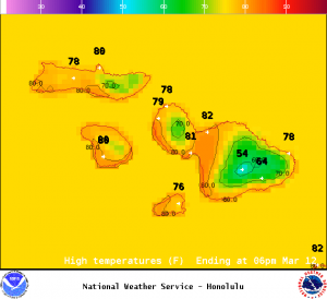
Image: NOAA / NWS
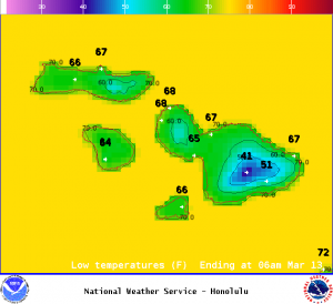
Image: NOAA / NWS
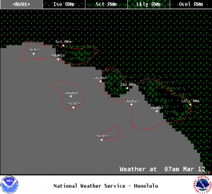
Image: NOAA / NWS
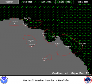
Image: NOAA / NWS
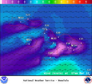
Image: NOAA / NWS
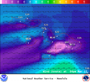
Image: NOAA / NWS
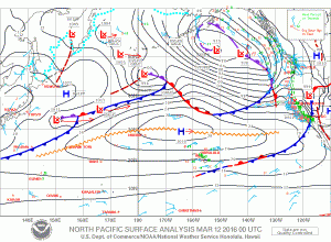
Image: NOAA / NWS
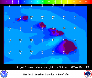
Image: NOAA / NWS
Sponsored Content