

SSW, SSE & NW Swells Expected This Weekend
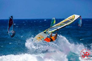
Image: Jimmie Hepp
Alerts (as of 1:00 a.m.)
A Small Craft Advisory is posted for the ʻAlenuihāhā & Pailolo channels, as well as Māʻalaea Bay through 6 a.m. Saturday.
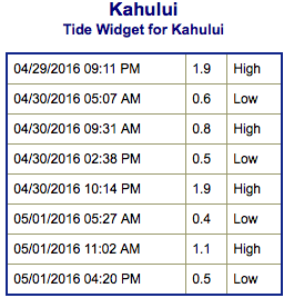
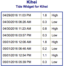
**Click directly on the images below to make them larger. Charts include: Maui County projected winds, tides, swell direction & period and expected wave heights.**
 Maui Surf Forecast
North: Wave heights are expected to be about waist/head high today. The best breaks could get up to slightly overhead on the sets.
West: Surf is ankle/knee high today for west shores that aren’t catching the northwest. Breaks catching the wrap are expected to be up to waist/head high at the best exposures with some plusses.
South: Surf is knee/waist high today, with occasional waves up to tummy/chest high at the best breaks on the sets.
 A couple northwest swells are forecast for the weekend, one peaking Saturday at around chest/head high (possibly overhead on the sets) and easing Sunday into the upcoming week. The other peaking Sunday afternoon. Another pulse is possible around May 3rd.
A fun south-southwest swell is expected to start building late Saturday and peak May 1st. A south-southeast should fill in into the weekend.
Keep in mind, surf heights are measured on the face of the wave from trough to crest. Heights vary from beach to beach, and at the same beach, from break to break.
**Click here for your detailed Maui County weather report.**
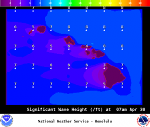
Image: NOAA / NWS
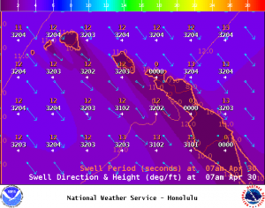
Image: NOAA / NWS
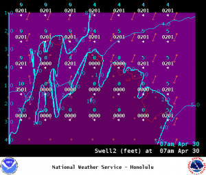
Image: NOAA / NWS
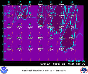
Image: NOAA / NWS
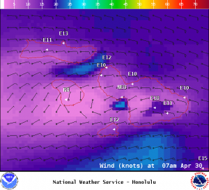
Image: NOAA / NWS
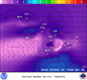
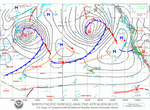
Image: NOAA / NWS
Sponsored Content


