

Increased Showers as Weather Pattern Shifts

Image: Chris Archer
Alerts (as of 1:00 a.m.)
There are no weather alerts posted at this time.
**Click directly on the images below to make them larger. Charts include: Maui County high/low forecasted temperatures, projected winds, projected localized weather conditions and expected wave heights.**
Looking Ahead
Trade winds will continue to weaken, with showers remaining focused over windward slopes through early Wednesday. Widespread afternoon sea breezes are expected to trigger isolated heavy downpours on Wednesday, mainly over interior and mauka sections, as the atmosphere becomes increasingly unstable. A more stable but humid, hybrid trade wind and weak afternoon convective pattern will prevail on Thursday, followed by light and variable winds and a land and sea breeze weather regime heading into the weekend.
Today
Partly cloudy skies are forecast today with scattered showers for windward and mauka spots. Morning sunshine with isolated showers in leeward areas. Mostly cloudy in the afternoon with showers likely and the possibility of locally heavy rainfall and maybe even thunderstorms. East winds around 10 mph with afternoon sea breezes. High temperatures from 83° to 88°.
UV index at 10 (“very high” exposure level)
Tonight
East winds are expected around 10 mph with overnight land breezes. Partly cloudy skies are expected with scattered windward showers. Leeward spots are expected to be mostly cloudy with showers likely to start and clearing as the night goes on. Low temperatures from 70° to 75°.
Our Maui Now Weather homepage always includes daily: Sunrise | Sunset | Moonrise | Moonset | Moon Phase | Live Weather Cams | 5-day Forecast | Current Temperature & Conditions
***Click here for your marine outlook and surf report.***
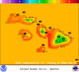
Image: NOAA / NWS
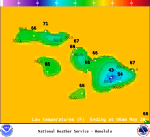
Image: NOAA / NWS
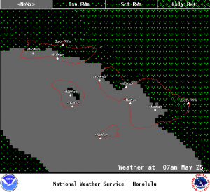
Image: NOAA / NWS
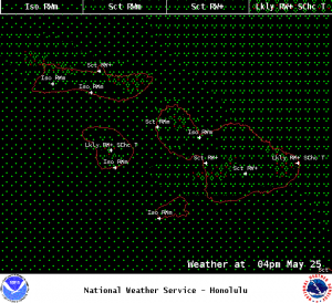
Image: NOAA / NWS
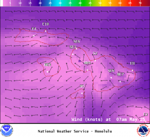
Image: NOAA / NWS
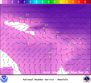
Image: NOAA / NWS
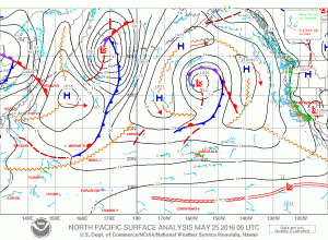
Image: NOAA / NWS
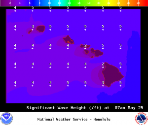
Image: NOAA / NWS
Sponsored Content


