

Band of Showers Moves Through Late Morning
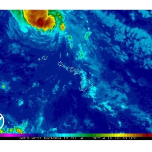
Image: 7:30 a.m.
Alerts (Updated at 7:30 a.m. Sunday morning)
The Hurricane Watch for Maui County has been DROPPED. No weather alerts are posted on land.
A Tropical Storm Warning is posted for all offshore waters in the Hawaiian Islands.
**Click directly on the images below to make them larger. Charts include: Maui County high/low forecasted temperatures, projected winds, projected localized weather conditions and expected wave heights.**
Looking Ahead
Sunday, there is a north to south band of clouds and showers trailing Lester that will bring more showers late morning – including a slight chance of a thunderstorm for the smaller islands. This band will continue westward finally clearing Kauai County by mid Monday morning. Daytime heating could also lead to afternoon thunderstorms.
Well ahead of the band, a convergent southerly wind flow that covers Maui County and Oahu, has resulted in isolated to widely scattered heavy showers over the waters. One showers that formed in the Alenuihaha Channel, has ended up over the slopes above Hana Maui, prompting a Flood Advisory for that section of Maui earlier this morning.
By this time tomorrow, all islands will be under stable, moderate to locally strong trade wind regime. Showers will be present with this flow, favoring the windward and mountain areas. The frequency of the showers will highest during the nights and mornings. The strength of the trades will be switching between moderate and moderate to locally strong during the new work week. An upper level disturbance may enhance some the trade showers during the second half of the week.
As Lester pulls farther away from the islands, trades will be returning to the islands Monday. The trades are expected to stay with us through the rest of the new week.
Today
Mostly cloudy with scattered showers becoming more likely in the afternoon. Possible locally heavy rain and a slight chance of thunderstorms are also in the forecast. High temperatures from 83° to 88° but feeling warmer due to the humidity. Southeast winds up to 10 mph.
UV index at 10 (“very high” exposure level)
Sunday Night
East winds around 10 mph on Sunday. Mostly cloudy skies with scattered showers. Low temperatures from 73° to 78°.
Our Maui Now Weather homepage always includes daily: Sunrise | Sunset | Moonrise | Moonset | Moon Phase | Live Weather Cams | 5-day Forecast | Current Temperature & Conditions
***Click here for your marine outlook and surf report.***
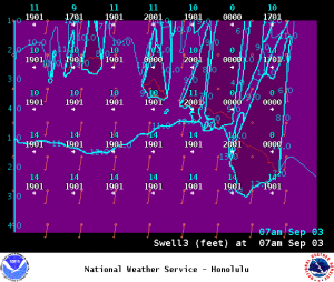
Image: NWS
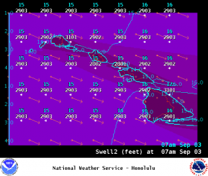
Image: NWS
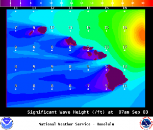
Image: NWS
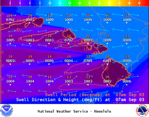
Image: NWS
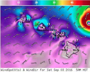
Image: NWS
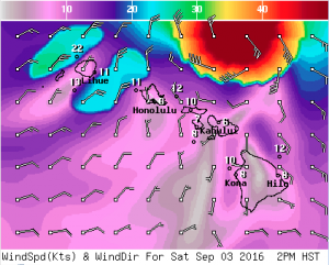
Image: NWS
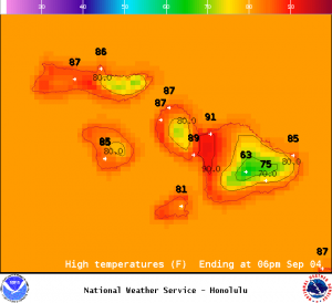
Image: NWS
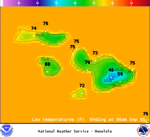
Image: NWS
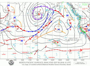
Image: NWS
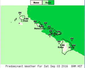
Image: NWS
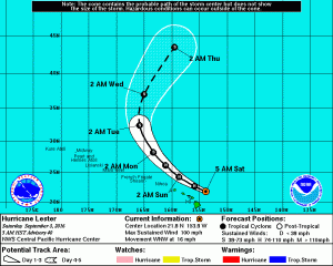
Lester remains a Category 2 Hurricane. Imagery shows the system’s projected track as of 5 a.m. HST on 9.3.16. Background imagery courtesy NOAA/CPH/NWS.
Sponsored Content


