

Orlene Still Too Far Out to Forecast Impacts to Hawaiʻi Weather
Orlene Just Under Cat 3 Strength (as of 2 p.m. HST 9.12.16)
Forecasters with the National Hurricane Center continue to monitor Orlene, which strengthened to a Category 2 (96-110 mph) hurricane today and remained in Eastern North Pacific waters, several hundred miles WSW of the southern tip of the Baja California peninsula.
With sustained winds at 110 mph, the system was just under Category 3 (111-129 mph) strength on the Saffir-Simpson Hurricane Wind Scale at 11 a.m. HST (2 p.m.), and was moving north at 6 mph.
The motion is expected to continue until the system takes a turn toward the NNW late Tuesday night, and then make a westward turn on Wednesday.
The National Hurricane Center says some additional strengthening is forecast through Tuesday morning with gradual weakening expected to begin by Tuesday night.
Orlene Still Too Far Out to Forecast Impacts to Hawaiʻi Weather
The system is still too far out to say if the system will have any weather impacts on the Hawaiian Islands.
Meantime, forecasters in the Central Pacific were monitoring an area of scattered thunderstorms that was about 775 miles WSW of Honolulu at 1:30 this afternoon. The agency reports that the thunderstorms remained “poorly organized.”
Wetter Than Normal Conditions Through Wednesday
The National Weather Service says “deep tropical moisture over the region this week will bring wetter than normal conditions to the islands.”
According to the NWS, “A weak surface trough will move over the eastern islands today, while an upper level trough will approach the islands from the northwest Tuesday. By Wednesday night, an upper level low within the trough will add additional instability, leading to the possibility of locally heavy rainfall.”
Later in the week, high pressure far to the NE of the islands could bring increase in trade winds across the area, according to the NWS.
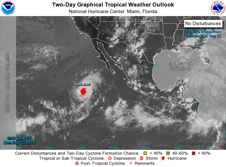
2 p.m. HST 9.12.16. Satellite 2-day graphical imagery of Orlene courtesy National Hurricane Center/NOAA/NWS.
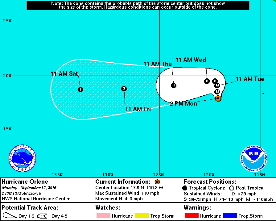
Orlene 5-day track as of 11 a.m. HST 9.12.16. Image: National Hurricane Center/NOAA/NWS
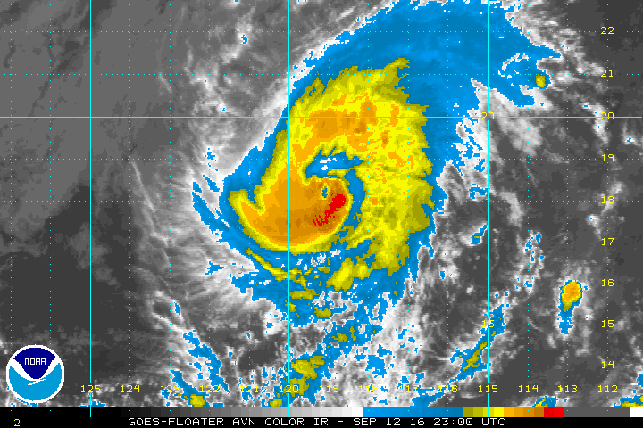
11 a.m. HST 9.12.16. Satellite imagery of Orlene courtesy National Hurricane Center/NOAA/NWS.
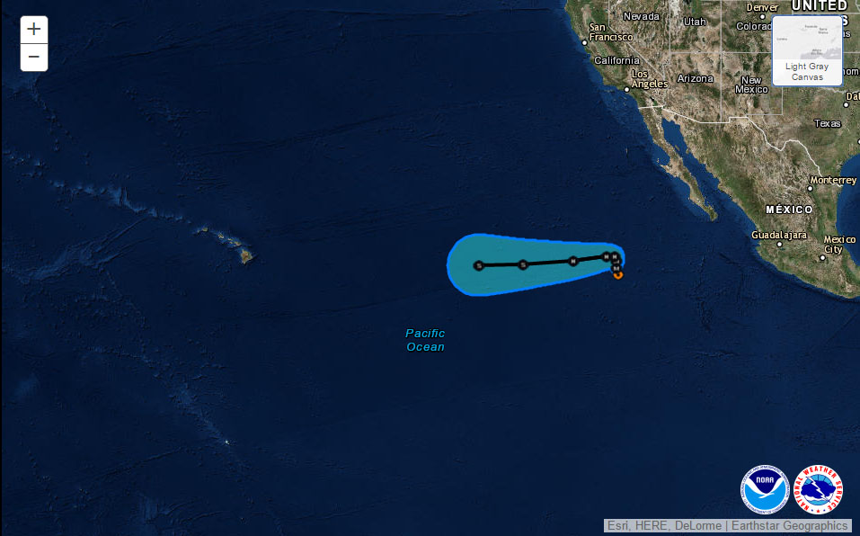
Orlene 5-day track as of 11 a.m. PDT 9.12.16. Image: National Hurricane Center/NOAA/NWS
Sponsored Content


