

Heavy Rain, Thunderstorm Potential Continues Through Weekend

Image: Asa Ellison
Alerts (as of 1:00 a.m.)
A Flash Flood Watch is posted through Sunday afternoon.
A High Surf Advisory is posted for east facing shores until 6 p.m. Saturday.
A Small Craft Advisory is posted for all windward waters and channels in Maui County through 6 p.m. Saturday.
**Click directly on the images below to make them larger. Charts include: Maui County high/low forecasted temperatures, projected winds, projected localized weather conditions and expected wave heights.**
Looking Ahead
The potential for active weather remains through the weekend as a couple of disturbances high in the atmosphere combined with a deep moist southerly flow possibly interact. Locally heavy rainfall and thunderstorms will be possible at times. The weather may calm down briefly Monday and Monday night, though more troublesome weather may return throughout rest of next week.
Today & Sunday
Partly to mostly cloudy skies are expected today with numerous windward showers. Scattered showers are forecast for leeward spots. High temperatures from 80° to 85°. Variable winds up to 15 mph. Sunday the chances for locally heavy rainfall and thunderstorms increase.
UV index at 6 (“high” exposure level)
Tonight & Sunday Night
Variable winds up to 15 mph. Mostly cloudy with numerous windward showers and scattered leeward showers. Slight chance of thunderstorms with locally heavy rainfall possible. Low temperatures from 66° to 71°.
Our Maui Now Weather homepage always includes daily: Sunrise | Sunset | Moonrise | Moonset | Moon Phase | Live Weather Cams | 5-day Forecast | Current Temperature & Conditions
***Click here for your marine outlook and surf report.***
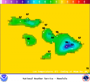
Image: NOAA
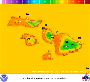
Image: NOAA
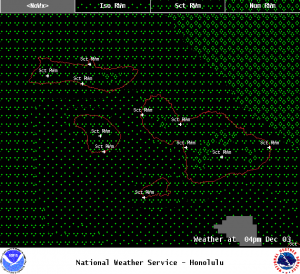
Image: NOAA
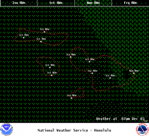
Image: NOAA
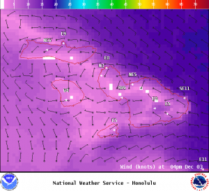
Image: NOAA
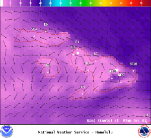
Image: NOAA
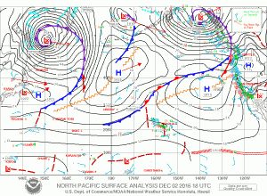
Image: NOAA
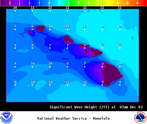
Image: NOAA
Sponsored Content


