

High Surf Warning Posted, Blustery Conditions Today
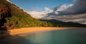
Image: Chris Archer
Alerts (as of 1:00 a.m.)
High Surf Warning: North and west shores of Molokai and north shore of Maui through 6 p.m. Monday.
Small Craft Advisory: All waters and channels through 6 p.m. Monday.
Wind Advisory: Posted through 6 p.m. Monday for north to northeast winds from 20 to 35 mph, gusting to 55 mph. The strongest winds will be in the lee of mountain areas, across much of Lāna’i and Kaho’olawe and through the central valley of Maui.
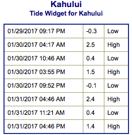
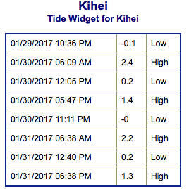
**Click directly on the images below to make them larger. Charts include: Maui County projected winds, tides, swell direction & period and expected wave heights.**
 Maui Surf Forecast
North: Most spots are completely washed out today. Deep water breaks will get upwards of 20 foot faces in the middle of the day and into the afternoon. Pe’ahi could be even bigger than that. Blustery conditions are forecast with very strong north to northeast winds expected.
West: Surf is ankle/knee high today. Spots catching some of the west-northwest wrap will be bigger.
South: Surf is ankle/knee high today. The best spots catching the wrap could get bigger.
 Our current swell is slowly easing but still keeping wave heights elevated. A new northwest pulse is expected to peak on Monday and ease Tuesday through the second half of the work week.
The North Pacific is looking to remain quite active further out with another swell forecast for the 2nd and more pulses right on the heels of that.
Nothing significant expected out of the South Pacific any time soon.
Keep in mind, surf heights are measured on the face of the wave from trough to crest. Heights vary from beach to beach, and at the same beach, from break to break.
**Click here for your detailed Maui County weather report.**
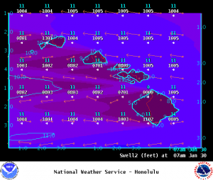
Image: NOAA
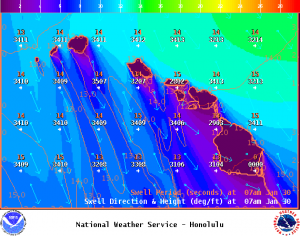
Image: NOAA
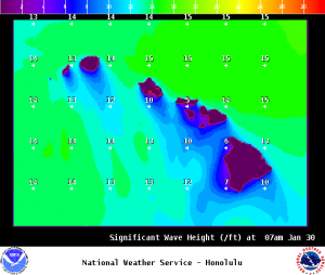
Image: NOAA
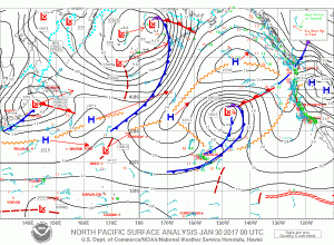
Image: NOAA
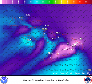
Image: NOAA
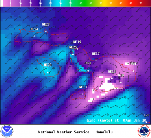
Image: NOAA
Sponsored Content


