

NNW Swell Continues, Trade Swell Builds Today

Image: Asa Ellison
Alerts (as of 1:00 a.m.)
Small Craft Advisory: In effect through 6 a.m. Friday with east winds up to 25 knots and seas up to 10 feet.
**Click directly on the images below to make them larger. Charts include: Maui County projected winds, tides, swell direction & period and expected wave heights.**
Maui Surf Forecast
North: Surf heights are expected to be waist/shoulder high today.
West: Spots catching northwest swell could get up to waist/shoulder high today. Spots open to the southwest may get up to waist high.
South: Surf heights are expected to be knee/waist high today. The best breaks could get a bit bigger on the sets.
New small southwest is forecast to peak Wednesday and fade thereafter. A south-southeast will blend in to that. Not expected to get very much past waist high. A south-southeast will blend in to that. Not expected to get very much past waist high.
Fun north-northwest pulse is forecast to gradually ease up through Wednesday. A small north-northwest reinforcement is forecast to fill in Wednesday night but it should be short-lived and fade pretty fast on Thursday.
Trade swell is forecast to continue to build Wednesday and could be at advisory levels by Thursday.
Keep in mind, surf heights are measured on the face of the wave from trough to crest. Heights vary from beach to beach, and at the same beach, from break to break.
**Click here for your detailed Maui County weather report.**
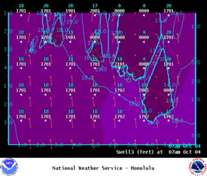
Image: NOAA
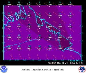
Image: NOAA
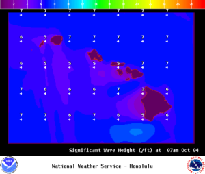
Image: NOAA
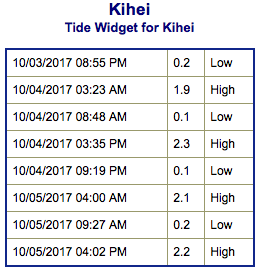
Image: NOAA

Image: NOAA
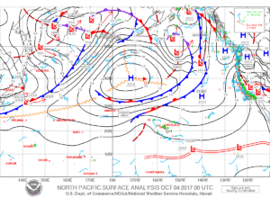
Image: NOAA
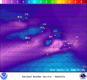
Image: NOAA
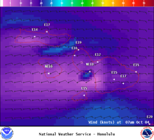
Image: NOAA
Sponsored Content


