Hawai‘i Volcano Eruption Update: Fuming, Rumbling Precedes Large Quake
The Kīlauea eruption continues on Hawaiʻi Island with several new fissures reported over the last 24 hours. The new lava outbreaks resulted in “copious amounts” of sulfur dioxide gas steaming from cracks and fountains of lava rising 100 feet in the air at some locations.
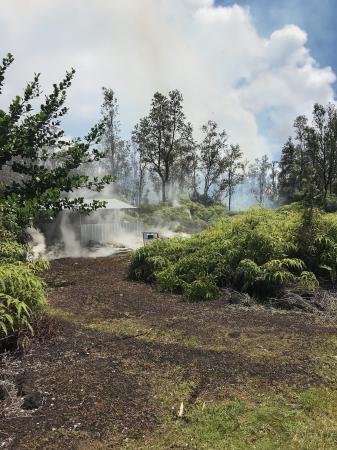
Fissure 2 commenced in the early morning hours on Friday on Kīlauea Volcano’s lower East Rift Zone on Makamae and Leilani Streets. The outbreak began as a small area of spattering in a residential driveway and became more vigorous, with lava thrown over neighborhood power lines.
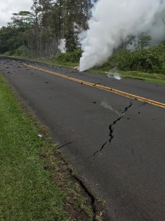
By 6 a.m., steaming cracks preceded a new fissure on Kaupili Street. The US Geological Survey reported “fuming” and “rumbling” sounds that increased with “large bubble bursts” reported at the location. This fissure spread lava on the road measured at approximately 2 yards thick.
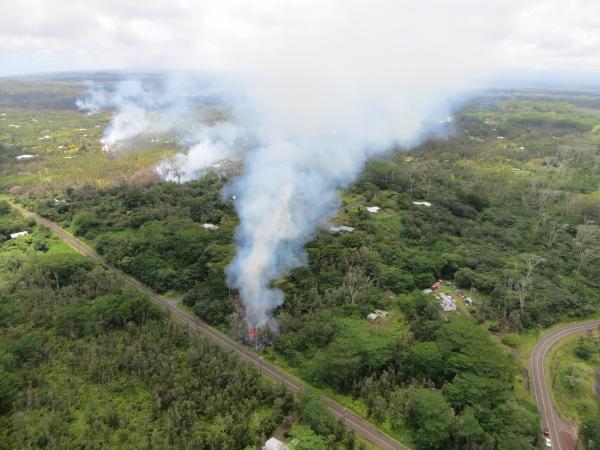
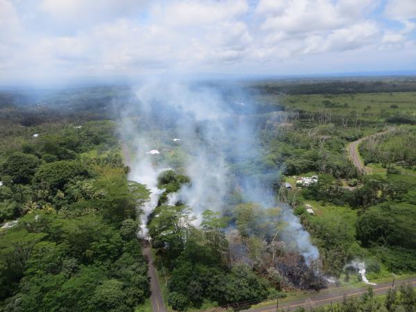
A fourth fissure opened in the forest on Friday morning between Kaupili and Mohala Streets; and fissure 5 began before noon.
These events preceded a large 6.9 earthquake on the south Flank of the Kīlauea volcano that sent a column of red ash into the air, and resulted in severe shaking near the epicenter. Scientists with the Hawaiian Volcano Observatory say the quake was the strongest quake in Hawaiʻi in more than 40 years, since 1975. It was centered about 10 miles SW of Leilani Estates and was felt as far away as the Island of Kauaʻi. The mainshock was preceded by a strong magnitude-5.4 earthquake approximately one hour prior.
HVO’s seismic network manager Brian Shiro said the earthquakes are related to the ongoing volcanic activity in Kīlauea’s East Rift Zone and reflect adjustments beneath the south flank of the volcano.
The Maui Emergency Managment Agency advises that, locally generated tsunami’s will have a very short travel time and staff may not be able to sound sirens or send messages prior to impact. If you feel an earthquake strong enough that you have difficulty standing, the agency advises that you move away from the coastlines and get to higher ground. An interactive map of tsunami inundation zones is available at tsunami.coast.noaa.gov.
Officials with the Hawaiʻi Emergency Management Agency say the recent activity in the area of Leilani Estates has resulted in dangerously high concentrations of sulfur dioxide, a gas that is a strong respiratory system Irritant and can cause serious eye, nose, and skin irritations, coughing, shortness of breath, or other effects. The agency released the following information relating to sulfur dioxide and vog:
Resources at Interagency Vog Dashboard (http://ivhhn.org/vog/) provide valuable information on the risks presented by volcanic gasses, including sulfur dioxide ( SO2) and fine particulates.
Vog (a local term for volcanic emissions from eruptions) is a hazy mixture of SO2 gas and aerosols, which are primarily composed of sulfuric acid droplets and other sulfate (SO4) compounds. Aerosols are created when SO2 and other volcanic gases combine in the atmosphere and interact chemically with oxygen, moisture, dust, and sunlight over periods of minutes to days.
SO2 presents particularly serious threats to the health of individuals with asthma or other respiratory conditions, people with cardiovascular disease, seniors, infants and children, and new and expectant mothers, but healthy people may experience symptoms as well. It is of particular concern in the current situation because the fissures are in inhabited areas; more SO2 is found in volcanic gasses closer to their source.
Everyone in the Leilani Estates area should evacuate to avoid exposure to sulfur dioxide gas.
The Interagency Vog Dashboard offers more information on sulfur dioxide and other volcanic emission concerns, and serves as one location where you can access a wide range of available information regarding volcanic emissions (vog). It is available at: http://ivhhn.org/vog/
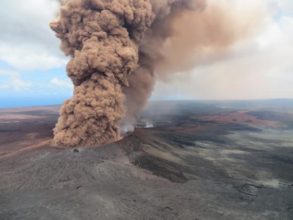
At 12:46 p.m. HST on Friday, May 4, 2018, a column of robust, reddish-brown ash plume occurred after a magnitude 6.9 South Flank of Kīlauea earthquake shook the Big Island of Hawai‘i. PC: US Geological Survey.
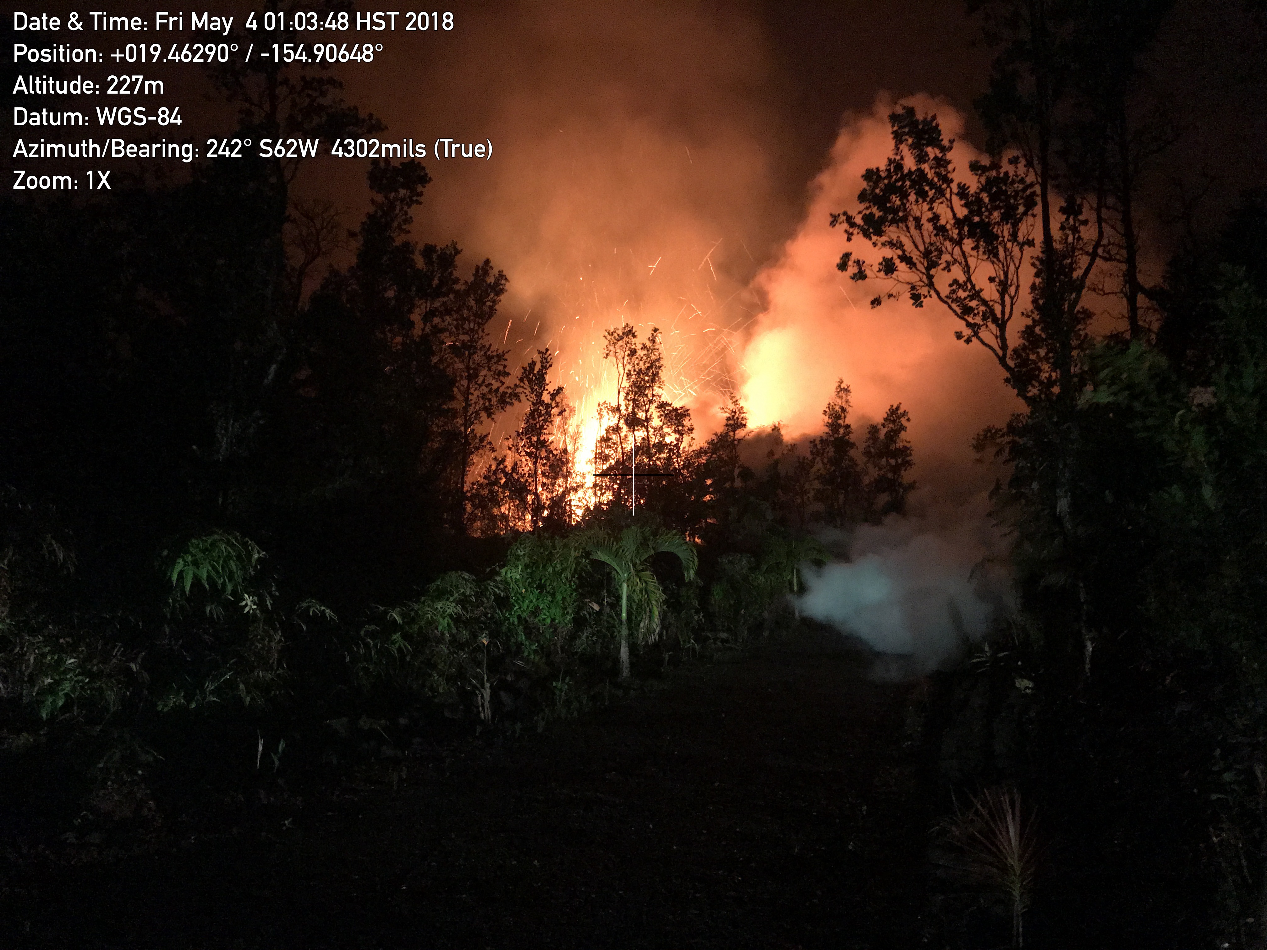
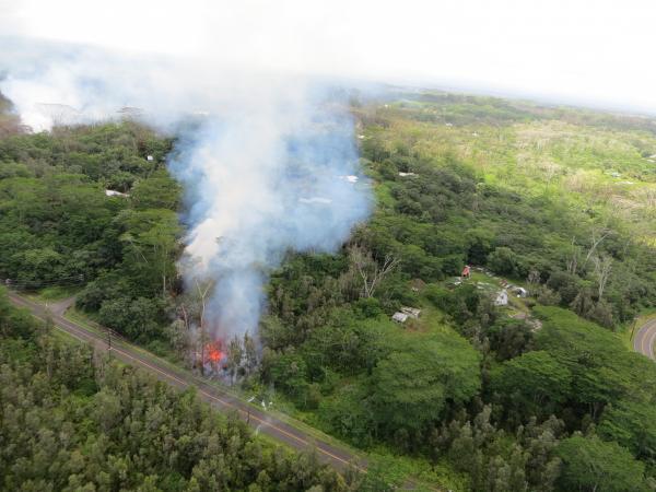
A new lava fissure (Fissure 2) commenced around 1 am HST 5.4.18 on Kīlauea Volcano’s lower East Rift Zone on Makamae and Leilani Streets in the Leilani Estates subdivision. Spatter was being thrown roughly 30 m (about 100 ft) high at the time of this photo. Copious amounts of sulfur dioxide gas, which should be avoided, is emitted from active fissures. The eruption is dynamic and changes could occur with little warning. PC: US Geological Survey.
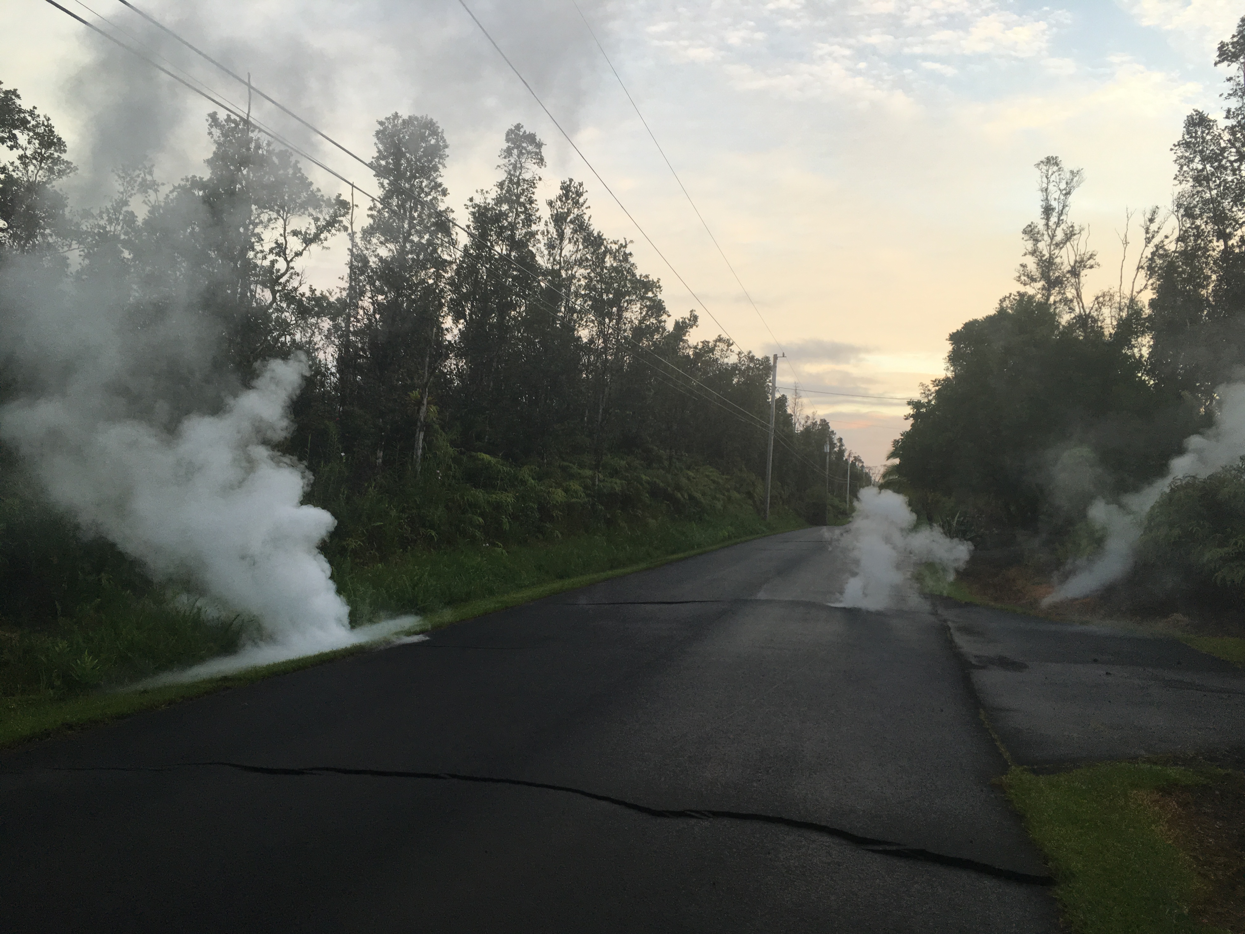
Steaming cracks at 5:57 a.m. HST on Friday, May 4, 2018 in Leilani Estates subdivision, moments before Fissure 3 opened up on Kaupili Street. PC: US Geological Survey.
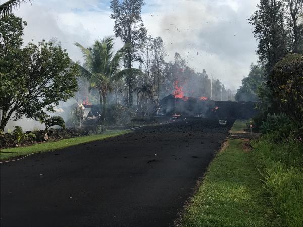
Fissure 3 at Leilani and Kaupili Streets in Leilani Estates subdivision at 8:07 a.m. HST on Friday, May 4, 2018. Lava on the road was approximately 2 m (about 2 yd) thick. PC: US Geological Survey.
Fissure 4 opened in forest around 10:39 a.m. on Friday, May 4, 2018 between Kaupili and Mohala Streets. PC: US Geological Survey.
Steaming cracks on Leilani Street–view is looking up rift. Crack in foreground opened during the 12:33 p.m. magnitude 6.9 south flank of Kīlauea earthquake on Friday, May 4, 2018. PC: US Geological Survey.
Eruptive area showing recent fissures in Leilani Estates subdivision when photo was taken at 12:07 p.m. HST. Fissure 5 is shown in the forefront. PC: US Geological Survey.
Another look at Fissure 5. Photo taken at 12:28 p.m. HST on Friday, May 4, 2018. Note the small finger that crossed Leilani Street (bottom right corner). PC: US Geological Survey.
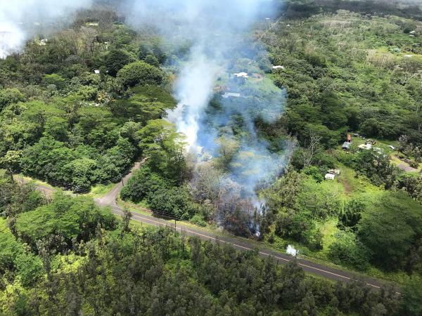
Fissure 5 opened shortly before 12 p.m. on Friday, May 4, 2018 in Leilani Estates subdivision–Leilani Street runs left to right at the bottom of the photo; Kahukai Street is the cross street. PC: US Geological Survey.
Lava from Fissure 5 at 12:11 p.m. on Friday, May 4, 2018. PC: US Geological Survey.
Sponsored Content