

New NW Expected to Fill in Sunday

Image: Asa Ellison
Alerts (as of 1:00 a.m.)
There are no marine alerts posted at this time.
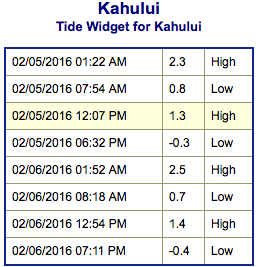
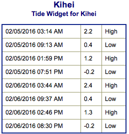
**Click directly on the images below to make them larger. Charts include: Maui County projected winds, tides, swell direction & period and expected wave heights.**
 Maui Surf Forecast
North: Wave heights are waist/head high at the best spots and easing through the day.
West: Wrap from the northwest swell affecting some western shores today will continue to taper off. Spots with northern exposure could get up to waist/head high.
South: Wave heights are waist high or less today out of the south-southwest. Many spots will be flat.
 Our current northwest is fading down to leftovers today. Another swell is expected to fill in Sunday and hold through early next week. A large northwest swell is expected around Thursday the 11th of February.
Not much expected out of the SPAC the next few days. A possible small swell could fill in starting February 9th.
Keep in mind, surf heights are measured on the face of the wave from trough to crest. Heights vary from beach to beach, and at the same beach, from break to break.
**Click here for your detailed Maui County weather report.**
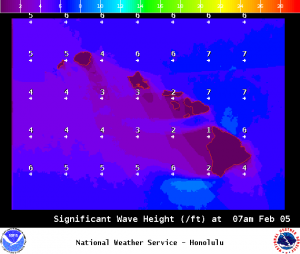
Image: NOAA /NWS
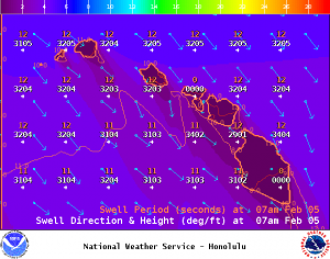
Image: NOAA /NWS
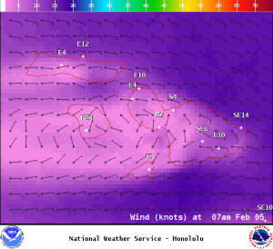
Image: NOAA /NWS
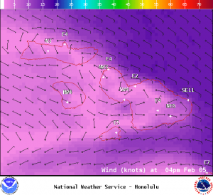
Image: NOAA /NWS
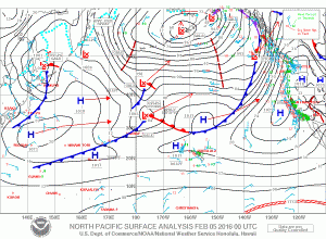
Image: NOAA /NWS
Sponsored Content


