Your Memorial Day Weekend Surf Forecast

Image: Aaron Lynton
Alerts (as of 1:00 a.m.)
There are no weather alerts posted at this time.
**Click directly on the images below to make them larger. Charts include: Maui County projected winds, tides, swell direction & period and expected wave heights.**
 Maui Surf Forecast
North: Wave heights are expected to be pretty flat. Spots catching a bit of wrap could get up to ankle/waist high today.
West: Surf is pretty ankle/knee high today for west shores. Exposures catching the wrap will get up to waist/chest high with standouts reaching shoulder/head high on the sets.
South: Surf is thigh/waist/chest high today with the best breaks reaching shoulder/head high from time to time.
 Our current southwest swell is expected to peak Friday and Saturday around head high at the best breaks before fading Sunday. Some energy is expected to filter in from May 30th through June 2nd.
A storm is possible in the northwest Pacific so this could mean some swell energy filling in around the 30th. Trade swell will continue to affect northeastern exposures but onshore winds mean messy conditions.
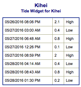
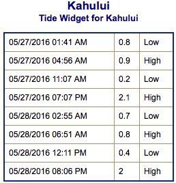
Keep in mind, surf heights are measured on the face of the wave from trough to crest. Heights vary from beach to beach, and at the same beach, from break to break.
**Click here for your detailed Maui County weather report.**
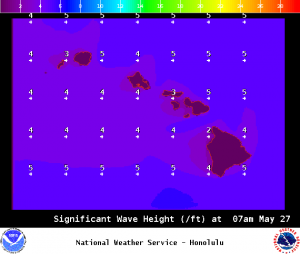
Image: NOAA / NWS
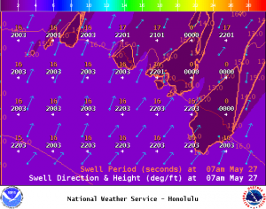
Image: NOAA / NWS
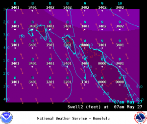
Image: NOAA / NWS
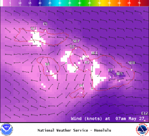
Image: NOAA / NWS
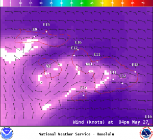
Image: NOAA / NWS
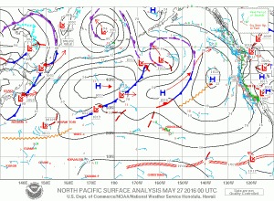
Image: NOAA / NWS
Sponsored Content