Warning Level Surf, Pe’ahi “Jaws” up to 25 Feet
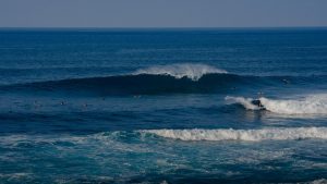
Image: Asa Ellison
Alerts (as of 1:00 a.m.)
Small Craft Advisory: All windward coastal waters and channels through 6 p.m. Wednesday.
High Surf Warning: North shores of Molokai and Maui through 6 p.m. Wednesday.
High Surf Advisory: West shores of Molokai through 6 p.m. Wednesday.
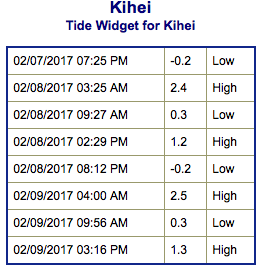
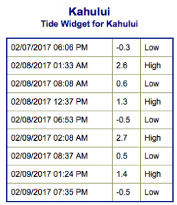
**Click directly on the images below to make them larger. Charts include: Maui County projected winds, tides, swell direction & period and expected wave heights.**
 Maui Surf Forecast
North: Most spots will be double overhead to triple overhead in the morning today. Deep water breaks like Pe’ahi should be in the 18 to 25 foot face range. Surf will gradually ease through the day.
West: Surf is ankle/knee high this morning. Spots that catch the west-northwest wrap will be bigger.
South: Surf is ankle/knee high this morning.
 A new west-northwest is expected to peak on Wednesday and hold through Thursday morning before beginning to fade back out.
Another storm is developing in the northwest Pacific that will generate a swell for the upcoming weekend. This swell is forecast to build Friday evening, peak Saturday and hold steady through Sunday before fading.
Nothing significant expected out of the South Pacific but activity is starting to pick up a little bit.
Keep in mind, surf heights are measured on the face of the wave from trough to crest. Heights vary from beach to beach, and at the same beach, from break to break.
**Click here for your detailed Maui County weather report.**
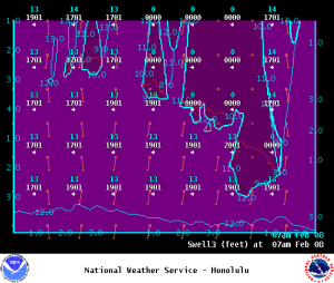
Image: NOAA
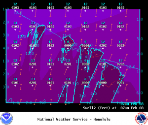
Image: NOAA
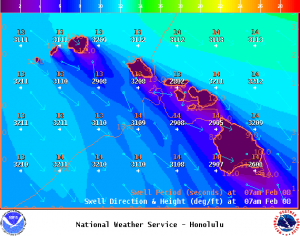
Image: NOAA
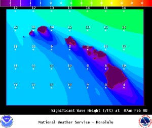
Image: NOAA
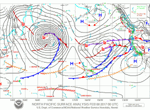
Image: NOAA
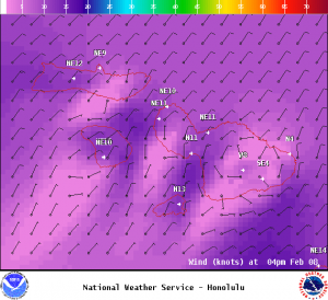
Image: NOAA
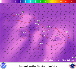
Image: NOAA
Sponsored Content