

SSW Swell Peaking, NW Swell Filling in Today
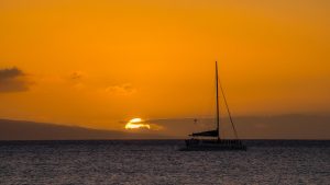
Image: Asa Ellison
Alerts (as of 1:00 a.m.)
There are no weather alerts posted at this time.
**Click directly on the images below to make them larger. Charts include: Maui County projected winds, tides, swell direction & period and expected wave heights.**
Maui Surf Forecast
North: Surf heights are expected to be waist/head high today with the best breaks getting head high to overhead on the sets. Showing strongest for Ho’okipa eastward.
West: Surf is ankle/waist high today. Th best breaks could get up to chest high on the sets. Spots catching the northwest wrap will be bigger.
South: Surf is ankle/waist high today and rising a bit by sunset.
Our current south-southwest swell is expected to continue filling in Thursday, peaking Thursday/Friday before fading. Yet another swell is forecast for around the 27th.
A storm that recently developed off the Kamchatka peninsula is sending swell our way. We expect northwest swell to fill in late Thursday into Friday, peaking Friday before fading Saturday.
Keep in mind, surf heights are measured on the face of the wave from trough to crest. Heights vary from beach to beach, and at the same beach, from break to break.
**Click here for your detailed Maui County weather report.**
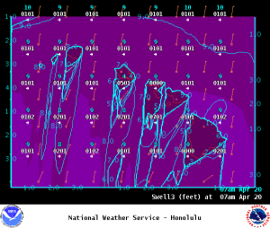
Image: NOAA
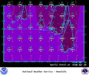
Image: NOAA
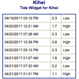
Image: NOAA
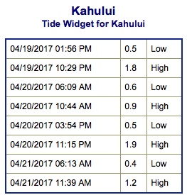
Image: NOAA
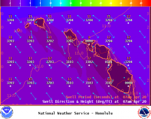
Image: NOAA
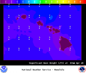
Image: NOAA
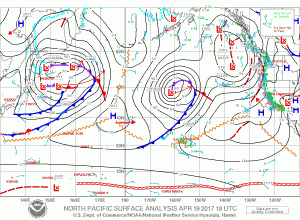
Image: NOAA
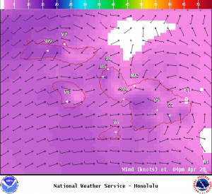
Image: NOAA
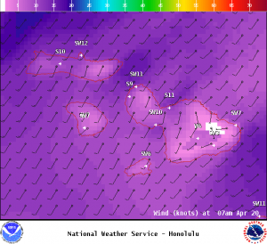
Image: NOAA
Sponsored Content


