

Maui Flood Advisory Until 3 p.m., Flood Watch Until Sunday Afternoon
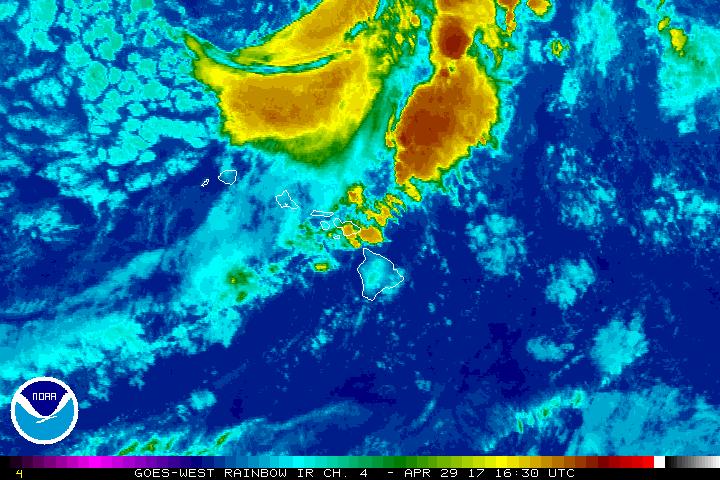
Satellite imagery 4.29.17. PC: NOAA/NWS.
Click HERE to view Meteorologist Malika Dudley’s Live weather update on our Maui Now Facebook page.
Flood Advisory Until 3 p.m. 4.30.17
(Update: 1:11 p.m. HST 4.29.17)
The National Weather Service has EXTENDED a FLOOD ADVISORY for MAUI ISLAND in effect until 3 p.m. on Sunday, April 30, 2017.
A Flood Advisory means that nuisance flooding is occurring or imminent. A Flood Advisory may be upgraded to a Flash Flood Warning if flooding worsens and poses a threat to life and property. This advisory may need to be extended if heavy rain persists.
At 11:47 a.m., areas of moderate to heavy rain continue to move over the eastern slopes of Haleakala from the south keeping stream levels elevated. Radar estimates of rain rates were at about an inch per hour. Additional rainfall will continue move over east Maui over the next several hours. Locations in the advisory include but are not limited to Huelo, Kaupo, Kipahulu, Nahiku, Hana, Kailua, Haleakala National Park, Keanae, Wailua and Hamoa.
At 8:43 a.m., rainfall has diminished across most of Maui except for a band of moderate to heavy rainfall over the eastern slopes of Haleakalā east of a line from Keʻanae to Kaupō. Stream gauges across the island still show elevated water levels.
At 530 a.m., radar indicated areas of locally heavy rain moving across the island of Maui. Rain was falling at a rate of locally 1 to 2 inches per hour. Stream gauges across the eastern half of the island of Maui indicate elevated water flows continue in many streams and waterways.
At 2:53 a.m., radar indicated heavy rain across portions of the island of Maui. Rain was falling at a rate of up to 1 inch per hour in areas of already saturated ground. Stream gauges show continued elevated stream flows over especially the eastern half of the island.
At 11:29 p.m., radar indicated heavy rain across portions of the island of Maui . Rain was continuing to fall at a rate of up to 2 inches per hour over mainly the eastern half of the island of Maui. Stream gauges in those areas have reported some minor rises over the past few hours.
At 8:42 p.m., radar indicated moderate to heavy rain moving over Maui from the southwest. Rain was falling at a rate of 1 to 2 inches per hour. This advisory includes all of Maui Island.
A flood watch remains in effect until Sunday afternoon. Details are posted below:
Flood Watch Remains in Effect for Maui County Until Sunday Afternoon
(Update: 4:22 a.m. 4.29.17)
The National Weather Service has continued the flash flood watch for Maui County until Sunday afternoon. A Flash Flood Watch means that conditions may develop that lead to flash flooding.
A front will stall over the area at the same time a potent low aloft moves overhead, bringing slow-moving heavy showers and thunderstorms that could result in flash-flooding. Forecast models currently indicate the greatest threat for flooding will occur over Maui County.
Heavy rain is expected to be widespread, especially in Maui County this weekend. Rain will affect windward areas, while also impacting urban and leeward areas, which are more susceptible to flooding problems, especially in south and west Maui. These areas include Kīhei, Lahaina, Kāʻanapali, and low-water crossings along Piʻilani Highway between Kaupō and ʻUlupalakua.
_____
Previous Post:
A Flood Advisory means that nuisance flooding is occurring or imminent. A Flood Advisory may be upgraded to a Flash Flood Warning if flooding worsens and poses a threat to life and property. This advisory may need to be e
At 3:22 p.m., radar indicated a widespread area of moderate rain moving over Maui from the southwest, with some embedded heavier showers. Runoff remains high, ponding continues in low-lying areas.
At 2:10 p.m., radar indicated heavy showers and isolated thunderstorms moving over Maui from the southwest, with especially heavy rainfall affecting the area from Olowalu to Kīhei to Mākena to Kaupō. Rainfall rates up to two inches per hour can be expected in the stronger showers. Maui police report intermittent closures on South Kīhei Road between Kaonoulu Road and the old Maui Lu Resort due to water on the roadway.
At 12:25 p.m., radar indicated a widespread area of light to moderate rain moving over Maui from the southwest, with some embedded heavier showers, especially near south Maui. Runoff remains high from earlier rainfall. Maui police report intermittent closures on South Kīhei Road between Kaonoulu Road and the old Maui Lu Resort due to water on the roadway.
At 11 a.m. radar indicated a widespread area of light rain moving over Maui from the southwest, with embedded heavier showers, especially near south Maui.
At 9:40 a.m., radar indicated moderate to heavy showers and isolated thunderstorms near Maui. Most of the rainfall will continue to affect the area from Olowalu to Kīhei to Mākena to Kaupō, with peak rainfall rates around one inch per hour. Briefly heavy showers can be expected over other portions of Maui as well, with showers moving toward the east and northeast at 10 to 15 mph. This advisory includes the entire island of Maui.
At 8:40 a.m., radar indicated moderate to heavy showers over several areas on Maui, including south Maui from Kīhei to Mākena to Kaupō, and along the north shore between Keanae and Pāʻia. Showers were moving toward the east at 10 to 15 mph, with rainfall rates near one inch per hour in the heaviest showers. Locations in the advisory include but are not limited to: Kahului, Kīhei, Lahaina, Honokōhau, Kahakuloa, Hāliʻimaile, Kēōkea, Pāʻia, Makawao, Wailuku, Wailea and Waiheʻe.
At 6:55 a.m. HST, radar indicated moderate to heavy showers and isolated thunderstorms near Maui, with heavy showers moving over the island from the west and southwest. Most of the rainfall will continue to affect the area from Wailea to Māʻalaea to Olowalu, with rainfall rates between one and two inches per hour in the heaviest downpours. Other briefly heavy showers can be expected over west Maui as well. Locations in the advisory include but are not limited to: Māʻalaea, Olowalu and Kīhei, including the Mokulele and Piʻilani Highway junction north of Kīhei.
As a precaution, the public is advised to stay away from streams, drainage ditches and low lying areas prone to flooding. Rainfall and runoff will also cause hazardous driving conditions due
to ponding, reduced visibility and poor braking action.
Motorists and pedestrians are reminded not to cross fast flowing or rising water in your vehicle, or on foot. Turn around, don’t drown. There is also a flood watch in effect until Sunday afternoon.
Sponsored Content


